Download

1 / 36
390 likes | 912 Vues
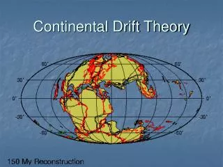
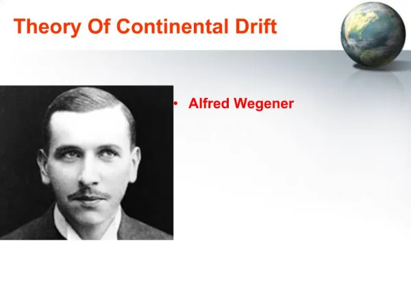
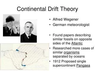
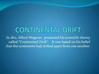
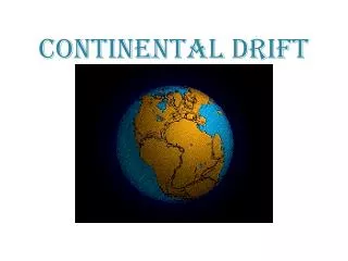
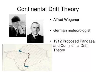
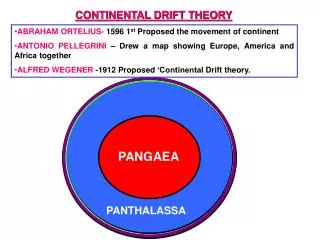
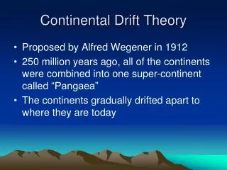
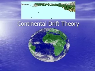
Theory of Continental Drift. Alfred Wegener, German meteorologist Proposed in 1912 in articles Single large continent (Pangaea – “all earth”) started breaking apart about 225-200 MYA. Permian 225 MYA. Triassic 200 MYA. Jurassic 135 MYA. Cretaceous 65 MYA. Present day.

E N D
Theory of Continental Drift • Alfred Wegener, German meteorologist • Proposed in 1912 in articles • Single large continent (Pangaea – “all earth”) started breaking apart about 225-200 MYA
Permian 225 MYA Triassic 200 MYA Jurassic 135 MYA Cretaceous 65 MYA Present day
Evidence for Continental Drift Fit of African and South American continents (1858 drawing by geographer Antonio Snider-Pellegrini)
Weakness of Theory What kind of forces could be strong enough to move such large masses of solid rock over such great distances? Wegener suggested that the continents simply plowed through the ocean floor, but Harold Jeffreys, a noted English geophysicist, argued correctly that it was physically impossible for a large mass of solid rock to plow through the ocean floor without breaking up.
Earth’s “Inner Furnace” Lithosphere (crust & uppermost solid mantle) Crust 0-100 km thick Mantle Mantle Crust 2,900 km Core Outer core 5,100 km Not to scale Inner core 6,378 km To scale
After World War II, new evidence from ocean floor exploration and other studies rekindled interest in Wegener's theory, ultimately leading to the development of thetheory of plate tectonics.
Evidence for Plate Tectonics • Ruggedness & youth of ocean floor • Confirmation of repeated reversals of Earth’s magnetic field in geologic past • Emergence of the seafloor-spreading hypothesis and associated recycling of oceanic crust • Documentation that the world's earthquake and volcanic activity is concentrated along oceanic trenches and submarine mountain ranges.
What is the nature of the forces propelling the plates? Conceptual drawing of assumed convection cells in the mantle. Below a depth of about 700 km, the descending slab begins to soften and flow, losing its form.
Faults Fractures in Earth’s crust along which motion may occur Mark plate boundaries Faults • Fault
Oceanic Crust Lies under oceans & seas Basaltic (mafic) Heavier Denser Thinner Average age 55 million years, totally recycled every 150 million years Types of Crust • Continental crust • Makes up landmasses • Granitic (felsic) • Lighter • Less dense • Thicker • Average age 2.3 billion years, oldest is 3.96 billion years
Three Types of Plate Boundaries • Divergent: new crust forms as plates pull away from each other • Convergent: crust destroyed as plates collide, one dives under the other • Transform: crust neither created nor destroyed, plates slide past one another
Convergent Plate Boundaries • Continent-ocean collisions (denser oceanic crust dives under) • Ocean-ocean collisions (older denser crust dives under younger crust, form island arcs) • Continent-continent collisions (form mountain ranges – Himalayas)
Divergent Boundaries Ocean: Sea Floor Spreading Ocean plates are being pushed apart by convection currents and new ocean floor is made Crustal Features: Rift Valleys on land and Mid-Ocean Ridge in ocean
Sea Floor Spreading mid ocean ridge
Convergent Boundaries • Continental-Continental: huge mountains
Convergent Boundaries • Continental-Continental: huge mountains • Continental-Oceanic: Subduction! The • more dense oceantic crust sinks under • the continental. Trenches, mountains, and • volcanoes occur.
Convergent Boundaries • Continental-Continental: huge mountains • Continental-Oceanic: Subduction! The • more dense oceantic crust sinks under • the continental. Trenches, mountains, and • volcanoes occur. • Oceanic-Oceanic: Subduction! Very deep trenches and volcanoes
Transform Boundaries • A plate boundary where two plates move past each other in opposite directions • Makes faults and causes earthquakes
Find the Nazca plate on the map. What direction is it moving? • The Nazca plate is moving east
Find the South American plate and describe its movement. • The South American plate is moving west
What do you think will happen as these plates continue to move? As the plates move, they will collide (convergent boundary) Since the Nazca plate is oceanic crust and the South American plate is continental crust, the Nazca will plunge beneath the South American plate