Download
1 / 53
530 likes | 670 Vues
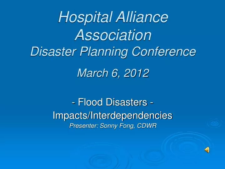
Hospital Alliance Association Disaster Planning Conference March 6, 2012. - Flood Disasters - Impacts/Interdependencies Presenter: Sonny Fong, CDWR. CA Disaster Seasons. What type of major disaster seasons are there in CA each year? Fire (normally runs from June to October)

E N D
Hospital Alliance AssociationDisaster Planning ConferenceMarch 6, 2012 - Flood Disasters - Impacts/Interdependencies Presenter: Sonny Fong, CDWR
CA Disaster Seasons What type of major disaster seasons are there in CA each year? • Fire (normally runs from June to October) • Flood (official flood season is from October to April) • Earthquake (Year Around)
Critical Infrastructure – Interdependencies and Resilience • Pre 9/11/01 - CI included highways, roads, bridges, airports public transit, water supply facilities, wastewater treatment facilities, solid waste and hazardous waste services • Post 9/11/01 – CI list expanded to a total of 18 sectors to include agriculture and food systems, defense-industrial base, energy systems, public health & health care, national monuments and icons, banking and finance, drinking water systems, chemical facilities,commercial facilities, dams, emergency services, nuclear power, postal and shipping, transportation, telecommunications, info technology, critical manufacturing, and government facilities
How is CI Interlinked? • Concept of “Lifeline System” developed to evaluate performance of large, geographically distributed networks during earthquakes, floods, other natural disasters and man-made events • Lifelines are grouped into six principal systems: electric power, gas and liquid fuels, telecommunications, transportation, waste disposalandwater supply
CI Interlink cont’d • Lifeline systems are interdependent – mostly by virtue of physical proximity and operational interaction • Lifeline systems in congested urban/suburban environments have higher risks due to potential failure impacts of the other systems – i.e. gas line failure with electrical and water lines above or below it • Lifeline systems all influence each other i.e. electric power systems supply energy for pumping stations, storage facilities, and SCADA for equipment control of distribution systems for oil, natural gas and chemicals • Over 86% of lifeline systems are owned and operated by private companies
System Resiliency • Resilience is defined as “the ability to bounce back or spring back into shape, position, etc. after being pressed or stretched.” • Examples of Resilience Qualities as related to technical elements: - Robustness (building codes, and construction procedures for new or retrofit work) • Redundancy (technical substitutions and “work around” capabilities) • Resource depth (availability of technical staff, equipment and materials for restoration and repair, resource allocation) • Timeliness (response time, system downtime, and restoration time)
Interesting Fact US counties with levees, which account for only 28% of all counties in the country and only 37% of the total US land area, are home to a whopping 55% of the US population. In 2004, a majority of Americans, over 156 million citizens, resided in these counties.
What Are The Primary Influences Leading to a Levee Failure? Fast and high water flows (embankment erosion) Wind-driven wave wash and high tidal influences specific to the Delta (both lead to over-topping) Earthquakes (liquefaction and structural damage) Substandard construction methods and materials (lack of compaction, poor fill materials) Seepage and boils (loss of levee soils due to water piping) * Burrowing animals Intentional acts * The next slide shows one of the types of animals
Although Officials will never know for sure, it’s suspected that a burrowing animal caused the failure of Jones Tract Levee in 2004 which put 12,000 square acres under 8’-12’ of water
What Would A Levee Failure In SACTO. Look Like?? This short video will tell the “STORY”
What Would the flood impacts to Sacramento be if a Flood Happens? The next slides will give you a better feel for what we’re in for.
UrbanFloodScenario SacramentoAreaLeveeBreaks (Estimates as of 2005)
Urban Flood Scenario: Sacramento Area levee break • What is the direct cost of a significant flood with levee overtopping and breaching in the Sacramento area? What are the other impacts of a flood in the Sacramento area? •
Urban Flood Scenario: Sacramento Area levee break Hypothetical levee breach scenario 1. Large regional flood (1 in 200 chance) with high flows in Sacramento River and American River Sacramento River at I Street : near “Danger” stage American River at H Street : exceeds “Danger” stage Three levee breaches, each 300 ft in width: American River breach near California State University Sacramento River breach into Natomas Sacramento River breach near Pocket area 2. 3.
Urban Flood Scenario: Sacramento Area levee break Areas of inundation • Natomas • Downtown / Land • Park • Pocket area • River Park
Urban Flood Scenario: Sacramento Area levee break Depths of flooding Flooding depths Inundated area 1 ft or more 100 square miles 6 ft or more 85 square miles 10 ft or more 67 square miles 15 ft or more 33 square miles 20 ft or more 6 square miles
Urban Flood Scenario: Sacramento Area levee break Areas of deep flooding Sacramento neighborhoods • Natomas • Downtown • Land Park • GreenHaven • Pocket • River Park
Urban Flood Scenario: Sacramento Area levee break Population at risk Depth of flooding Population 0 to 1 ft 15,000 – 20,000 people 1 to 6 ft 69,000 – 80,000people 6 to 10 ft 39,000 – 45,000 people 10 to 20 ft 96,000 – 100,000 people 20 ft or greater 20,000 – 23,000 people 239,000 – 268,000 estimated people
Urban Flood Scenario: Sacramento Area levee break Inundation of critical facilities 4 Hospitals, 2 have 1 ft or more 26 Medical/health facilities, 19 have 1 ft or more 193 Licensed care facilities, 176 have 1 ft or more 65 Schools, 59 have 1 ft or more
Urban Flood Scenario: Sacramento Area levee break Inundation of critical response facilities and lifeline utilities • 12 Fire stations, 9 have inundation depth of 4 ft or more • Significantly reduces service for emergency response such as fire suppression, search and rescue, and emergency medical response • 1 Police station, minor flooding • 38 Power substations, including 3 high voltage substations • Wastewater pump stations; likely many collection pipe breakages • 1 Water treatment plant; water not drinkable • 2 Airports; including 13 ft flooding of Sacramento Intl. Airport
Urban Flood Scenario: Sacramento Area levee break Property damage Residential $9.2 billion Commercial $1.3 billion Industrial $0.5 billion Public buildings $0.2 billion Total $11.2 billion Category Damage Includes damage to structures, contents, vehicles, landscaping, and other property. (From USACE)
Urban Flood Scenario: Sacramento Area levee break Economic impacts Category Cost • Displacement (temporary housing and relocation) $ 1.5 billion • (average displacement time = 10 months, and • 230,000 residents displaced) • Lifeline utilities • Loss of electric power $ 188 per person per day • Loss of water (complete loss) $ 103 per person per day • (potability loss) $ 43 per person per day • Loss of wastewater (no treatment) $ 33 per person per day • (partial treatment) $ 8 per person per day • Cost to repair $ 24 million minimum
Urban Flood Scenario: Sacramento Area levee break Summary of direct cost for levee-breach scenario Cost Cost items Property damage $ 11.2 billion Displacement/temporary housing $ 1.5 billion Lifeline utility repairs $ 24 million Levee repair and pumping cost $ 58 million Emergency response and recovery $ 16 million $ 12.8 billion minimum Larger, deeper hypothetical floods would cause even greater damage and disruption to the Sacramento area
Urban Flood Scenario: Sacramento Area levee break Indirect fiscal impacts for levee-breach scenario • Displaced residents may not return • Loss of jobs and incomes • Loss of sales and property taxes • Reduction in gross regional product (all goods and services) • Long term impact to development patterns and economic activity • Emergency response and recovery Net indirect fiscal impacts up to $15 billion min.
Urban Flood Scenario: Sacramento Area levee break What can we learn from the New Orleans flooding from Katrina? New Orleans Sacramento 239,000 – 268,000 Unknown Population flooded Fatalities 547,000 1,053
Urban Flood Scenario: Sacramento Area levee break Flood insurance policy holders In 2005, 50,000 parcels removed from 100-year regulated floodplain in Sacramento. Much of Sacramento now qualifies for less expensive flood insurance. Current policies *2005 est Area City of Sacramento 45,228 County of Sacramento 14,423
Urban Flood Scenario: Sacramento Area levee break Sources of information Results reported are based on information developed for and supplied by: Sacramento Area Flood Control Agency US Army Corps of Engineers California Department of Water Resources City and County of Sacramento Sacramento Municipal Utility District Information provided was developed for flood defense infrastructure planning and design.
What Are Flood Impacts To The Delta? Should an earthquake occur which causes the failure of the levees for the Eight Key Western Delta Islands it’s anticipated that salt water intrusion would occur which would lead to the shutdown of the State Water Project (SWP) and the Central Valley Project (CVP). The saltwater intrusion impacts would be for a long period of time (a year or more) - CVP provides source water for approximately 1.8 Million acres of farmland through the Central Valley - SWP provides source water for approximately 650,000 acres of farmland throughout the state and for over 25 Million people - SWP is the State’s 5th largest electric power generator - Both SWP and CVP are components of the Flood Control System - Significant impacts to State and National Economies - agriculture, power, manufacturing, tourism, environmental, water quality, recreation, transportation, quality of life .…………… It should be noted that flood impacts of most Delta Islands/regions would be similar to those of an urban area however at a varying and lesser degree.
Sherman Island Location Western most tract of the 57 tracts or islands in the Sacramento Delta Meeting point of Sacramento, Solano, and Contra Costa Counties At the confluence of the Sacramento and San Joaquin Rivers, near the mouth of the Sacramento and also bordered by Three Mile Slough
Sherman Island Early History 1855: First settled 1869: Dikes built, the first island to be carved out of the peat zone 1869: Substantial levees built on the island by Chinese laborers Early 1870’s: Sherman Island flooded annually 1874: Reclamation and preservation costs for Sherman Island’s levees totaled $500,000 ($6.2 million today) 1875: Levee last breached and it was decided not to reclaim the land, creating Lower Sherman Island Lake Property sold to the State of California for one dollar. Today the area is owned by the California Department of Fish and Game as a game preserve to guarantee hunting access to the public
Sherman Island Ownership Today Much of the land is owned by DWR and leased for agriculture (2002: DWR owns 8,146 of 9,183 acres) Sherman Lake is managed as a State Waterfowl Area Sacramento County Park (including boat launch) located on Island and open year round
Sherman Island Infrastructural Role Protects water export facilities in the Southern Delta from saltwater intrusion by displacing water and maintaining the salinity balance State Hwy 160 Three major power lines Underground gas fields
Comparison of Repairs of Major Levee Breaks in Delta Brannan-Andrus Levee Maintenance District, Levee Break: June 21, 1972 • National Disaster declared June 27, and Breach closed July 26 • Estimated total damages 1981 dollars: $91 million • US Army Corps repaired break, • 35% of City of Isleton was inundated Webb Tract, RD 2026, Levee Break: Jan.18, 1980 • 850 feet wide, 60 feet deep • US Army Corps repaired break Approximately $12 million • 4 month delay in breach repair • Corps first repaired Holland Tract due to availability of equipment, materials • Sustained extensive landside erosion damage; Corps rocked inside Holland Tract-RD 2025, Levee Break: Jan. 18, 1980 (about 1 hour after Webb) • 250 feet wide, 40 feet deep • US Army Corps repaired break Approximately $8 million
Lower Jones Tract-RD 2038, Levee Break Sept. 26, 1980 • 275 feet wide, 55 feet deep • Reclamation District managed Levee Break contract, paid with warrants • Breach repaired prior to AT & SF railroad embankment failure • Fearing flood surge Trapper Slough was raised by US Army Corp • Total estimated costs to RD, SJ County, EBMUD and DWR: $5.6 million • Corps costs estimated $700,000 McDonald Island- RD 2030, Levee Break August 23, 1982, Governor’s Disaster August 25,1982 • 600 feet wide, 40-85 feet in depth • Approximately $13 million in total levee damages • RD instigated repairs immediately, Contract with Dutra, paid with warrants • FEMA Disaster declared on Sept. 24, 1982 • Breach 90 % complete in last week of September
Venice Island-RD 2023, Levee Break Nov. 30, 1982, during highest tide since 1955 • 500 feet wide, 40 feet deep • Approximately $ 9 million in total levee damages • DWR sent inspectors on 12/1/82 State Disaster Assistance was initiated • Corps performed limited PL-84-99 • District signed emergency repair contract with Dutra on 12/8/82 • District paid for repairs using warrants • FEMA disaster declared 2/22/83 and was backdated to Nov 1982 • As of 12/30 the break repair was 90% complete Mildred Island, RD 2021, Levee Break Jan 27,1983, 1000 Acres Not Reclaimed • Corps of Engineers under PL-84-99 rocked inside levee to protect adjoining islands • FEMA approved request to help repair after approx. one month • District let island stay flooded; chose not come up estimated $250,000 share of costs
Bradford Island-RD 2059, Levee Break: December 3,1983 • 600 feet wide, 40-50 feet deep • State Disaster declared December 9, 1983, NO federal disaster declaration • District paid repairs with warrants • Approximately 84% of rock placed in break by Feb 29, 1984 New Hope Tract, February 20 1986 • 170 feet wide levee break, repaired at approximately $900,000 • Finished placing rock in break on March 20, 1986 • RD paid for levee work with warrants, FEMA Disaster declared Feb 21, 1986 Tyler Island- RD 563, 1986 Levee Break, February 19 1986, Two levee breaks in same general area • RD paid for levee work with warrants, FEMA Disaster declared 2/21/86 • 2 levee breaks approximately, each about 300’ in length; began repairs immediately • Approximate cost to repair both breaks: $3 million 1996-97 Flood - Project levees on San Joaquin River System - Corps of Engineers repaired under Public Law 84-99