Download
1 / 13
130 likes | 245 Vues
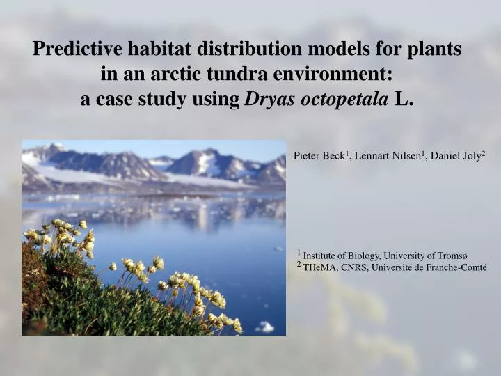
Predictive habitat distribution models for plants in an arctic tundra environment: a case study using Dryas octopetala L. Pieter Beck 1 , Lennart Nilsen 1 , Daniel Joly 2. 1 Institute of Biology, University of Tromsø 2 THéMA, CNRS, Université de Franche-Comté.

E N D
Predictive habitat distribution models for plants in an arctic tundra environment:a case study using Dryas octopetala L. Pieter Beck1, Lennart Nilsen1, Daniel Joly2 1 Institute of Biology, University of Tromsø 2 THéMA, CNRS, Université de Franche-Comté
Environmental variables are used to predict a species’ performance The distribution of environmental variables is used to predict the distribution of a species’ potential habitats Predictive Habitat Distribution Models observations & experiments species’ performance environmental variables in a GIS database model of a species’ realized niche maps of species’ habitats GIS
Developing models for an arctic landscape A study to test the potential of PHDmodels for plant species in the Arctic using a case study: D. octopetala around Kongsfjorden.
Field sampling 32 gradsects covering topographical variation 284 plots: 2 m × 2 m along the gradsect at 80 m intervals in which % cover of D. octopetala was recorded. n=284 n=284 n=83
GIS database of environmental variables spatial resolution 20 m geological map DEM substrate altitude slope E aspect S aspect runoff topography ASTER image 26th of June ‘01 temperature map for june, july and august: mean, minimum and maximum temperature snow cover (NDSI > 0.4) water cover (B1/ B3 >1.2)
Modelling occurrence and abundance separately FIELD SAMPLING GIS DEM altitude slope E aspect S aspect runoff topography ASTER IMAGE snow cover water cover GEOLOGICAL MAP geology TEMPERATURE MAP for june, july and august: mean, minimum and maximum temperature n=284 n=284 n=83 per plot: predictor variables abundance model presence/ absence model L.S. REGRESSION LOGISTIC REGRESSION
the presence/absence model fitted responses performance of the model using an independent validation data set (n=84) The model performs equally well as models developed for species in alpine landscapes by Guisan and Theurillat (2000).
the abundance model fitted responses performance of the model using an independent validation data set (n=36)
Visualizing the predictions as maps GIS D. octopetala MAPS DEM altitude slope E aspect S aspect runoff topography ASTER IMAGE snow cover water cover GEOLOGICAL MAP geology TEMPERATURE MAP for june, july and august: mean, minimum and maximum temperature % cover abundance [ 0, π/2 ] abundance model L.S. REGRESSION probability of occurrence: [ 0 , 1] presence/ absence 0 / 1 presence/ absence model LOGISTIC REGRESSION
Given the known importance of snow cover for the growing season in the arctic, it is believed better snow models would greatly benefit the field of PHDmodelling for arctic landscapes. If the effect of snow cover and temperature is quantified and modelled, climate change scenarios could be incorporated in high resolution predictive habitat distribution models for arctic plants. What lessons to draw? the need for snow models Many of the predictor variables retained in the models can be related to snow cover: water cover ~ snow, ice and liquid water cover topographical exposure snow is blown away on exposed site S aspect S exposed sites become snow free earlier june temperature ~ timing of snow melt
Conclusions The 20 m spatial resolution of the environmental variables is useful to model the distribution of D. octopetala in the study area. The distribution of D. octopetala might be more easily modelled than other species in the area since it is dominant and has clear-cut ecological requirements (Guisan and Theurillat 2000). Snow cover models will benefit the field of PHDmodelling for arctic plant species and possibly allow for incorporating climate change effects.