Download
1 / 88
880 likes | 1.06k Vues
Land Degradation Due to Agriculture: Part 3 Impacts of Deforestation and Soil Erosion. Fall 2012 , Lecture 7. Earth Observatory Image. On March 19, 2012, MODIS, on NASA’s Terra satellite, captured this natural-color image of a storm sweeping across Iran, Afghanistan, and Pakistan

E N D
Land Degradation Due to Agriculture:Part 3 Impacts of Deforestationand Soil Erosion Fall 2012 , Lecture 7
Earth ObservatoryImage • On March 19, 2012, MODIS, on NASA’s Terra satellite, captured this natural-color image of a storm sweeping across Iran, Afghanistan, and Pakistan • Some source points are visible in southern Afghanistan, and the dust blew in southeast-northeast arcs • Most of the dust plumes in this storm were thick enough to completely obscure the land and water surfaces below
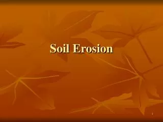
Soil Loss • Deforestation often leads to soil erosion • Agricultural use of land can also produce soil erosion • Modern methods used in advanced countries have greatly cut these losses • In developing countries, agricultural soil loss is still a major problem
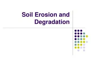
On-site Impacts of Soil Erosion • Reduction in soil quality resulting from • Loss of the nutrient-rich upper layers of the soil • Reduced water-holding capacity of many eroded soils • Increased use of artificial fertilizers can mitigate the first problem in developed countries • Not an option in most developing countries
Time-Scale of Problems • On-site impacts of soil erosion are a present-day problem for many of the developing nations • For developed nations, on-site impacts will be a problem only in the long term future because they are outside the relatively short time horizon within which their policy makers work
Off-site Impacts of Soil Erosion • Water erosion’s main off-site effect is the movement of sediment and agricultural pollutants into watercourses • China's Yangtze River at the Three Gorges, in Hubei province. Note the sediment-rich water
Watercourse Sedimentation • Sediment in watercourses can lead to the silting-up of dams, disruption of the ecosystems of lakes, and contamination of drinking water • Satellite view of the delta of the Yangtze River as it discharges into the East China Sea. The sediment plume is clearly visible. (Image: NOAA)
Down-stream Flooding • Increased downstream flooding may also occur due to the reduced capacity of eroded soil to absorb water, and to the reduced capacity of streams and lakes to hold water
Time-Scale of Off-Site Problems • Short-term effects of erosion's off-site effects can be a notable problem for developed nations • Policy change in developed countries may be driven by off-site impacts • For less developed nations, there may be less incentive for short-term policy change
Examples of Soil Erosion • We will examine soil loss in several areas • Indonesia • Madagascar • Haiti
Kalimantan, Borneo, Indonesia • In less than 25 years, three-quarters of Kalimantan, which occupies a large part of the Island of Borneo in Indonesia, half of the thick forests have been cut by loggers for agricultural land, including oil palm plantations
Agricultural Land Clearing • Kalimantan locals have long burned forestland to create plots for farming • Formerly small, controlled fires were used “A” is Borneo, in relation to SE Asia
Drying the Land • As deforestation has progressed, the island has become drier • The small fires have changed to conflagrations • The cause is burning peat
Loss of Swamp Land • Peat has formed over thousands of years from decomposed trees, grass and scrub • It contains huge quantities of carbon dioxide • Formerly, that was safely sequestered in the ground • Deforestation has caused drying, and the peat is disintegrating • Once-soggy swamps are shorn of trees and drained by canals • When peat burns, carbon dioxide gushes into the atmosphere
Indonesian Photo Gallery • Washington Post Photo Gallery – Indonesia • The link is from a story “A climate threat, rising from the soil”, by Andrew Higgins, which appeared in the Washington Post on November 19, 2009
CO2 from Peat Burning • Wetlands International, a Dutch research and lobbying group, estimated Indonesia's peatlands released roughly 1.9 billion metric tons of carbon dioxide in 2006 • This was equal to the combined emissions that year of Germany, Britain and Canada, and more than U.S. emissions from road and air travel. • In 1997, particularly bad fires raged across Kalimantan and, according to a study led by a British scientist, the amount was up to four times as high -- more than the total emissions by the United States in that period
Economics versus the Environment • Logging and palm oil companies deploy formidable resources across Kalimantan • These are both economic, and physical forces, used against environmental activists trying to protect the fragile peat
Palm Oil Operations • At the PT Globalindo Agung Lestari, an oil palm estate, a wooden barrier separated a dozen or so out-of-town environmental activists with a bullhorn • On the other side, company security guards, local police officers and Indonesian soldiers, armed with automatic weapons, stood ready
Supporting the Company • Villagers were angry at the plantation, but had to stay away • They couldn’t afford to lose their jobs tending oil palm • The pay is about $3 a day and the work is backbreaking • Budi, a 21 year old worker, said "when you don't have anything, you have to support the company"
Ethics vs. Economics This video, from Time movies, shows the ethical problems faced by indigenous peoples, when choosing to exploit the environment or be unemployed
Erosion in Action • Video clip shows erosive rainfall in a region of steep topography in Indonesia • The effect of vegetation removal is evident
Kuala Cenaku, Riau Province, Indonesia • Riau is a province of Indonesia, located in the center and eastern coast of Sumatra along the Strait of Malacca • Extensive logging has led to a massive decline in forest cover from 78% in 1982 to only 33% in 2005
WWF Information • Riau Province is the home of two of the world’s largest pulp mills, produces more than two thirds of Indonesia’s pulp, and is covered with more timber plantations and more oil palm concessions than any other province in Indonesia • Between 1988 and 2005, half of Riau’s forests disappeared at an average rate of 170,000 hectares per year or 460 hectares per day • The loss of some of the most diverse forests on earth is accelerating rapidly - the annual rate of forest cover loss was 2.2% in 2002, 4.2% in 2004 and 6.8% in 2005
Peat Depth • According to Indonesian law, it is illegal to clear forest where peat exceeds 3 meters in depth • The law is largely ignored, with disastrous consequences
Greasy Palms: The Impact of Indonesia’s Palm Oil Plantations • Video from the Paradigm Shift Project
Air Pollution • A final problem caused by fires in the thick peat deposits is severe air pollution • The haze can travel hundreds of miles in SE Asia • The following video shows the effects in Malaysia • The video also some of the products palm oil is used for
Madagascar • Fourth largest island in the world • Madagascar split from India around 88 million years ago, allowing plants and animals on the island to evolve in relative isolation • Isolated areas often see less evolution than other regions
Restricted Evolution • In Madagascar, there are no woodpeckers or ungulates (hooved animals) present • Instead, animals like lemurs dominate rare ecosystems, present no where else on earth • More than 200,000 known species are found on Madagascar, and about 150,000 exist nowhere else
Madagascar History • Beginning in the early 19th century, most of the island was united and ruled as the Kingdom of Madagascar by a series of Merina nobles (Merina is the largest cultural sub-group) • Collapse of the monarchy occurred in 1896 when the island was conquered and absorbed into the French colonial empire, from which the island gained independence in 1960 • The autonomous state of Madagascar has since undergone four major constitutional periods, termed Republics
Coup d'état • Since 1992 the nation has officially been governed as a constitutional democracy from its capital at Antananarivo • However, in a popular uprising in 2009 the last elected president Marc Ravalomanana was made to resign and presidential power was transferred in March 2009 to Andry Rajoelina in a move widely viewed by the international community as a coup d'état
Patricia Wright • Before Rajoelina came to power, the state of Madagascar's ecological health was actually improving, according to Patricia Wright, professor of anthropology at the State University of New York at Stony Brook, executive director for the Institute for the Conservation of Tropical Environments, and a recipient of a MacArthur Foundation "genius award"
Wright’s Opinion • “It's one of the success stories in all of the conservation world. Because of big inputs from conservation agencies — U.S. AID [Agency for International Development], the European Union — the infrastructure of the country improved. The protected areas were being protected. Everything looked really optimistic for keeping the island's forests in place.”
Effects of the Coup d'état • The problem with the coup d'état, according to Wright, “Everyone assumes they can literally take anything they want. So we have major rosewood being extracted from the beautiful forests in the north. We have a certain amount of lawlessness that's going on, also in the north. Inside protected areas, the National Park Service [rangers] abandoned their posts because they were afraid. They've since returned, but it's been a very difficult year for protecting wildlife.
Tavy • “Tavy” is a Malagasy word for the slash and burn agriculture practiced in Madagascar • An acre or two of forest is cut, burned, and then planted with rice • After a year or two of production the field is left fallow for 4-6 years, then the process is repeated • After 2-3 such cycles the soil is exhausted of nutrients and the land is likely colonized by scrub vegetation or alien grasses • On slopes, the new vegetation is often insufficient to anchor soils, making erosion and landslides a problem
Economic Necessity • Madagascar is among the world's poorest countries • As such, people's day to day survival is dependent upon natural resource use • Where day-to-day subsistence is a question, people show little concern for the long-term consequences of their actions • As long as there is more forest land freely available for clearing, you might as well use the land before a neighbor does.
Erosion in Madagascar Seen from the air
Erosion in Madagascar • Betsiboka River, Madagascar, running like liquid chocolate, January 2012 • Astronauts have remarked that it looks as if Madagascar is bleeding to death, with its rivers running blood red and staining the surrounding Indian Ocean
Image from Space • Nearly a century of extensive logging of Madagascar’s rainforests and coastal mangroves has resulted in nearly complete clearing of the land and fantastic rates of erosion • After every heavy rain, the bright red soils are washed from the hillsides into the streams and rivers to the coast This image of the Betsiboka Estuary on the northwest coast of Madagascar reveals the mouth of the country’s largest river and one of the world’s fast-changing coastlines
NASA Description • Astronauts describe their view of Madagascar as 'bleeding into the ocean' • One impact of the extensive 20th century erosion is the filling and clogging of coastal waterways with sediment - a process that is well illustrated in the Betsiboka estuary • In fact, ocean-going ships were once able to travel up the Betsiboka estuary, but must now berth at the coast
Malagasy Agriculture • Agriculture is the mainstay of the Malagasy economy, using 80% of the labor force • Deforestation, unsustainable farming methods, low productivity and insecure land tenure are all fuelling diminishing soil yields and threatening the island's food security, putting the agriculture section at risk
Agroecological Techniques • The Agence française de développement (AFD) is developing, the use of agroecological techniques with Malagasy farmers • This approach involves protecting the soil with a green cover crop, as a way of avoiding plowing, and restricting the use of fertilizers • Soil fertility is restored, watershed erosion is reduced and as are CO2 emissions • The video on the next slide explains the use of agroecology
Haiti • Haiti occupies the western third of the island of Hispaniola, which is situated in the Caribbean between Cuba and Puerto Rico • The Dominican Republic occupies the remainder of the island • The Atlantic Ocean borders Haiti’s northern shores, while the Caribbean Sea is to the west and south
Haitian Topography • Haiti occupies the mountainous portion of the island of Hispaniola • Five mountain ranges dominate Haiti’s landscape and divide the country into three regions⎯northern, central, and southern • Slopes of more than a 20 percent grade cover nearly two-thirds of the country • Plains constitute only about 20 percent of Haiti’s land, making cultivation difficult
Haitian Deforestation • Haiti faces a severe deforestation problem • In 1923, forests covered nearly 60 percent of the country; today they cover less than 2 percent • Wood and charcoal are the primary fuel source
Beginnings of Deforestation • At the onset of colonialism, Haiti began to suffer deforestation • Around 1730, coffee was introduced, producing a monoculture agriculture • Within 50 years upland forest clearing resulted in 25% of the land being under coffee • Other crops included indigo, tobacco, and sugarcane • Clean cultivation between row crops exhausted nutrients and lead to erosion
Nineteenth Century • Throughout much of the 19th century, the government was forced to export timber to repay a large debt to France • Peasants were restricted to hillside farms, where often steep slopes lead to severe erosion
Poverty • Lack of economic capital make farming difficult • Average per capita income is less than one-seventh of the average for Latin America and the Caribbean • With inheritance, land is subdivided, and plots grow increasing smaller • One estimate claims the average peasant has less the one-quarter of a hectare
Leased Land • Many families lease or sharecrop additional land • Farmers on leased or share-cropped land have little incentive to take care of the land • In addition, most agricultural work is by hand, with no mechanical equipment