Download
1 / 32
320 likes | 448 Vues
The National Geospatial Program, The National Map , and A-16. FGDC Coordination Group May 14, 2013. Agenda. Provide a General description of the program What are you’re A-16 Theme and Dataset Responsibilities? What Data and Services do you have registered in the Geospatial Platform?

E N D
The National Geospatial Program, The National Map, and A-16 FGDC Coordination Group May 14, 2013
Agenda • Provide a General description of the program • What are you’re A-16 Theme and Dataset Responsibilities? • What Data and Services do you have registered in the Geospatial Platform? • Any other Geospatial Platform activities? • What coordination mechanisms to you participate in? • What subcommittees are part of these themes/datasets? • Provide any major program initiatives. • Are there any major program/data changes coming? • What are the underpinning standards for the program?
USGS Mission • Science organization – non regulatory • Provide impartial, unbiased science information • Ecosystems • Environment Health • Natural Hazards • Energy and Minerals • Climate and Land-Use Change • Core Science systems
National Geospatial Program Mission Data visualization • Organize, maintain, publish, and disseminate the geospatial baseline of the Nation’s topography through The National Map • Foster a general understanding of broad geographic patterns, trends, and conditions through The National Atlas of the United States of America® Data services Historic Map scans Online maps: US Topo
National Geospatial Program Strategic Direction Sharpen focus on our topographic mapping mission • High investment – layers that define topo mapping: Elevation - Improve data quality and resolution nationally, pursue a national enhanced elevation data initiative Hydrography and watershed boundaries - Work with stewards to maintain data, enhance NHD to support users’ modeling and business needs, improve user tools • Moderate investment - Geographic names: Fulfill the Public Law 80-242 requirements of the Board on Geographic Names • Maintenance investment - Imagery, transportation, boundaries, selected structures and land cover: For reference purposes, maintain coverage by obtaining data from other organizations and suppliers with a minimum investment
National Geospatial Program Strategic Direction • Emphasis on meeting user needs • Priority communities of use • Waterresources • Natural resources conservation • Geologic mapping • Geologic hazards
USGS/ NGP Theme Leads NGP • Elevation - Co Lead with NOAA, Dave Saghy • Imagery - Co Lead with FSA, Dick Vraga • In-land Waters - Co Lead with FWS, Steve Aichele Other • Land Use/Land Cover – Co Lead with USDA, Climate and Land Use Change, Jonathan Smith • Geology - Co Lead with BOEM, Dave Soller • Biota - Marcia McNiff
USGS/ NGP National Geospatial Data Assets • Biota • National Standardized Ecosystems Dataset - • GAP Species Dataset • Cultural Resources • Geographic Names Information System • Elevation • National Elevation Dataset • Shuttle Radar Topography Mission (SRTM) • Global Multi-resolution Terrain Elevation Data (GMTED2010) • LiDAR Point Cloud
USGS/ NGP National Geospatial Data Assets • Geology • Geologic Mapping • Imagery • Landsat - Multi Spectral Scanner • Landsat – Thematic Mapper • Landsat – Enhance Thematic Mapper + • Advanced Speceborne Thermal Emission and Reflection Radar • Moderate resolution Imaging Spectroradiometer • High Resolution Orthoimagery
USGS/ NGP National Geospatial Data Assets • Land Use Land Cover • Coastal Change Analysis Program (C-CAP) • Geographic Information Retrieval and Analysis System • National Land Cover Dataset (NLCD) Land Cover Classes • NLCD Percent Imperviousness • NLCD Percent Tree Canopy • North American Land Change Monitoring System (NALCMS)
USGS/ NGP National Geospatial Data Assets • Real Property • National Structures Dataset • Transportation • National Transportation Dataset • Water – Inland • National Hydrography Dataset (NHD) • Watershed Boundary Dataset (WBD) • National Water Information System (NWIS) – Stream Gage Locations • National Water Information System (NWIS) – Water Quality Monitoring Station Locations
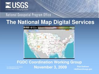
Data and Services Registered on the Platform/ Other platform activities • 10 Dynamic Base map services • Elevation, Hydrography, Orthoimagery, Land Cover, Geographic Names, Transportation, Structures, and Governmental Units/Boundaries • FGDC metadata records • 2 tile cache basemap services • US Topo maps, Imagery Only • TNM Viewer Application • 1000’s of metadata records via data.gov • Collection Record
Coordination Mechanisms • FGDC Subcommittees • National Digital Orthophotography Program • Geologic • Spatial Water Data • Transportation • Working Groups • Standards • Historical Data • Marine Boundary
Coordination Mechanisms • 3DEP • National Enhanced Elevation Assessment • 3DEP Executive Forum • Alaska Mapping Executive Committee • Board of Geographic Names • NHD Advisory Group • National Digital Elevation Program • NGP Communities of Use • Geospatial Liaison Network • Oversight Management Groups w/ Census, USFS
Major Program Initiatives • 3DEP • Alaska • US Topo
Introducing 3DEP Proposing a cooperatively funded national enhanced elevation program executed by USGS Higher quality LiDAR data for 49 states, IfSAR in Alaska Goal is an 8 year acquisition cycle Bare earth elevation, point cloud and other basic derivatives (TBD) will be distributed and archived http://nationalmap.gov/3DEP/neea.html 3D Elevation Program
National Enhanced Elevation Assessment Sponsored by the National Digital Elevation Program (NDEP) and funded by USGS, NGA,FEMA, NRCS and NOAA to: Document national requirements for improved elevation data from technologies such as LiDAR and IfSAR Estimate the benefits and costs of meeting these requirements Evaluate multiple national enhanced program scenarios 602 mission-critical activities that require enhanced elevation data were identified by: 34 Federal agencies 50 states A sampling of local governments, tribes, private and not‐for profit organizations A national program has the potential to generate $1.2 billion to $13 billion in new benefits each year when fully operational http://www.dewberry.com/Consultants/GeospatialMapping/FinalReport-NationalEnhancedElevationAssessment At a Glance
(8) Annual Benefits of 3DEP Top Ten Federal Agencies* * NGA benefits considered to be major but are not quantified. Stated benefits are a combination of improved customer services, other outcomes and operational savings
Current USGS Activities (9) Data delivery through the National Map Viewer, Earth Explorer. Archiving fully NARA compliant. Elevation and Lidar data program operations being consolidated and modernized Two year transition to QL2 data collections 3DEP Implementation Plan under development 3DEP Executive Forum established Pursuing multiple funding alternatives $10 M increase proposed in President’s FY 14 budget USGS and NOAA briefing FGDC Steering Committee, June 6, 2013 Toward Implementing 3DEP by January, 2015
(4) Interagency Elevation Inventory Ongoing NOAA, USGS, and FEMA collaboration to maintain the inventory and make the data accessible 2012 update has been released Inventory is critical to assessing progress towards 3DEP goals www.csc.noaa.gov/inventory
Alaska Mapping Initiative • Work with Alaska Statewide Digital Mapping Initiative (SDMI) to continue IfSAR data acquisition and seek sources for other map layers needed for US Topo • Presented US Topo samples for user feedback at the Alaska Mapping and Surveying Conference in February • Goal to finalize specifications and begin making US Topo maps for Alaska in FY13 • Conducted an Alaska Roundtable to discuss IfSAR funding options with Federal partners
Alaska Mapping Initiative • DOI Alaska Round Table • Anne Castle, DOI Assistant Secretary for Water & Science, Chair • Raise awareness of the need for statewide topographic mapping for Alaska • Ensure that the federal government are on the same page with regard to the topic of mapping Alaska. • Governor’s office supports federal-state cooperation. • Committed to seeing us through this goal and is committed to providing funding.
US Topo maps/ Historic Maps • Nationally consistent, driven from TNM databases • GeoPDF, available free on-line • 18,000+ maps/year • 3 year revision cycle • 59,000 Downloads/mo • Historic maps • All editions • All Scales • 179 K Downloads/mo
The National Map Data Layers • Orthoimagery – National Agriculture Imagery Program (NAIP) • Elevation – National Elevation Dataset • Hydrography – National Hydrography Dataset • Boundaries – National Boundaries Dataset – US Census Bureau • Names - Geographic Names Information System • Structures – National Structures Dataset • Transportation – US Census, Tele Atlas (2010) and USFS roads • Vegetation – National Landcover Dataset
Program/Data Changes • Focus on core datasets – Elevation, Hydrography • Names – continue BGN support, update w/ features • Maintenance layers • Authoritative national dataset from other sources • Crowd sourcing for structures data • 3DEP – national, high resolution, beyond bare earth • Transition to TIGER • Strategic direction for partnerships
Strategic Direction for Partnerships • Addition of user engagement activities at headquarters and in liaison network • Increase specialization • In user communities • In topographic mapping data themes • Focus partnerships and data acquisition • Focus partnerships in liaison network to elevation, NHD, and imagery • Address both topographic and ancillary themes at headquarters
Under pinning standards • FGDC Metadata and Framework Standards • OGC – WMS, WFS, WCS, CSW • OGC Interoperability Assessment • JSON-based Web Context Standard • DLCM – “simplified” • Product Specifications and Standards • NHD Standards, BGN • US National Grid • NARA