Download
1 / 26
260 likes | 353 Vues
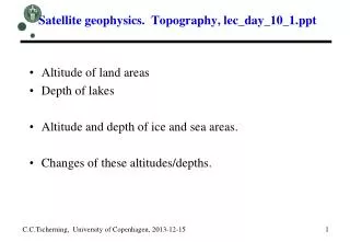
Satellite geophysics. Land and Sea Ice. Applications : Mapping the altitude of ice-covered areas Map the distribution of sea-ice, ice warning (DMI). Changes and interpretation of changes related to sea-level.

E N D
Satellite geophysics. Land and Sea Ice. Applications: • Mapping the altitude of ice-covered areas • Map the distribution of sea-ice, ice warning (DMI). • Changes and interpretation of changes related to sea-level C.C.Tscherning, University of Copenhagen, 2013-12-01 1
Satellite geophysics. Land and Sea Ice. C.C.Tscherning, University of Copenhagen, 2013-12-01 2
Satellite geophysics. Land and Sea Ice. • Satellitter: • http://database.eohandbook.com/database/missiontable.aspx • Instrumenter • http://database.eohandbook.com/database/instrumenttable.aspx • Data sources • http://database.eohandbook.com/measurements/overview.aspx C.C.Tscherning, University of Copenhagen, 2013-12-01 3
Satellite geophysics. Land and Sea Ice. Satelitter I SEASAT, ERS1/2, ENVISAT, TPX – Radar altimetry and SAR RADARSAT (SAR) CryoSat2 - Interferometric altimetry ICESAT – Laser altimetry SPOT-5, ASTER C.C.Tscherning, University of Copenhagen, 2013-12-01 4
Satellite geophysics. Land and Sea Ice. Satelitter Nimbus-7, DMSP, NOAA, Landsat,Aqua (NASA): SMMR, SSM/I, AMSR-E. NPP: VIIRS (npp.gsfc.nasa.gov) SMOS GRACE (tyngdeændringer) C.C.Tscherning, University of Copenhagen, 2013-12-01 5
Satellite geophysics. SEASAT. • Launched 28 JUN 78, stopped 10 OCT 1978 • a= 7930 km, i=108 grader, T= 100 m • Radar-altimeter, Syntetisk Aparture Radar. • Demonstrated earth-observation from satellie worked. (Maybe too well). • Forrunner for ESA, NASA as well as US-DOD satellittes. • http://ilrs.gsfc.nasa.gov/satellite_missions/list_of_satellites/seas_general.html C.C.Tscherning, University of Copenhagen, 2013-12-01 6
Satellite geophysics.ERS-1/2, ENVISAT, TPX. • ERS1/2, ENVISAT – Radar altimetry and SAR • Covers up to 82 degrees ! 36 days repeat. • http://cct.gfy.ku.dk/publ_cct/cct1422.pdf • http://cct.gfy.ku.dk/publ_others/ccta2002.pdf • US DOD satellittes: GEOSAT, GSFO • Secret USSR satellittes • TOPEX/Poseidon, Jason – Radar Altimetry • Covers up to 65 degrees, 11 days repeat. C.C.Tscherning, University of Copenhagen, 2013-12-01 7
Satellite geophysics. CryoSat2. • CryoSat2 - Interferometric altimetry • Not sun-synkroneous, a=7095, i=92 grader, 369 days repeat • http://www.esa.int/esaLP/LPcryosat.html • http://www.esa.int/esaLP/SEMNKR1PLFG_LPcryosat_0.html C.C.Tscherning, University of Copenhagen, 2013-12-01 8
Satellite geophysics. ICESAT. • i=94 degrees, • http://icesat.gsfc.nasa.gov/ • Anvendelser: Aakjær og Levinsen, 2009. http://cct.gfy.ku.dk/publ_others/ccta1989.pdf C.C.Tscherning, University of Copenhagen, 2013-12-01 9
Satellite geophysics. ICESAT. C.C.Tscherning, University of Copenhagen, 2013-12-01 10
Satellite geophysics. SPOT-5. • http://en.wikipedia.org/wiki/SPOT_%28satellite%29#SPOT_5 • Levinsen et al., 2013: • http://cct.gfy.ku.dk/publ_cct/cct2175.pdf • HRS High Resolution Stereoscope • http://catalog.spotimage.com/PageSearch.aspx C.C.Tscherning, University of Copenhagen, 2013-12-01 11
Satellite geophysics. Nimbus, DMSP, AQUA. • http://nsidc.org/data/docs/daac/f17_platform.gd.html • Http://www.nasa.gov/mission_pages/aqua/ • http://toms.gsfc.nasa.gov/n7toms/nimbus7tech.html C.C.Tscherning, University of Copenhagen, 2013-12-01 12
Satellite geophysics. NPP. • NPP: VIIRS (http://npp.gsfc.nasa.gov) • Build your own NPP: • http://npp.gsfc.nasa.gov/images/D1978_NPP_Paper_Model_Letter_OPTIMIZED.pdf C.C.Tscherning, University of Copenhagen, 2013-12-01 13
Satellite geophysics. Instruments. Radar and Laser altimeters Interferometrisk altimetri C.C.Tscherning, University of Copenhagen, 2013-12-01 14
Satellite geophysics. SAR. C.C.Tscherning, University of Copenhagen, 2013-12-01 15
Satellite geophysics. SAR. C.C.Tscherning, University of Copenhagen, 2013-12-01 16
Satellite geophysics. SAR. C.C.Tscherning, University of Copenhagen, 2013-12-01 17
Satellite geophysics. SPOT-5 HRS. C.C.Tscherning, University of Copenhagen, 2013-12-01 18
Satellite geophysics. SPOT-5 HRS. C.C.Tscherning, University of Copenhagen, 2013-12-05 19
Satellite geophysics. SAR. C.C.Tscherning, University of Copenhagen, 2013-12-01 20
Satellite geophysics. NOAA-N. C.C.Tscherning, University of Copenhagen, 2013-12-01 21
Satellite geophysics. Radiometri. AVHRR/3 is a six channel imaging radiometer that detects energy in the visible IR portions of the electromagnetic spectrum. HIRS/4 provides multispectral data from one visible channel, seven shortwave channels, and twelve longwave channels using a single telescope and a rotating filter wheel containing twenty individual spectral filters. AMSU-A is a cross-track scanning total power radiometer, which is divided into two physically separate modules that interface with the spacecraft independently. The AMSU-A measures scene radiance in the microwave spectrum. MHS is a five-channel microwave instrument intended primarily to measure profiles of atmospheric humidity. C.C.Tscherning, University of Copenhagen, 2013-12-01 22
Satellite geophysics. GRACE. - Gravity Recovery and Climate Experiment C.C.Tscherning, University of Copenhagen, 2013-12-01 23
Satellite geophysics. GRACE – Greenland. Time series of ice mass changes for the GrIS based on GRACE monthly mass http://cct.gfy.ku.dk/ccta2024.pdf. Blue is the unfiltered mass change estimates, red is the filtered data, and green is the best fitting quadratic trend. C.C.Tscherning, University of Copenhagen, 2013-12-01 24
Satellite geophysics. EUMETSAT. • /http://www.eumetsat.int/Home/Main/Satellites/GroundNetwork/ApplicationGroundSegment/SAFs/SAFProjects/SP_2010053117495263 C.C.Tscherning, University of Copenhagen, 2013-12-01 25
Satellite geophysics. DTU. • http://www.dcrs.dtu.dk/ C.C.Tscherning, University of Copenhagen, 2013-12-01 26