Download
1 / 26
260 likes | 334 Vues
Window to My Environment. Tom Brody Region 5 US EPA (Chicago). IT IS FREE!!. www.epa.gov/enviro/wme. 54136. Multi-Activities – Facilities covered by two or more of the other regulated site features. T. T.

E N D
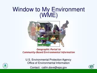
Window to My Environment Tom Brody Region 5 US EPA (Chicago)
IT IS FREE!!
Multi-Activities –Facilities covered by two or moreof the other regulated site features. T T Superfund – Facilities designated by EPA to respond to concerns over health and environmental risks posed by hazardous waste. T T Toxic Releases – Specific facilities regulated by EPA that must report to state and local governments the locations and quantities of any chemical stored on site. T T T Water Discharge – Specific facilities that are regulated by EPA to discharge to US waters. Air Emissions – Specific facilities regulated by EPA that release pollutants into the air. BRS (Biennial Reporting System) – Specific facilities regulated by EPA that collect data on the generation, management, and minimization of hazardous waste. Hazardous Waste – Specific facilities regulated by EPA that handle materials designated as hazardous waste.
Schools, Churches, Hospitals – Extracts from the Geographic Names Information System (GNIS), which is part of EPA’s National Shape File Repository. T T T Highways - The Highways layer is extracted from the Department of Transportation's Office of Geographic Information Services Streets - The Street layer is from US Census Bureau’s Census 2000 TIGER/Line.
Impaired Water Bodies/Streams – From the section 303(d) (impaired waters) prioritized list of waters that do not meet EPA’s water quality standards. Water Bodies/Streams - From the US Geological Survey National Hydrography Dataset (NHD). Demographics - From the US Census Bureau’s Population and Housing 1990 Summary Tape File 3A (STF-3A). T T T
Congressional Districts, City Boundaries, and Counties – From the USGS Map Layers Warehouse. States - From the US Census Bureau’s Census 2000 TIGER/Line files. T T Special/Moderate Flood Hazard Areas - Retrieved in real-time from ESRI's Geography Network. It depicts the U.S. Federal Emergency Management Agency (FEMA) Digital Q3 Flood Data. T Air Monitors - From the Aerometric Information Retrieval System (AIRS) operated by EPA Office of Air Quality Planning And Standards. T Water Monitors - Retrieved in real-time from the United States Geological Survey (USGS) NWIS website. T
Geographic Portal Uses ArcIMS technology A Work In Progress What Is WME?
Not a Predictive or Simulation Tool Not Temporally Standardized Not Finished What WME Isn’t
Dave Catlin 202.566.0694 Catlin.Dave@epamail.epa.gov Tom Brody 312.353.8340 Brody.Tom@epa.gov Comments? Questions? Ideas? www.epa.gov/enviro/wme