Download
1 / 7
70 likes | 213 Vues
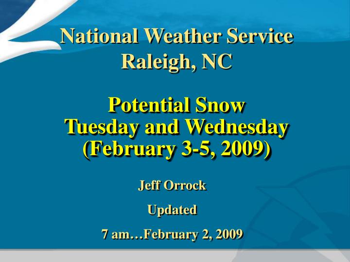
Potential Snow Tuesday and Wednesday (February 3-5, 2009). National Weather Service Raleigh, NC. Jeff Orrock Updated 7 am…February 2, 2009.

E N D
Potential SnowTuesday and Wednesday(February 3-5, 2009) National Weather Service Raleigh, NC Jeff Orrock Updated 7 am…February 2, 2009
A coastal low is forecast to track up the coast Tuesday morning, but will track far enough offshore and will be weak enough to bring mostly rain ending as a short period of rain/snow mix Tuesday morning. Temperatures Tuesday morning should remain above freezing and no accumulation of snow is expected. Temperature Rain Snow
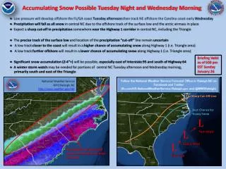
Possible Snow Tuesday Night/ Wednesday • A very strong upper level trough of low pressure (disturbance marked by the red line) will track across the state Monday night and early Tuesday morning. • This system will provide enough instability to create scattered snow showers if enough moisture is available.
Monday Night / Tuesday Morning • Models differ on the actual track of the disturbance and the amount of snow which may fall Monday night / Tuesday morning. • The model forecast shown here does forecast enough moisture available to result in scattered snow showers. • The patches of light green over NC represent forecast precipitation which would be snow.
Issues and Concerns • No accumulation is expected with any snow which falls Tuesday morning. • Temperatures will be much colder Tuesday night / Wednesday morning in the low to mid 20s. If scattered snow showers do develop accumulations across central NC will be possible by daybreak Wednesday. • Current trends suggest any snow showers which develop will occur shortly after sunset in the Triad and spread east across the rest of central NC overnight. • Any snow which does fall will be mainly a dry type of snow resulting in a higher liquid to snow ratio. A higher snow ratio would allow for more snow depth which could reach a few inches of snow in some locations if enough moisture is available.
Keep up with the Forecast • There is still uncertainty regarding exactly how the two storm systems on Tuesday and Wednesday mornings will shape up. • Giving the type of storm systems freezing rain should NOT be an issue and the only concerns facing NC are rain Tuesday and possible snow Monday night into early Tuesday. • Please check local NWS forecasts and discussions Through Tuesday in order to stay informed.
NWS Web Pages • Western NC • http://www.erh.noaa.gov/gsp/ • Central NC • http://www.erh.noaa.gov/rah/ • Eastern NC • http://www.erh.noaa.gov/mhx