Download
1 / 20
220 likes | 452 Vues
Determination of Tectonic Movements in the Swiss Alps using GNSS and Levelling. E. Brockmann, D. Ineichen, U. Marti, S. Schaer, A. Schlatter. Content. Information sources for vertical tectonic movements Swiss Permanent Network AGNES + analysis (10 years)

E N D
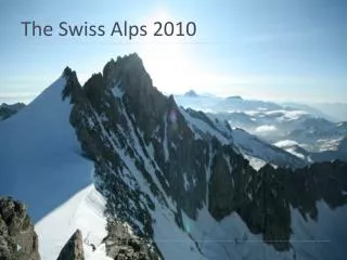
Determination of Tectonic Movements in the Swiss Alps using GNSS and Levelling E. Brockmann, D. Ineichen, U. Marti, S. Schaer, A. Schlatter
Content • Information sources for vertical tectonic movements • Swiss Permanent Network AGNES + analysis (10 years) • Levelling network + analysis (100 years) • Local ties (5-15 years) • GNSS-densification networks (16 years) • Results and comparisons • Next steps and conclusions
Swiss Permanent Network AGNES • 30 stations • since 1998 operational(10-years anniversary) • 50 km spacing • GNSS since 2007.5(20antenna changed +but 10 double stations forreference frame monitoring) • Analyzed by Bernese GNSSSoftware together with EUREF-and IGS stations (hourly +daily + weekly + annually)
Multi-annual solution: Transformation parameters of weekly solutions based on rel. antenna PCV model + results not (yet) based on a reprocessing # sites rms trafo-para. - Weekly updated and SINEX+plots available: http://www.swisstopo.ch/pnac
Height repeatability improvement due to vertical velocity estimation 16 % improvement Swiss sites> 2 years observations
2.2 yr 4.2 yr 2.5 yr Example station: EPFL (Lausanne) Equipment changes Remark: “worst” case station (monumentation + many equipment changes) Relative velocity constraints !
Combined multi-annual solutions: vertical velocities • Reference: min. constraints for some IGS sites w.r.t. ITRF2005 at mean epoch of obs. rise 1 mm/yr downward movement
Time series ZIMM-WTZR; comparisons ->ITRF2005 ZIMM: + 2.3 mm / yr -> EPN-densification (Dec. 08): ZIMM: + 2.3 mm / yr WTZR: + 0.8 mm / yr ZIMM-WTZR: + 1.5 mm / yr -> ITRF2008: ??? WTZR: + 1.5 mm / yr ZIMM-WTZR: + 0.8 mm / yr
National height network 95 (LHN95) • National Levelling network (LHN95): 4000 km, 1100 points • Time span of data used: 1903 - 2004 • approx. 10’000 km line measurements
Alpine Uplift determined from levelling Defined with zero vertical motion Levelling: Alps are rising1.5 mm/yr
Alpine Uplift model RCM04 Defined with zero vertical motion Released 2004
Comparison: GNSS / Model (Levelling) vertical velocities Defined with zero vertical motion Re-scaled error ellipses from estimated formal rms
GNSS vertical rates by region Re-scaled estimated formal rms
Comparison: GNSS / Model (Levelling) vertical velocities (2) ZERM JUJO
Comparison: GNSS / Model (Levelling) vertical velocities (3) • 2 extreme alpine sites not considered (JUJO, ZERM) • systematic discrepancy between GNSS and Model of roughly 1 mm/yr, which is a significant part (65-82%) of expected vertical movements 1.0265% 0.8582%
Local tie at Geostation Zimmerwald GNSS vertical velocities -1.2 mm/yr shift ITRF05 CH-Aarberg Local Tie (Sept. 2008): SLR – ZIMM – ZIM2 +2.1 mm/yr ZIMM (10 yrs): +0.93 mm/yr +1.6 mm/yr ZIM2 (1.5 yrs): +0.40 mm/yr ZIM2 antenna and terrestrial target Vertical velocities ZIMM/ZIM2 not relatively constrained
Local tie results: ZIMM - SLR horizontally vertically Conclusion from local tie: Movement of top of the 9-meter mast 7 mm displacement (in 13 years) 5 mm rising of GPS ≈ 0.4 mm/yr ≈ 0.5 mm/yr local effect at the significance level to be detected with permanent networks; overall movement is with +2.1 mm/yr (in ITRF05) significant
Densification (200 LV95 sites; since 1989) Next campaign planned in 2010 -> 21 years time span horizontally: homogeneous velocity results achieved (< 1mm/yr movements)vertically: possible problems due to antenna calibration inconsistencies 627 stations
Conclusions • Analysis of 10 years of permanent GNSS data verified an Alpine rising which was derived from 100 years repeated levelling (3 epochs). • Due to Swiss permanent sites and the usage of IGS/EUREF sites, the movements w.r.t the stable Eurasian plate were determined, showing a rising of all Swiss sites. • The rates from GNSS are bigger: Alps are rising 2.6 mm/yr (GNSS) compared to 1.5 mm/yr (levelling). • Not all permanent AGNES sites are “tectonically” suited sites; local effects of “class-A” / double stations are monitored with local ties. • Additional info (GNSS densification campaign 2010, local tie results of additional 9 double stations, homogeneous reprocessing) will improve the results and its interpretation.
Thanks for your attention rise 1 mm/yr downward movement