Download

1 / 100
1.07k likes | 1.51k Vues
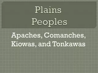
Plains. Valleys / Plains. Indo-Gangetic Plain. Physical Geography. Two great rivers - the Ganges and Indus – rise in the mountains and drain Indo-Gangetic Plain. INDIA: Plains.

E N D
Valleys / Plains Indo-GangeticPlain
Physical Geography Two great rivers - the Ganges and Indus – rise in the mountains and drain Indo-Gangetic Plain
INDIA: Plains • Sedimentary covers: The riverine plains of the Indus, the Ganges (known as Ganga to Indians), and the Brahmaputra and the coastal plains of the Indian Peninsula form this region. • The North Indian Plain forms a belt of alluvial lowlands stretching from Pakistan’s Indus River on the west to the Brahmaputra on the east. • The Ganges River with its various tributaries is the major river of northern India. • This region of plains is from 320 to 500 km (200 to 300 mi) wide and it extends through Pakistan, India, and Bangladesh. • The climate varies from arid in Punjab to tropical around the Bay of Bengal. • Soils (inceptisols) are derived from alluvium and they are relatively fertile and generally level. • In the arid areas, irrigation has created environmental problems through accumulation of salts (salinization).
Northern Plain • Fertile region due to Indus, Ganges, and Brahmaputra Rivers • Carry melting snow from mountains to the plains making agriculture possible • Rivers are sacred to Indian people
Coastal Plains • Small rivers and seasonal rains provide area with water for farming • Eastern and Western Ghats
Physical Geography Narrow coastal plains lie along the Arabian Sea and the Bay of Bengal
Physical Geography The peoples of these coastal plains became sea traders
Indo-Gangetic Plain • Made up a large fertile flood plain the Northern India and present day Pakistan • Seasonal monsoon rains brought predictable floods to the river systems • Annual floods brought rich deposits of soil over a wide area
Indo-Gangetic Plain • Indo-Gangetic Plain stretches from Indus valley of Pakistan to lower Gangetic delta of Bangladesh • Two regions within the plain • West- Indus Valley- Punjab and Hariyana • East beyond the Delhi Ridge stretching up to Bangladesh • This alluvial plain constitutes the heartland of the Indian civilization Hstory of South Asia
Indo-Gangetic Plain • Densely populated region • Centers of Maurya(300BC), Gupta (4 th Century Ad) Mughal ( 1526-1707) and the British Empire (1757-1947) • Major Urban Centers in South Asia • Lahore, Delhi, Banaras, Calcutta and Dacca • Agricultural Heartland of India, Pakistan, Bangladesh.
Farming Begins Along These Rivers • Early cultures used the water resources of the two rivers to irrigate their fields and produce crop surpluses • 2500 BC first cities emerge in this region
Mountains & Peaks Hindu Kush KhyberPassI I Karakoran Mts. Mt. Everest▲ Himalayas Vindhya Hills Eastern Ghats Western Ghats
Physical Geography High mountain ranges cut India off from immigrants and invaders
Mountains of India • Mountainous Rim • Hems in the country • Has not prevented invasions however • Himalayas • Western Ghats • Eastern Ghats • Rainforests in the shadow of the Ghats
INDIA: Mountains • Alpine system:The Himalayas form a major barrier to the movements of air masses north and south and exceed 6,096 m (20,000 ft) in several locations. • Mount Everest (Nepal: Sagarmatha; Tibetan: Chomolungma) is the world’s highest mountain at 8,848 m (29,035 ft). • The climate ranges from tropical lowlands to Arctic conditions in the high altitudes of Mount Everest and other peaks. • The Karakoram Pass provides access from north-central India through the Himalayan and Hindu Kush mountains. • The Khyber Pass in the west was used by invading groups. • Population in the Himalayas is limited except in the Vale of Kashmir and in Nepal (25,200,000 people). • Bhutan has 900,000 and Sikkim less than one million. Sikkim has been incorporated into India and is one of its provinces. • Rice and wheat are the dominant grain crops.
Coastal India • The Western and Eastern Ghats: These Ghats (hills) rise abruptly on either side of the Deccan Peninsular. • The Ghats are a barrier to transportation and rainfall. • The narrow coastal plains bordering the Arabian Sea and the Bay of Bengal lie beyond the Ghats. • The Western Coastal Plain is much narrower than the Eastern Coastal plain and much wetter. • Part of ancient maritime empires and well connected with the rest of Asia through trade and commerce. • Thickly populated with flourishing agriculture
The Himalayas • The colossal Himalayan Mountains form a border between the Indian subcontinent and the rest of Asia. The Himalayas are the world's tallest mountains, towering more than five miles above sea level. Himalaya means "home of snow" because the tallest peaks of the Himalayas are always covered with snow.
Mountains of South Asia • The Himalayas • Northern Barrier of South Asia • World’s Tallest Peaks • Mt. Everest (29, 035 feet) http://www.peakware.com/encyclopedia/peaks/everest.htm
Himalaya • Himalaya means abode of snow • The largest and highest mountain system in Asia, forming a broad continuous arc for nearly 2600 km (1600 mi) along the northern fringes of the Indian subcontinent, • The Himalayas range, averaging 320 to 400 km (200 to 250 mi) in width, rises sharply from the Gangetic Plain. • North of this mountain belt lies the Tibetan Plateau (Qing Zang Gaoyuan). • Origins of snow fed river systems and movements of monsoon • Dividing line between India and the rest of north Asia
The Himalayas • The Himalayas include Mount Everest, the tallest mountain in the world. • Everest rises 29,028 feet above sea level on the border between Nepal and China. • No plant life grows near the mountain's peak due to powerful winds, extremely cold temperatures, and a lack of oxygen.
The Himalayas • Many adventurous people attempt to climb Everest every year • Often their venture ends in sickness or death. Most people are unable to breathe 20,000 feet above sea level because there is not enough oxygen in the atmosphere. • A person will suffer brain damage when they are unable to breathe . • Strong winds and frigid temperatures make the climate even more rigorous. • Clearly the peak of Mount Everest is a place for only the heartiest of people.
The Himalayas • “him” [snow] • “aalaya” [home] • Mt. Everest is 29,035 feet. It is the highest mt. peak in the world.
Himalaya as Civilization • Himalaya in Hindu legend • Abode of Shiva and Durga • The Great Himalayas, (the highest zone, consists of a huge line of snowy peaks with an average height exceeding 6100 m (20,000 ft). The width of this zone is about 24 km . • The Middle Himalayas (also known as the Inner or Lesser Himalayas), (average height between 6000 and 10,000 ft, width of about 80 km ). • the Sub-Himalayas, which includes the Siwalik Range and foothills and the Tarai and Duars piedmont (an area of land formed or lying at the foot of a mountain or mountain range) (width of 48 km). • Residence of 40 million people • Densely populated valleys • English hill stations • Sparsely populated forests and natural resources • Diversity of population Muslim, Hindus, Buddhists, Christians
More MOUNTAINS • Eastern and Western Ghats (India) • Twin Escarpments in South India – “V” shaped. http://www.tamilnadutourism.org/geo.htm
Influence of Mountains: • Population & Settlements • -lower elevations have higher populations • Movement • -Khyber Pass – “gateway for invasions” • Climate • -block cold air from the North
2004 Earthquake In Indonesia:Tsunami Devastates Indian Ocean Coastlines!
the Tsunami’s Devastation 100,000s dead!
Deserts / Plateaus TibetanPlateau TharDesert DeccanPlateau
Deccan Plateau • Gondwana Shield: This landform region extends southward from the southern borders of the Ganges drainage area and includes the lava covered Deccan Plateau. • This plateau is framed on the north by the Vindhyas and the Tapti and Godavari Rivers; on the west, the Western Ghats (Hills) lining the Malabar Coast; on the east, the Eastern Ghats paralleling the Coromandel Coast; at the southern margin are the Blue Mountains which exceed 2,600 m (8,800 ft). • The central portion of the Deccan Plateau has fertile soils (vertisols), derived from volcanic materials, primarily cultivated with cotton. • Elevations of the Deccan Plateau are approximately 305 to 450 m (1,000 to 1,500 ft). • The coastal areas have a humid tropical climate with abundant rain from the orographiceffect of the Ghats.
India • The Deccan lies south of these two river valleys. • It is a hilly and dry plateau extending from the southern Ganges valley to the southern end of India
Deccan • Triangular plateau- raised level of land • Most of area is arid, unproductive, and sparsely populated
Peninsular India Deccan Plateau • This plateau occupies the greatest part of India - a tilted tableland of low rolling hills, great river valleys and uplands. • In the central area, the rich black soil retains water but in the regions where this soil does not occur water is a constant problem. • Much of India's mineral wealth is found on the plateau. • The southern part of the plateau is called the Deccan Peninsular. • The Dec ' can tilts to the east, declining in elevation and containing river systems which form fertile deltas when they reach the Bay of Bengal.
The Deccan Plateau • 31,800 square miles in size. • Elevation range: 2,000 – 8,000 feet high. • From the Sanskrit word, “dakshina” [“the south”].
The tibetan Plateau • The “Roof of the World.” • average elevation is 16,400 feet.
The Thar Desert • The Great Indian Desert • 200 - 1500 feet in elevation. • up to 127ºF in July.
Other Kashmir Punjab
Completed Map Hindu Kush KhyberPassI I Karakoran Mts. TibetanPlateau Kashmir Mt. Everest▲ Punjab Indus R. Brahmaputra R. Himalayas Indo-GangeticPlain TharDesert Ganges R. Vindhya Hills Bay ofBengal DeccanPlateau Eastern Ghats Western Ghats Arabian Sea Indian Ocean
Climate of South Asia
Drass -450C in December night Tawang 190C in June 550C temperature in June Thar desert Diurnal range of temperature 300C Jaisalmer receives 9cm rainfall Cherrapunji & Mawsynram have 1080cm rain Tiruvanantapuram & Chennai 200C in December night Kerala Diurnal range of temperature 80C MONSOON REGIME IS THE UNITY OF INDIA