Download
1 / 38
430 likes | 795 Vues
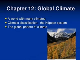
Chapter 10 Global Climate Systems. Geosystems 6e An Introduction to Physical Geography. Robert W. Christopherson Charles E. Thomsen. Climate. Climate is weather averaged over time over broader geographic areas. Usually averaged over 30-yr periods.

E N D
Chapter 10Global Climate Systems Geosystems 6e An Introduction to Physical Geography Robert W. Christopherson Charles E. Thomsen
Climate • Climate is weather averaged over time over broader geographic areas. • Usually averaged over 30-yr periods. • Climatology is the study of climate over both time and space. • One central goal is to determine climatic regions, areas with similar weather statistics. • Another central goal is to analyze climate variability over time (like global warming!).
Earth’s Climate System and Classification • Climate Components: • Insolation • Temperature • Pressure • Air Masses • Precipitation • These help the classification of climatic regions. • By using 2 principal climatic components, temperature and precipitation, general climate types are revealed
Climatic Relationships Figure 10.3
Climate Classification • Provides an organized and manageable source of information that simplifies rather complex patterns in the real world • Also gives us a common short hand way to describe climates quickly and easily • There are 2 approaches to climate classification: genetic and statistical
Climate Classification • Genetic classification: based on what major air masses and global circulations that dominate the climateidealized continent approach • Empirical classification: based on comparisons of climate variables, such as precipitation changes from season to season • statistics!
Empirical Classification • Koppen climate classification • Developed 1918 • Developed to correlate the spatial distribution of plants to the spatial distribution of climate • The Koppen-Geiger climate classification system is the updated version in your text
Koppen-Geiger • Statistical climate classification based on average monthly temperatures, average monthly precipitation, and total annual precipitation • Takes seasonality into account • Drawbacks: omits winds, temperature extremes, precipitation intensity, amount of insolation, and cloud cover
Köppen’s Climate Classifications Primary Letters • Tropical Climates (A) • Average temp of every month > 18ºC • Mesothermal Climates (C) • Coldest month average temperature < 18ºC but >-3ºC • At least 1 month average temperature > 10ºC • Microthermal Climates (D) • Average temperature of warmest month >10ºC • Average temperature of coldest month < -3ºC
Köppen’s Climate Classifications Primary Letters • Polar Climates (E) • Average temperature of all months < 10ºC • Dry Arid and Semiarid Climates (B) • Evaporation > precipitation • Highland (H)
Köppen’s Climate Classifications Secondary Letters • These letters are based primarily on seasonal precipitation: • f = adequate rainfall all through the year, no distinct dry season • w = winter dry (keep in mind the hemisphere), if 70% or more of annual rainfall occurs in summer • s = summer dry, if 70% or more of annual rainfall occurs in winter • m = extremely wet summer = monsoon. A climate only.
Köppen’s Climate Classifications Secondary Letters • For B climateonly: • S = semiarid = steppe • W = arid = desert • which results in either BS or BW. • For E climateonly: • T = tundra • F = perpetual frost = permanent ice • which results in either ET or EF.
Köppen’s Climate Classifications Tertiary Letters • The third letters in the system are based exclusively on seasonal and annual temperature: • a = hot summer, warmest month > 22°C; C and D only • b = warm summer, warmest month < 22°C; C and D only • c = cool summer, < 4 months over 10°C; C and D only • d = very cold winter, coldest month < -38°C; D only • h = dry-hot, annual temperature > 18°C; B only • k = dry-cold, annual temperature < 18°C; B only
Köppen’s Climate Classifications Examples of Combinations • Af = Tropical Rainforest climate type • Am = Tropical Monsoon climate type • BWh = Low-Latitude Hot Desert climate type • Cfa = Humid Subtropical climate type • Csa = Mediterranean climate type • Dfb = Humid Continental climate type • ET = Tundra climate type
Generalized Climate Regions Figure 10.4
World Climate Classification Figure 10.5
Temperature(curve) Precipitation(bars) Climographs
Climatic Relationships Figure 10.3
Tropical Climates (A) • Tropical Rain Forest Climates (Af) • Tropical Monsoon Climates (Am) • Tropical Savanna Climates (Aw) • Consistent daylength and insolation input • = consistent warm temperatures • Dominance by ITCZ • Shifts seasonally with high sun period • Warm ocean currents, unstable maritime air masses
Tropical Rain Forest (Af) Figure 10.7
Tropical Monsoon (Am) Figure 10.8
Tropical Monsoon Climate (Am) Figure 6.21
Arid and Semiarid Climates (B) Figure 10.3
Arid and Semiarid Climates (B) • Köppen system: • W = Desert (arid), S = Steppe (semiarid) • h = hot (mean annual temp > 18°C) • usually found in lower latitudes • k = cold/cool (mean annual temp < 18°C) • usually found in the midlatitudes • Low-Latitude Hot Desert Climates (BWh) • Midlatitude Cold Desert Climates (BWk) • Low-Latitude Hot Steppe Climates (BSh) • Midlatitude Cold Steppe Climates (BSk)
Arid and Semiarid Climates (B) • Potential for evaporation exceeds rainfall (called “moisture efficiency”) • Cover 35% of Earth’s surface • Most extensive geographically of the major climate groups • One-third of U.S. is classified as arid/semiarid • Plants are sparse but specifically adapted: • Xerophytes: adapted to aridity, drought resistant, able to store moisture
Arid and Semiarid Climates (B) • Climatic controls: • STHP: dry subsiding air over land masses • Shifting STHP: produces semiarid conditions around periphery of arid areas • Rain shadows: leeward sides of mountain ranges that intercept rainfall on windward side • Continentality: interiors of continents far from moderating effects of water bodies