Download
1 / 43
530 likes | 1.08k Vues
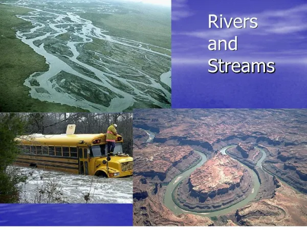
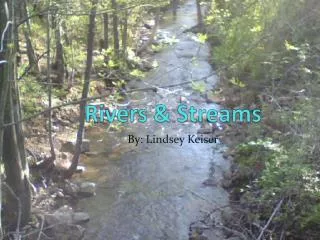
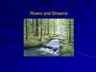
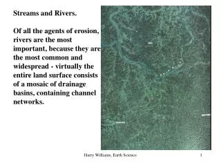
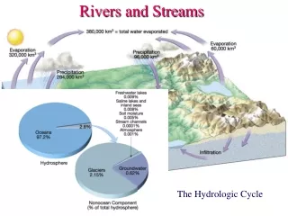
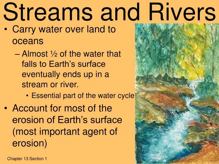
Streams and Rivers. Carry water over land to oceans Almost ½ of the water that falls to Earth’s surface eventually ends up in a stream or river. Essential part of the water cycle Account for most of the erosion of Earth’s surface (most important agent of erosion). Chapter 13 Section 1.

E N D
Streams and Rivers • Carry water over land to oceans • Almost ½ of the water that falls to Earth’s surface eventually ends up in a stream or river. • Essential part of the water cycle • Account for most of the erosion of Earth’s surface (most important agent of erosion) Chapter 13 Section 1
River Systems • river system- a river and all of its tributaries • tributary- a stream that runs into another stream or river • Carry water and sediment to a main river which eventually flows into a lake or ocean • Sediment is deposited there because the water slows down
River Systems • drainage basin/watershed- includes all the land that drains into the river either directly or through its tributaries • Largest drainage system in U. S. is Mississippi River system • Boundaries: • West = Continental Divide • East = Appalachian Mts
River Systems • divide- the high land that separates one drainage basin from another • Continental Divide in Rocky Mountains is the major divide of the U. S. • Rain falling to east flows to the Atlantic • Rain falling to west flows to the Pacific
Characteristics of Streams and Rivers • velocity- distance water travels in a given amount of time • Related to the amount of energy a river has • Determined by a number of factors • 1. Gradient (slope or steepness) • 2. Discharge (amount of water) • 3. Channel • Size (width & depth) • Shape of the path (straight/curved) • Texture (smooth/rough) • A fast-moving stream can erode materials more quickly and carry larger particles.
Characteristics of Streams and Rivers • gradient- steepness of the slope • Steeper (larger) slope closer to vertical • Gentler (smaller) slope closer to horizontal (flat) • To figure out gradient: • gradient = change in elevation change in distance
Characteristics of Streams and Rivers • discharge- amount (volume) of water that passes a certain point in a given amount of time • Often increases downstream (tributaries add water) • Not constant year-round • As discharge increases, velocity increases • Becomes wider, deeper, and may flood banks
Characteristics of Streams and Rivers • channel- the path through which the water flows in a stream or river • Size and shape affects velocity of water • Shallow and winding (a lot of boulders) • A lot of surface area in contact with water • Greater friction ~slower • Straight, wide, and deep • Less surface area • Less friction ~faster
Stream Erosion & Deposition • Streams are effective agents of erosion because as gravity pulls the water downhill, the water carries soil and rock materials with it. • When the stream’s energy decreases, these materials can no longer be transported are dropped or deposited. • This is known as deposition. Deposition Patterns Chapter 13 Section 2
How Streams Weather & Erode Material • Running water breaks up bedrock (weathering) and removes the rock and soil materials (erosion). • Mostly mechanical weathering • Split and move rocks • Abrasion (by “cutting tools” = sand, pebbles, boulders, etc.) • Produces the rounded and smoothed rocks and sand grains that are commonly found in streams/rivers.
Potholes & Plunge Pools • Pothole • Deep, oval/circular basins • Form when sand, pebbles, and small boulders swirl around in whirlpools and grind into the rocks • The “cutting tools” are often found at the bottom • Plunge pool • Basin worn away at the base of a waterfall • Form by the action of falling water and abrasion of churning particles
How Streams Transport Material • load: eroded rock & soil materials that are transported downstream • Carried in 3 ways: • 1. solution • 2. suspension • 3. bed load How Streams Transport Materials
1. Solution • Minerals are dissolved from the bedrock & carried in the water • Commonly include calcium, magnesium, & bicarbonate • Most comes from groundwater seeping into river
2. Suspension • particles are swept up and carried in the water as it swirls around (turbulence) • Particles do not touch the bottom • Includes clay, silt, and fine sand • often looks muddy
3. Bed Load • Larger particles rolled along the bottom of a stream • Includes sand, pebbles, & boulders that are too heavy to be carried by suspension • Move by rolling, sliding, jumping, or bouncing
2 Measures used to describe the ability of a stream to transport materials… • Competence: maximum size of the particles a stream can carry • Capacity: the total amount of sediment a stream can carry
The size and amount of sediment carried by a stream depends on: •Velocity (speed of stream) • Discharge (volume of water) choice A choice B Which stream carries larger/more sediment?
Stream Deposition • Rock materials and sediments transported by running water are eventually deposited. • Happens when velocity or discharge decreases • Results in “graded” (sorted) material vertical sorting animation settling rate by size, shape, density animation Horizontal sorting in a stream animation
Depositional Features • Delta: fan-shaped deposit of silt & clay that forms when a river flows into a quiet or large body of water • Resembles a triangle, surface is flat • Results from a decrease in the river’s energy • Balance between erosion and deposition • Deposition (sediment supply) greater than erosion delta grows • Erosion greater than sediment supply (deposition) delta shrinks • A river flowing into a delta splits into distributaries.
Depositional Features • Alluvial fan: fan-shaped deposit formed when a steep mountain stream meets dry, level land at the base of the mountain • Differs from a delta in several ways: • Formed on land (not in water) • Sediments are coarse • sands and gravels (instead of silt and clay) • Surface is sloping not flat
River Valleys Chapter 13 Section 3
Headward Erosion • Formation of river valley starts on small scale • Temporary stream forms small valley called gully • Gully grows in length, width, & depth each time it rains • Headward erosion: the process by which land is worn away at the head of a stream or erosion • Lengthens streams or gullies • Eventually cuts down far enough to become permanent • When join tributary gullies river system is formed
Canyons and V-Shaped Valleys • Youthful Stream • Steep gradient (slope) • Flow in a straight line • Erodes downward • V-shaped valley (canyon, gorge, chasm) • steep, almost vertical sides and narrow bottom • Form: • in areas of less rainfall • when river cuts into bed rapidly • when rock is resistant to erosion
Rapids and Waterfalls • Temporary features of streams • Because erosion is greatest here • Causes undermining • Water falling into the plunge pool at the base erodes rock there, leaving the rocks at the top to overhang • Pieces break off ~waterfall recedes further upstream *Ex. Niagra Falls Waterfall animation
Base Level • The level of the largest body of water into which a stream flows • Lowest level a stream can erode to • Lakes and rivers local base level (temporary) • Ocean (sea level) ultimate base level (final) • As stream approaches base level: • Gradient decreases (flatter) • Velocity decreases (slower) • Less erosion of bed, more erosion of sides • Valley--wider, broad floor, gently sloping walls
Floodplains & Floods • Flood: when a river overflows its banks • Floodplain: the area of the valley floor that is covered when a river floods its banks Chapter 13 Section 4
Features of a Floodplain • Mature Stream • Small gradient (slope)/flatter • Meandering (winding, bends) • Erodes wider instead of deeper • More discharge
Old Age Stream • Very small/shallow gradient (almost horizontal) • Meanders across flood plain • Sometimes forms oxbow lakes • More sediment deposited on sides
Life of a Stream Youthful Mature Old Age
Stream Deposition 1. Small sediments are deposited where the stream slows down. Friction causes slow down
2. Large Sediments show where current was flowing fasterAll smaller sized sediments washed away
3. Since streams tend to separate sediments by size, the sediments deposited are SORTED (or graded) small medium large
4. Profiles- a side view Large Sediment (Pebbles) Small Sediment (Sand) ------------------ Fast Water Slow Water Cross Section on next slide
Cross Sectional View of a Meander Slow Cut Bank Point Bar Fast Shallow Deep Sediments fall (Deposition) Cuts into curve (erosion)
Profile of a Straight Section of a Stream Slow Slow Fast ----------- Slow
5. Formation of an Oxbow Lake The river becomes so s-shaped, that the next time the river floods…
it is easier for the water to "take a short cut" and go straight across the flood plain.
Natural Levees • When a river overflows onto its floodplain, the velocity decreases & sediment is immediately deposited. • Thick deposits build up along stream banks • Form elevated (raised) ridges called levees
Floods • Naturally occurring • Can be constructive (helpful) or destructive (harmful) • Temporarily relieve river of water/sediment overload • Deposit minerals & nutrients on floodplains • Making land fertile for agriculture • Destructive for people living near river • Most result from heavy or long-lasting rain, the melting of winter snow, or both • Flash floods occur quickly, usually from short, heavy rains in areas of young, narrow streams • Human activity can worsen or even cause floods by increasing runoff (decreasing water absorption) • Cover land with buildings or pavement • Removal of vegetation • Removal of wetlands
Flood Prevention & Control • Restore natural flood protections that humans have altered • Replant vegetation • Build dams…however, they can also cause more erosion of floodplain, which worsens flooding • Build artificial levees • Can cause more erosion (due to more water & velocity) • Build spillways (channels running parallel to river) • Natural floodplain management (preserve sections of floodplain, restore wetlands, discouraging development of flood-prone areas)