Download
1 / 134
1.4k likes | 1.63k Vues
THE NEW FLOOD HAZARD AREA CONTROL ACT RULES. STATE OF NEW JERSEY DEPARTMENT OF ENVIRONMENTAL PROTECTION VINCENT J. MAZZEI, JR., PE March 13, 2008. The Floods. Between 1994 and 2003: New Jersey residents filed more than 19,000 flood insurance claims

E N D
THE NEWFLOOD HAZARD AREACONTROL ACT RULES STATE OF NEW JERSEY DEPARTMENT OF ENVIRONMENTAL PROTECTION VINCENT J. MAZZEI, JR., PE March 13, 2008
The Floods • Between 1994 and 2003: • New Jersey residents filed more than 19,000 flood insurance claims • New Jersey residents received nearly 1/4 billion dollars in flood insurance payments • Between 1996 and 2006: • Nine Major Disaster Declarations by FEMA in NJ related to flooding
HISTORY 1929: Stream encroachment program begins 1962: State begins mapping 100-year flood plains 1975: NJDEP adopts floodway rules 1977: 0% net-fill instituted in Central Passaic Basin 1984: 20% net-fill instituted Statewide 1995: Previous rules with 25-ft & 50-ft buffers adopted
“Flooding is New Jersey's #1 Natural Hazard” (FEMA, August 4, 2004)
Flood Mitigation Task Force • April 18, 2005: Acting Governor Codey forms Flood Mitigation Task Force • August 22, 2006: Governor Corzine releases final task force report • Recommended sweeping changes to New Jersey’s policies regarding development in flood hazard areas and riparian corridors
The New Rules • Proposed: October 2, 2006 • Received: 1,023 comments • Effective: November 5, 2007 • Posted: www.nj.gov/dep/landuse
Theme • No Adverse Impact: Ensuring that “…the action of one property owner does not adversely impact the rights of other property owners, as measured by increased flood peaks, flood stage, flood velocity, and erosion and sedimentation…” (Association of State Floodplain Managers, NAI White Paper, April 29, 2004)
Goals • Ensure flooding does not increase • Preserve flood storage • Prevent obstructions to flow • Protect public safety • Construct new buildings and roads above the flood hazard area elevation • Provide healthy riparian corridors • Preserve vegetation • Protect habitat
Jurisdiction THREE STEPS • Determine if you are along a regulated water(N.J.A.C. 7:13-2.2) • Determine if you are within a regulated area along this water (N.J.A.C. 7:13-2.3) • Determine if you are proposing a regulated activity(N.J.A.C. 7:13-2.4)
Step 1: Regulated Waters All waters are regulated except: • Manmade canals: N.J.A.C. 7:13-2.2(a)1 • Coastal wetlands: N.J.A.C. 7:13-2.2(a)2 • Waters that drain less than 50 acres in three particular cases described at N.J.A.C. 7:13-2.2(a)3 SEE N.J.A.C. 7:13-2.2(a)
Step 1: Regulated Waters A water is not regulated if it drains less than 50 acres and meets one or more of the following: 1. The water has no discernible channel - such as a freshwater wetlands swale SEE N.J.A.C. 7:13-2.2(a) 3i
Step 1: Regulated Waters 2. The water is confined within a lawfully existing, manmade conveyance structure or drainage feature, such as a pipe, culvert, ditch, channel or basin (not including any water that historically possessed a naturally-occurring, discernible channel, which has been piped, culverted, ditched or similarly modified) SEE N.J.A.C. 7:13-2.2(a) 3ii
Step 1: Regulated Waters 3. The water is not connected to a regulated water by a channel or pipe, such as an isolated pond or depression that has no outlet. SEE N.J.A.C. 7:13-2.2(a) 3iii
Step 2: Regulated Areas • Along regulated waters there are two distinct and overlapping areas of jurisdiction: 1. The flood hazard area 2. The riparian zone
Flood Hazard Area • A flood hazard area exists along every regulated water that has a drainage area of 50 acres or more SEE N.J.A.C. 7:13-2.3(a)1
Riparian Zone • A riparian zone exists along every regulated water, except there is no riparian zone along: • The Atlantic Ocean • Any manmade lagoon or stormwater management basin • Any oceanfront barrier island, spit or peninsula • Any piped section of an otherwiseregulated water SEE N.J.A.C. 7:13-2.3(a)2
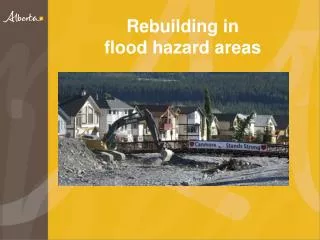
Flood Hazard Area • Approximately 35% of New Jersey lies in a flood hazard area
Flood Hazard Area • The flood hazard area is comprised of the floodway and flood fringe
Flood Hazard Area • Area inundated by the flood hazard area design flood • In tidal areas: equal to 100-yr (1%) flood • In fluvial areas: equal to 100-yr (1%) flood plus a factor of safety • Previous rules required assumption of full development of upstream watershed • New rules add different factors of safety depending on the mapping resources available
Floodway • Conveys the majority of floodwater • Structures & other materials can obstruct flow and increase flooding • Calculated using a 0.2-ft rise in the 100-year flood elevation
Flood Fringe • The portion of the flood hazard area outside the floodway • Waters are less deep and move slower than in floodway • Structures, fill and other material can displace flood storage volume and increase flooding
Flood Hazard Area • THERE ARE 6 METHODS FOR DETERMINING THE FLOOD HAZARD AREA • Method 1 (Department delineation method) • Method 2 (FEMA tidal method) • Method 3 (FEMA fluvial method) • Method 4 (FEMA hydraulic method) • Method 5 (Approximation method) • Method 6 (Calculation method) SEE N.J.A.C. 7:13-3
RiparianZone • Measures 50, 150 or 300 ft from a regulated water (previously 25 or 50 ft)
Riparian Zone • 300 ftalong: Category One waters and upstream tributaries within the same HUC-14 watershed • Category One waters are listed in the Department’s Surface Water Quality Standards at N.J.A.C. 7:9B • Not exactly the same as the Special Water Resource Protection Area SEE N.J.A.C. 7:13-4.1
300-ft Riparian Zone • Difference #1: The SWRPA applies only to waters that are shown on a USGS quad or County Soil Survey • The riparian zone applies to regulated waters regardless of any mapping SEE N.J.A.C. 7:13-4.1
300-ft Riparian Zone • Difference #2: The SWRPA applies only to projects that are major developments • The riparian zone applies to regulated waters regardless of the size of the project SEE N.J.A.C. 7:13-4.1
150-ft Riparian Zone • Trout production waters and all tributaries • Trout maintenance waters and all tributaries within one mile • Waters that flow through an area that contains documented T&E habitat (if plant/animal is critically dependent on the regulated water for survival) and all tributaries within one mile • Waters that flow through an area that contains acid producing soils SEE N.J.A.C. 7:13-4.1
50-ft Riparian Zone • Along all other waters • Most common riparian zone width, especially in urbanized areas (except where acid producing soils exist) SEE N.J.A.C. 7:13-4.1
If a discernible bank is NOT present:Along a linear fluvial or tidal water, such as a stream, the riparian zone is measured landward of the feature's centerline
If a discernible bank is NOT present:Along a non-linear fluvial water, such as a lake or pond, the riparian zone is measured landward of the normal water surface limit
If a discernible bank is NOT present:Along a non-linear tidal water, such as a bay or inlet, the riparian zone is measured landward of the mean high water
If a discernible bank is NOT present:Along an amorphously-shaped feature, such as a wetland complex, through which a regulated water flows but which lacks a discernible channel, the riparian zone is measured landward of the feature's centerline
Step 3: Jurisdiction THREE STEPS • Determine if you are along a regulated water • Determine if you are within a regulated area along this water • Determine if you are proposing a regulated activity
Regulated Activities 1. The alteration of topography through excavation, grading and/or placement of fill; 2. The clearing, cutting and/or removal of vegetation in a riparian zone; 3. The creation of impervious surface; 4. The storage of unsecured material; 5. The construction, reconstruction and/or enlargement of a structure; and 6. The conversion of a building into a private residence or a public building. SEE N.J.A.C. 7:13-2.4(a)