Download
1 / 10
120 likes | 362 Vues
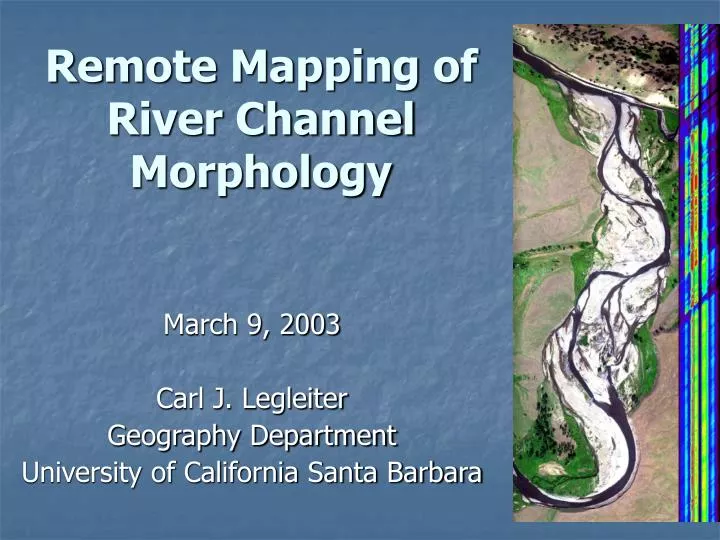
Remote Mapping of River Channel Morphology. March 9, 2003 Carl J. Legleiter Geography Department University of California Santa Barbara. Acknowledgements. Collaborators Dar Roberts and Tom Dunne, UCSB Mark Fonstad, Southwest Texas State University Andrew Marcus, University of Oregon

E N D
Remote Mapping of River Channel Morphology March 9, 2003 Carl J. Legleiter Geography Department University of California Santa Barbara
Acknowledgements • Collaborators • Dar Roberts and Tom Dunne, UCSB • Mark Fonstad, Southwest Texas State University • Andrew Marcus, University of Oregon • Robert Crabtree and Kerry Halligan, Yellowstone Ecological Research Center • Annie Toth, Jim Rasmussen, Rob Ahl, Seth Peterson • Funding agencies • NASA Earth Observation Commercial Applications Program - Hyperspectral • NASA Jet Propulsion Laboratory • California Space Institute • American Society for Engineering Education • National Science Foundation
Project rationale Significance of river channel morphology Role of remote sensing Methodology Laboratory spectra / numerical simulation Hyperspectral image analysis Radiative transfer modeling Accuracy assessment / sensitivity analysis Anticipated results Flexible model for estimating depth from imagery Identify potential and limitations of remote approach Broader impacts Applications in geomorphology and ecology Powerful tool for resource management Presentation outline
River channel morphology and the role of remote sensing • Channel morphology • establishes physical habitat conditions • influences flow processes and sediment transport • responds sensitively to disturbance impacts • requires an accurate, quantitative, and spatially explicit descriptive framework • Remote sensing • provides expanded coverage • captures spatial and temporal variations • allows analysis across a range of scales
Spectral properties of streams: measurement and modeling • Signal recorded by sensor influenced by • water depth • substrate characteristics • suspended sediment • surface turbulence • viewing and illumination geometry • Direct spectral measurements • Depth, substrate, image geometry • Numerical simulation • Suspended sediment, specular reflectance
Hydraulic / hyperspectral analysis • Data sources • AVIRIS hyperspectral imagery • USGS streamflow records • Theoretical basis • Manning’s equation Q = AR2/3S1/2/n • Radiative transfer models • Solution technique • Iteratively adjust model parameters to match measured discharge
Model evaluation • Accuracy assessment • AVIRIS scenes excluded from model-building • Probe-1 hyperspectral imagery and field data from Lamar River, WY • Sensitivity analyses to quantify effects of • suspended sediment • substrate variability • channel complexity • sensor resolution • Goal: identify appropriate conditions and define limitations
Anticipated Results • Laboratory spectral library • depth, substrate, image geometry • Radiative transfer model for estimating depth from imagery • flexible and physically-based • Quantitative analysis of potential and limitations • critical assessment of the technique • Continuous bathymetric maps • detailed, spatially extensive representation of channel morphology
Applications and broader impacts • Fluvial geomorphology • process interactions across a range of scales • Stream ecology • spatial distribution of habitat within watersheds • Resource management • inventory and monitoring • in-stream flow requirements • stream restoration • flood hazard assessment • Preservation efforts • maintain geomorphic, biotic, and aesthetic integrity
Conclusion: Remote mapping of channel morphology • Rationale • Ecological significance and vulnerability of streams • Remote sensing offers synoptic perspective • Methodology • lab spectra • hyperspectral/hydraulic analysis • accuracy assessment • Research objectives • flexible model for estimating depth • document potential and limitations • Applications • fluvial geomorphology • stream ecology • resource management