Download
1 / 39
390 likes | 535 Vues

E N D
Warsaw Agricultural University Department of Hydraulic Engineering and Environmental RecultivationCenter Of Excellence In Wetland Hydrology “WETHYDRO”Workshop 1"MEASUREMENT TECHNIQUES AND DATA ASSESSMENT IN WETLANDS HYDROLOGY" Biebrza Wetlands Goniadz, 12-14 June 2003
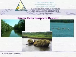
Danube Delta National Institutefor Research & Development Tulcea, ROMANIA
DANUBE RIVER: 2,840 Km length HYDROGRAPHIC BASIN - 817,000 Km2
Main Danube Delta hydrographic network modifications made within 1903 - 1997
Ecosystems map The establishmng ecosystems types have been made using the methodology of CORINE program.
8 9 Lacul MERHEI DUNAREA 2 2 20 5 12 3 7 21 13 22 18 Lacul RAZIM L.BABADAG 9 17 17 17 Lacul GOLOVI[A MAREA NEAGR~ 37 18 11 Danube Delta Biosphere Reserve hydrographic network
The highest Danube River levels (H) recorded at Tulcea harbour - Danube Delta’s upstream zone. Interval study: 1932-2002
Inundation days for the Danube Delta inner zones - Danube River water levels > 290 cm, Q > 10,000 m3/s
MONTHLY MULTIANNUAL CHARACTERISTIC VALUES FOR DANUBE RIVER WATER DISCHARGE (Q, m3/s) Measurement station: Tulcea port Study interval: 1840 - 1990
WATER SALTS DISCHARGE BALANCE (M, kg/s) MEAN VALUES FOR WATER MINERALIZATION Study interval: 1858 - 1990
WATER DISCHARGE BALANCE: Q (m3/s) Mean values within study year intervals
WATER DISCHARGE BALANCE - Mean values in interval study Q(m3/s)
SEDIMENT LOAD DISCHARGE BALANCE (R, kg/s) Study interval: 1858 - 1990 MEAN VALUES
Danube Delta Biosphere Reserve Hydrogrometric stations Hydrographic object: DANUBE River at Isaccea (ISC), Ceatal Izmail (CID)
Hydrotechnics works for navigation stream cross-section improvement