Download
1 / 25
250 likes | 387 Vues
Progress on Development of an Integrated Ecological Response Model for the Lake Ontario/St. Lawrence River. Presented by: Limno-Tech, Inc. September 11, 2002. Overview. Project Background Role of modeling for addressing the ecosystem level problems

E N D
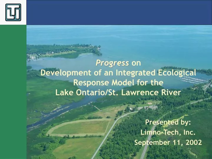
Progress on Development of an Integrated Ecological Response Model for the Lake Ontario/St. Lawrence River Presented by: Limno-Tech, Inc. September 11, 2002
Overview • Project Background • Role of modeling for addressing the ecosystem level problems • Development of conceptual framework for the LOSL Integrated Model • Development of a prototype LOSL Integrated Ecosystem Model • Demonstration of the prototype model • Next Steps
Background • LTI is assisting the LOSL Study Board and the ETWG in evaluating the ecological impacts of alternative flow and water-level regulation plans for the Lake Ontario-St. Lawrence River system • Three-phase project to synthesize all ecological research on system into an integrated ecosystem model • Phase 1 of project begun end of May, 2002 • Phase 1 intended to develop conceptual ecosystem model and demonstration prototype, and plan for full implementation
Phase 1 Tasks • Form a Modeling Advisory Panel (MAP) that can provide advice and system-level perspective • Develop a Conceptual Model Framework for the LOSL Integrated Ecological Response Model • Develop and vet a simple prototype model • Based on vetting of prototype, develop design criteria for full LOSL Integrated Ecological Response Model • Prepare a plan for development, implementation and application of a system-wide LOSL Integrated Ecological Response Model
Why Develop an Integrated Ecosystem Response Model? • Model serves as synthesis/repository of system knowledge • Model helps identify gaps in knowledge and data • Model allows assessment of multiple stressors acting in concert on multiple endpoints • Model connects and integrates different geographical areas of system
Why Develop an Integrated Ecosystem Response Model? • Model quantifies and demonstrates cause-effect relationships, including feedback processes • Model has potential to extend empirical observations in space and time (e.g., compute long-term response from short-term processes) • Model helps in evaluations and forecasts in Adaptive Management
Role of Integrated Ecological Response Model (LOSL IERM) • Quantify the relationship between water-level and flow fluctuations under alternative regulation plans and effects on ecological performance indicators • Integration of various ETWG ecological component response models • Captures important ecological feed-forward and feedback interactions • Account for management actions and system stressors related to other management issues and natural conditions • fisheries management, nutrients, toxic chemicals, aquatic nuisance species • natural hydrologic variability, global climate change • Provide ecological performance indicator output to the overall Shared Vision Model • Appropriate for environmental evaluations • Allows comparison with other interests
Conceptual Model Natural hydrological & climatological variations Regulation Other Management Actions and System Stressors H&H Model predicted water level/flow hydrograph Changes in Food Resources/Trophic Transfer Changes in Habitat Quantity/Quality • Shoreline Habitat • Wetland Habitat • Nearshore Habitat • Riverine Habitat • Open water/Impoundments Primary Producers Primary Consumers Secondary Consumers Tertiary Consumers Value? Input to Shared Vision Model Ecological Responses
Conceptual Model: Trophic Structure Phytoplankton/Benthic algae Aquatic Macrophytes Primary Producers Primary Consumers Zooplankton Benthic invertebrates Secondary Consumers Forage Fish Top Predator Fish Reptiles and amphibians Tertiary Consumers Birds Mammals
Conceptual Model Outputs Related to Ecological Performance Indicators • Muskrats • Habitat-specific abundance • Birds • Species richness • Relative abundance of guilds • Amphibians/reptiles • Fish – spatially specific • Fish guilds – population and biomass dynamics • Northern Pike – population and growth rate • Habitat and food availability • Wetland plant diversity • Habitat-specific area of each vegetation type • Wetland plant biomass • Special interest habitats • Special interest species • Water quality • Nutrient levels in water column and sediments
Conceptual Model: Northern Pike Population Sub-model Water Levels/Flow Nutrient Sources Effect on Food Availability: Primary Producers Effect on Habitat Phytoplankton/Benthic algae Aquatic Macrophytes Temperature Effect on Food Availability: Primary and Secondary Consumers Zooplankton Benthic invertebrates Abundance Juvenile Northern Pike Abundance Age-0 Northern Pike Stocking Abundance Adult Northern Pike Mortality • Predation • Natural Mortality • Harvest
Conceptual Model: Northern Pike Bioenergetics Sub-model Water Levels Nutrients Wetland Quantity/Quality Phytoplankton Stocking Zooplankton Northern Pike Biomass Juvenile Northern Pike Biomass Planktivores Mortality Harvest
Conceptual Model: Spatial Discretization Protected Bay Wetlands Drowned River mouth Open Water Open Embayment Lake Ecosystem Upper River Ecosystem Lower River Ecosystem Near Shore Beach Barrier Open bay wetland Move toward GIS-based habitat-specific resolution?
Conceptual Model: Temporal Scales Solar Radiation Temperature Input Data Forcing Functions and Environmental conditions Phytoplankton Zooplankton Biomass of Phytoplankton Zooplankton Biomass (mg C/L) No Read Data for next day Time Time = Month Yes No Read Data for next month Time=Max Time (say year) Yes Print Output End
Example: Forage Fish Interactions Temperature DO Muskrat Zebra Mussels Wetland Habitat Plankton Production Forage Fish Top Predator Fish Nutrients Benthic Production Birds
LOSL Prototype Model Overview • Prototype model demonstrates feasibility and utility of the full IERM. • Prototype model is currently driven by empirical relationships based on available literature. • Current performance indicators (PIs): • Wetland emergent plant coverage • Wetland emergent plant biomass • Wetland diversity index • Northern pike adult population • Muskrat population
LOSL Prototype Model Overview • Actual PIs and associated algorithms will be based on ETWG study results. • Five regulation scenarios currently provided by Bill Werick, including: • 1958DD (baseline scenario) • Pre-Regulation • Water level time series currently available for: • Lake Ontario • Lake St. Lawrence
Wetland Sub-model • Wetland emergent area/biomass • Emergent total area/biomass inversely related to water level • Based on Lake St. Pierre study (Hudon, 1997) • Wetland plant diversity index • Uses a representative wetland flood elevation to determine flooding frequency • Related to number of years between floods (disturbance events) (IJC, 1993)
Northern Pike Sub-model • Simple population model adapted from pike model for Hamilton Harbour (Minns 1996) • Tracks age class populations: • Young-of-year • Juveniles • Adults • Habitat suitability index (HSI) based on: • Wetland diversity index • Emergent plant coverage • Spring water level variation
Northern Pike Sub-model HSI % Emergent Coverage Wetland Sub-model Weighted Usable Area YOY Survival Rate Vegetation Diversity * Total Area Hydro Sub-model Spring Water Level Decline
Muskrat Sub-model • Adult muskrat population computed based on assumed density (no./ha) and habitat weighted useable area. • Habitat suitability index (HSI) based on: • Intra-annual water level fluctuation • Emergent plant coverage • Wetland hydroperiod
Muskrat Sub-model HSI Hydro period Wetland Sub-model % Emergent Coverage Weighted Usable Area Muskrat Population * Total Area * Optimal Density Hydro Sub-model Annual Fluctuations
Next Steps • Phase 1 completion (Oct, 2002): • Revise conceptual model based on input from ETWG, MAP, and other TWGs. • Prepare IERM development and application plan (include model concept, assumptions, design criteria, calibration/application strategy). • Phase 2 (2002-2003): • Work closely with ETWG sub-groups to structure and link sub-models. • Work with ETWG, MAP, and Plan Formulation Group to establish time and space scale for model.
Next Steps (cont) • Phase 2 (cont): • Work with other TWGs to obtain necessary input and desired outputs from IREM. • Encode and beta-test working model. • Phase 3 (2003-2004): • Integrate all available system data and new data being developed by LOSL studies. • Calibrate model with available field observations and conduct sensitivity analysis. • Apply model to evaluate alternative regulation plan scenarios and assess responses to other system stressors.