Download
1 / 17
240 likes | 707 Vues
ArcGIS. ArcCatalog, ArcMap and ArcToolbox. ArcCatalog. ArcCatalog let you Find Preview Document Organize geographical data Create personal geodatabase to store that data Create and import feature classes and tables View and update metadata

E N D
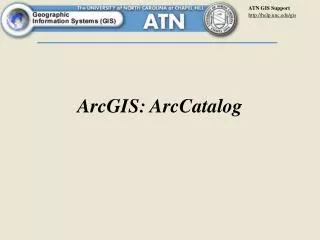
ArcGIS ArcCatalog, ArcMap and ArcToolbox
ArcCatalog • ArcCatalog let you • Find • Preview • Document • Organize geographical data • Create personal geodatabase to store that data • Create and import feature classes and tables • View and update metadata • Drag and drop data onto an existing map in ArcMap
ArcMap • Create and interact with maps • View, edit and analyze geographic data • Query spatial data • Symbolize your data • Create charts and reports • Map layouts • Support wide variety of data format (shapefile, coverages, tables, CAD drawings, images, grids, and triangular irregular network)
ArcToolbox • GIS geoprocessing tools
ArcGIS Feature Classes, Data File Formats in ArcGIS
Feature Class • A single geographic feature type (having the same spatial representation) corresponds to a feature class • Feature classes in geodatabase are: • Point feature class • Line feature class • Polygon feature class • Annotation
Data File Formats and ArcGIS • Shapefile - legacy ESRI (ArcView 3.x) • Coverage - legacy ESRI (ArcInfo 7.x) • Geodatabase - most recent (ArcGIS 8.x onwards) • Layer Source: http://www.indiana.edu/~gisci/courses/g338/lectures/introduction-to-gis-2.html
Shapefile (.shp) • Each shapefile corresponds to a feature class • A complete shapefile comprises of at least 3 files with the same prefix name( *.shp, *.shx and *.dbf) (should be saved in a same folder) • Geometric information displayed in ArcCatalog's "Preview” • Attribute information displayed in ArcCatalog's "Table Preview" http://www.geog.ucsb.edu/~jeff/gis/data_models1.html
ArcInfo Coverages • A coverage is a collection of files in a subdirectory • Contains multiple geographic feature types • Folder that contains all of these feature classes is the actual coverage • Two folders within a workspace (one with the name of the coverage and another named ‘info’) • Geometric information displayed in ArcCatalog's"Preview” • Attribute information displayed in ArcCatalog's "Table Preview" http://www.geog.ucsb.edu/~jeff/gis/data_models1.html
ArcInfo Coverages In Class Exercise • Question:1- Use ArcGIS Help to find "coverages" to answer the following questions. • List any 3 feature classes that a coverage can contain. • What are tic points?
Geodatabase (.mdb) • Primary mechanism used to organize and use geographic information in ArcGIS • Geodatabase is a collection of geographic datasets of various types (vector, raster, and tabular data) • Can be created, accessed, managed through standard menus and ArcCatalog, ArcToolbox and ArcMap
Geodatabase http://www.geog.ucsb.edu/~jeff/gis/data_models1.html
Layer File (.lyr) • Readable directly by ArcGIS • Does not contain actual geographic data • Specifications for the presentation of other datasets • color • label properties (font, color, placements, etc.)
Icons and hierarchy Source: http://www.geog.ucsb.edu/~jeff/gis/data_models1.htm