Download
1 / 36
420 likes | 889 Vues
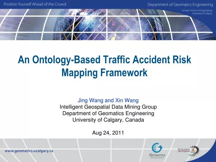
An Ontology-Based Traffic Accident Risk Mapping Framework. Jing Wang and Xin Wang Intelligent Geospatial Data Mining Group Department of Geomatics Engineering University of Calgary, Canada Aug 24, 2011. Outline. Overview of Road Accident Problem.

E N D
An Ontology-Based Traffic Accident Risk Mapping Framework Jing Wang and Xin Wang Intelligent Geospatial Data Mining Group Department of Geomatics Engineering University of Calgary, Canada Aug 24, 2011
Outline • Overview of Road Accident Problem • An Ontology-Based Traffic Accident Risk Mapping Framework • System Implementation and Case studies • Conclusions and Future Work
Road Safety Problem 1.18 • World Health Organization estimates 1.18 million people were killed by road accidents in 2002. (Source: WHO, 2004) • In Canada, about 3,000 are killed every year on roads. (Source: www.RememberRoadCrashVictims.ca) 3,000 • In Alberta, the average time between collisions is 5 minutes. (Source: Tay, 2006) 5 How to reduce traffic fatalities and serious injuries on public roads?
Accident Concentration • The occurrences of traffic accidents • Seldom random in space and time, but form clusters in geographic space • These accident concentration areas or locations have increased likelihood for an accident to occur based on spatial dependency of historical data.
Research Goal • Generate road traffic accident risk maps showing the risk area • “Risk” not only reflect the accident numbers but also the degree of danger
Weakness of Traditional Approaches 1. Handle accident analysis at data level • Cannot generate different maps to meet users’ different needs e.g. a map for the “downtown area” or the “rush hours” only • 4-year (1999-2002) accident statistics on the 16th Avenue of Calgary with the same time interval of the day
Weakness of Traditional Approaches 2. Ignore the severity levels of accidents Accident with Injury Accident with property damage only Fatalities and injuries put more strain on the network.
MinPts = 5 Eps = 40 How to Improve? • How to help user select the proper dataset? • Naive option - Translate users' requirements into traditional database queries [SQL] Select * from TrafficAccidentTable where AccidentCondition = “Rain” AND location = “DowntownArea”….. • Second option - Handle users' requirements at the knowledge level Ontology (provides domain knowledge include the non-spatial and spatial concepts and definitions relevant to the traffic accident. ) • How to generate the traffic accident risk map? DBSCAN (Density-Based Spatial Clustering of Applications with Noise)
ONTO_TARM Framework ONTOlogy-Based Traffic Accident Risk Mapping Framework Ontology-Based Traffic Accident Risk Mapping Framework Domain Ontology User’s goal Clustering Engine Publishing Module Reasoner User Proper Datasets Interface Data
Domain Ontology • The Traffic Accident Domain Ontology (TADO) • A formal description of the classes of concepts and the relationships among those concepts that describe traffic accidents. • Based on a 7-tuple structure O:= {D, C, R, A, HC, prop, att} • domain context identifier D • Concept set C • The relation identifiers R • Attributes describe C and R A • A concept hierarchy classification HC • Function prop • Function att
Traffic Accident Domain Ontology (TADO) Country Polygon Province Line RoadCondition City GeometricThing Point LightCondition County GeopoliticalRegion EnvironmentalCondition GeopoliticalRegion RoadSurfaceCondition Community GeographicalRegion GeospatialThing GeographicalRegion WeatherCondition EcologicalRegion AccidentCondition CitySection GeoculturalRegion Instant Thing TemporalCondition Interval Building Expressway FixedStructure Accident_Records DateTimeDescription Station Highways RoadCondition Roadway Majorroad LightCondition EnvironmentalCondition RoadSurfaceCondition Localroad WeatherCondition
Reasoner • Input of the reasoner is a user’s goal, and the output is a set of properties dataset • Decompose into one or more spatial and non-spatial tasks • Assemble returned results • Example: • Risk map for “The accidents happened in rush hours with bad weather in downtown Calgary” • Subtask 1 (Spatial task): find the "downtown Calgary". • Subtask 2 (Nonspatial task): find the “rush hours with bad weather ”. • Subtask 2.1 (temporal condition task) find the “rush hours” • Subtask 2.2 (weather condition task) find the “bad weather”
findDowntownAreaTask Pseudocode of spatial query task findDowntownAreaTask Sub-task: findDowntownAreaTask defgoal find Calgary Downtown Area Input: (object (is-a City) (object?ci) (hasName "Calgary")) (object (is-a CitySection) (object?cs) (hasName "Downtown Area") (insideOf?ci)) (object (is-a community) (object?co) (insideOf?ci) (belong-section?cs)) Output: (object (is-a $?community) (object? co))
findAccidentConditionTask Pseudocode of Nonspatial query task findAccidentConditionTask sub-task: findAccidentConditionTask defgoal find Accident Conditions Input: (object EnvironmentalCondition?ec (RoadSurface-condition "dry"), (RoadCondition "straight" || "curve"), (WeatherCondition findSevereWeatherTask()) (LightCondition "artificial"||"nature")) (object TemporalCondition?tc (Interval? findRushHoursTask())) … (object (is-a AccidentCondition) (object?ac) (include?ec & tc)) Output: (object (is-a $?AccidentCondition) (object?ac))
Risk Index • How to define the risks? Assign different weights to accidents with different severity levels With in a given accident dataset D, i - ith severity level n – the total number of different severity levels Count() - a function to get the total number of accidents at that level Wi - the weight assigned to the ith severity level
Risk Index Model • Converted into Equivalent Property Damage Only (EPDO) accidents • EPDO = W1* Fatal + W2* Injury + W3* PDO • PDO: property damage only crashes • e.g. PIARC (Permanent International Association of Road Congresses) recommended formula: W1=9.5; W2=3.5; W3=1; EPDO = 9.5 * Fatal + 3.5 * Injury + PDO Different jurisdictions use different weighting schemes:Model Ratio Source 1 1:1:1 Simple Total Crash Count 2 9.5:3.5:1 PIARC 3 76.8:8.4:1 North Carolina DOT 4 136.13:4.94:1 Ohio DOT 5 779.9:13.88:1 Transport Canada 6 1300:90:1 Federal Highway Administration DOT: Department of Transportation
Modified DBSCAN for Traffic Accidents • Density-based Clustering for Traffic Accident Risk (DBCTAR) Fatal Injury MinPts = 5 Eps = 40 PDO MinRisk =10 RiskIndex = W1* Count(Fatal) + W2* Count(Injury) + W3* Count(PDO) 9.5 3.5 ×6 1 ×1 ×1 19 = > RiskIndex Threshold: MinRisk
Main Interface Global Setting Menus Quick Setting Panel Tool bar Map Area Layer Control Status bar
Case Studies • Dataset • Reported collisions on the road within Alberta province (770,000+ records) • Network street dataset is clipped from Street Map of North American in the ArcGIS 9.3 Media Kit • Community boundary dataset is from census subdivisions • User’s goals • Case 1: to find a risk map "at rush hours in the morning of downtown area of Calgary" • Case 2: to find a risk map “between 8:00-10:00pm in the downtown area of Calgary” • Case 3: to find a risk map “on the Deerfoot Trail in Calgary”
Results Risk model = PIARC, MinRisk = 8, Eps=45, MinPts=3 (Case 2) Risk map between 8:00-10:00PM of Calgary downtown area (Case 1) Risk map in rush hours (7:30-9:00AM) of Calgary downtown area (Case 3)Risk Map of Deerfoot Trail (extract)
Results Road Accident Risk Mapping Web Publishing Platform
Results A risk map generated based on user’s requirement “Calgary downtown area under snow condition”, published with online platform MinRisk
Evaluation Detail Comparison of two mapping results Site 1 Site 2 Kernel Density Estimation (KDE) Result (radius set to 40 meters and cell size is 10X10 meters.) (A) KDE Site 1 Site 2 (B) DBCTAR 23
Evaluation Site 1 Site 2
Conclusions • Ontology is first time integrated into a traffic accident risk mapping framework to generate different risk maps based on users' goals • A density-based spatial clustering method for traffic accident risk (DBCTAR) is proposed • To demonstrate the framework, a prototype of proposed framework has been implemented • The preliminary results from the case studies are promising
Future Work • Improve ontology reasoner and map generator • Provide recommendations for the weight model • Adopt other properties in the risk index model • Explanations from civil experts
References • WHO, 2004. World Health Organization, World Report on road traffic injury prevention, World Health Day Publication. • RememberRoadCrashVictims.ca 2009. RememberRoadCrashVictims.ca • Anderson, Tessa K. 2009. Kernel density estimation and K-means clustering to profile road accident hotspots. Accident Analysis & Prevention 41, no. 3 (May): 359-364. • Borruso, G. 2005. Network density estimation: analysis of point patterns over a network, Osvaldo Gervasi, Marina L. Gavrilova, Vipin Kumar, Antonio Laganà, Heow Pueh Lee, Youngsong Mun, David Taniar, Chih Jeng Kenneth Tan (Eds.): Computational Science and Its Applications - ICCSA 2005, International Conference, Singapore, May 9-12, 2005, Proceedings, Part III. Lecture Notes in Computer Science 3482, 126-132. • Flahaut, B., Mouchart, M., Martin, E.S., and Thomas, I. 2003. The local spatial autocorrelation and the kernel method for identifying black zones a comparative approach, Accident Analysis & Prevention, 35, 991-1004. • Okabe, A. and Yamada, I., 2001. The K-function method on a network and its computational implementation. Geographical Analysis 33 3, pp. 271–290 • Okabe, A. Satoh, T. and Sugihara, K. 2009. A kernel density estimation method for networks, its computational method and a GIS-based tool. International Journal of Geographical Information Science 23(1):7 - 32. • Shino S. 2008, Analysis of a distribution of point events using the network-based quadrat method, Geographical Analysis 40 (2008), pp. 380–4000. • Steenberghen, T., Dufays T., Thomas,I. and Flahaut. B. 2004. Intra-urban location and clustering of road accidents using GIS: a Belgian example. International Journal of Geographical Information Science 18(2): 169 - 181. • Xie Z., Yan, J. 2008. Kernel density estimation of traffic accidents in a network space.. Computers, Environment and Urban Systems, 32, pp. 396-406. • Ester, M. Kriegel, H. Sander, J. & Xu, X. 1996. A Density-Based Algorithm for Discovering Clusters in Large Spatial Databases with Noise. In Proc. Second International Conference on Knowledge Discovery and Data Mining: 226-231. Portland: AAAI Press. • Wang, X., Gu, W., Ziébelin, D. and Hamilton, H. 2010. An Ontology-Based Framework for Geospatial Clustering, International Journal of Geographical Information Science, 24(1): 1601 - 1630 • Gruber, T. R, 1993. A translation approach to portable ontologies. Knowledge Acquisition, 5(2) (1993) 199-220
Thank You ! 28
System Implementation Prototype Implementation 29
Ontology Implementation Using Protégé OWL
Mapping Find the suitable parameters Limited to the Network Publish Evaluation Buffer & Intersect Clustering
Spatial Clustering MinPts = 5 K-dist (p): distance from the kth nearest neighbour to p Eps = 40 q Sorting by k-dist (p)
Threshold - MinRisk The kth-distance of p (k=30)
Threshold - MinRisk The risk index value of the Eps neighbours of p (Eps=100)
[rule: (?X tado:insideOf ?Y) (?Y tado:insideOf ?Z) -> (?X tado:insideOf ?Z)]