Download
1 / 29
290 likes | 309 Vues
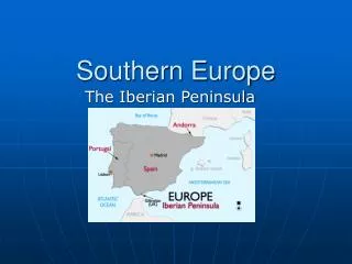
Orographic Storms in the Southern Europe. Heavy precipitating storms resulting from proximity to Mediterranean Sea Fall season particularly dangerous because of warm water

E N D
Orographic Storms in the Southern Europe • Heavy precipitating storms resulting from proximity to Mediterranean Sea • Fall season particularly dangerous because of warm water • Many ranges of mountains act to channel low-level flow into jets that focus lifting and lead to sustained precipitation that can result in flooding • Two types of storms: • Simple orographic storms • Convective orographic storms
Flash Floods in Europe • Fall season when first cold troughs move in and: • Mediterranean is still warm • Sahara is still hot and boundary layer is deep • Sawyer-Elliasen Circulation strong • Elevated Mixed Layer off Sahara • Channeling by topography
Ingredients for Southern Europe Flash Flood • Approaching long wave trough from west produces strong southerly flow surge • Deep desert boundary layer drawn from Sahara northward over the Mediterranean marine boundary layer forming strong cap • Air-sea interaction increasing moisture and theta_e below the cap • Channeling by topography to focus flow into a jet against the continent • Mountains breaking inversion to “pull the trigger”
Piemonte FloodOctober 12-16, 2000 • Orographic heavy rain in Piemonte region of northern Italy (along Swiss Border) • Problem was duration of rain more than intensity. • Moisture focused by low level channeling • Upper level trough stalled by high pressure to east
Alps <= Piemonte region
Convective Orographic Storms • Conditionally unstable flow approaching a barrier leads to the formation of deep convection along slopes of mountains • Orographic lifting itself can destabilize the flow • Mountains may act as a trigger to release instability built up elsewhere
Flash Flooding • Convective orographic rains are especially likely to lead to flash flooding • Topography focuses runoff • Topography can break a strong cap • Topography focuses convective release • Topography increases conditional instability
Flash Flooding • When large amounts of rain fall in a short time • Most likely when • Cap is strong, focusing convection along slopes • Moisture is high leading to high energy release through latent heating and also high rainfall • Air is warm, and can hold a lot of moisture
Flash Flooding in the Rockies • Normally, there is not enough moisture • In the west, the ocean is relatively cool in the summer and so the on shore flow is not conditionally unstable • In the east, Gulf moisture rarely reaches the severe topography from the east • When it does, storms typically move away from their genesis region because of the upper level Westerlies • Normally, the upper level flow moves from the west, moving storms in the east off the slopes
Two major Flash Floods: Both are listed as “Storms of the Century” • The 1972 Rapid City South Dakota Flood • The 1976 Big Thompson Canyon, Colorado Flash Flood
Common Large-Scale Features to Big Thompson and Rapid City • Negatively tilted ridge just east of threat area, producing low inertial stability and low winds at storm outflow level • A weak 500 mb short-wave trough rotates northward in long wave trough as it approaches threat area, I.e. PVA • Light southeast to south-southeast (5-20 kt) winds in upper troposphere over threat area • Slow moving stationary polar front just to south of threat area • High moisture content present through large depth of troposphere
Common Mesoscale Features to Big Thompson and Rapid City • Afternoon heating to west of threat area and cold air advection to east combine to increase thickness and pressure gradients • Narrow band of conditionally unstable and unusually moist air moves westward behind polar front • Orographic lift provides mechanism to break cap and release instability • Cells drift slowly north-northwestward and new cells regenerated on southern flank where cold front intersects mountains resulting in quasi-stationary system
Summary of Orographic Flash floods • Occur when orography acts to break a strong inversion and resulting storms remain focused along the slopes • Ingredients include: • High conditional instability of air approaching mountains • Strong cap so that convection does not “jump the gun” and go off before the flow reaches the mountains • Upper level winds that will not allow convection to move back toward moisture and instability source region • Focusing of the flow along a particular mountain site: • Topography channeling • Local fronts