Download
1 / 12
120 likes | 271 Vues
Geography of Southwest Asia and Northern Africa. World Studies. Where in the world?. Northern Africa and Southwest Asia. Why is North Africa considered part of this region? Historically, the region has more similarities with Arabic countries than Central or South African.

E N D
Geography of Southwest Asia and Northern Africa World Studies
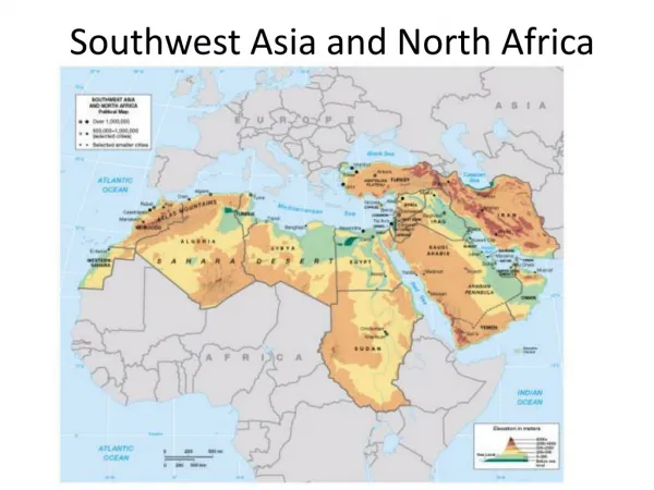
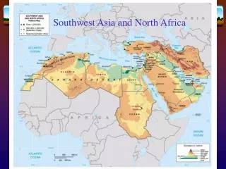
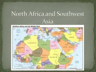
Northern Africa and Southwest Asia • Why is North Africa considered part of this region? • Historically, the region has more similarities with Arabic countries than Central or South African.
Why not the Middle East? • The term “Middle East” was based on the location of Europe (Eurocentric) • The Middle East was in between Europe and the Far East (China, Japan) • Southwest Asia puts Asia at the center and not Europe.
Why not the Middle East? Europe Far East Middle East
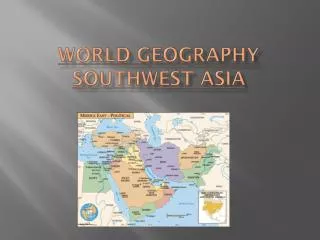
Crossroads of the World • This region connects 3 continents: Asia, Africa, and Europe. • Many major bodies of water also surround the region. • Red Sea, Persian Gulf, Caspian Sea, Black Sea , Mediterranean Sea. • All are very important in trade and travel. • Because of this, Southwest Asia has always been a major focal point for trade. • Migrating people spread ideas and inventions throughout the region.
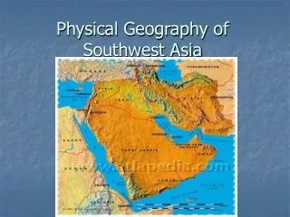
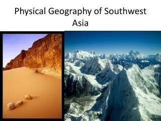
Major Region #1: Northern Tier • Modern day Turkey and Iran • Mountains and plateaus • Anatolian Plateau (Turkey): Fertile soil, adequate precipitation allows for large population • Iranian Plateau (Iran): Dry, small population
Major Region #2: Arabian Peninsula • Saudi Arabia, Yemen, Oman, Qatar, U.A.E. • Covered in desert (Rub Al- Khali) • Large land area • Small population • Scarce drinking water • Oasis- fertile land area with water that supports lots of desert life • Surrounded by important bodies of water. • Large amounts of oil lay beneath the surface= $$$
Major Region #3: Fertile Crescent • Iraq, Syria, Lebanon, Israel. • Tigris and Euphrates rivers create rich soils that sustain large populations • Home of the earliest civilizations
Major Region #4: Nile River Valley • Egypt • People live along the Nile due to abundance of fresh water and fertile soil. • The rest of Egypt is desert and sparsely inhabited. • Close to the Suez Canal Med. Sea Sinai Pen. Red Sea
Major Region #5: The Maghreb • Northern Africa, inc. Libya, Tunisia, Algeria, Morocco. • Sahara desert, Atlas mts. • Major cities on the Mediterranean coast. • Most of the population lives near the coast where there is more rain.