Download
1 / 27
270 likes | 398 Vues
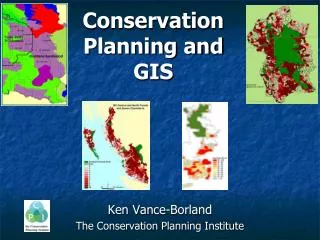
2008 Ohio GIS Conference September 10-12, 2008 Crowne Plaza North Hotel Columbus, Ohio. The Ohio Conservation GIS Project (OCGIS). Aaron Lantz Soil Information Coordinator ODNR Division of Soil & Water Conservation. Ohio’s Conservation Partnership. Division of Soil & Water Conservation.

E N D
2008 Ohio GIS Conference September 10-12, 2008 Crowne Plaza North Hotel Columbus, Ohio The Ohio Conservation GIS Project (OCGIS) Aaron Lantz Soil Information Coordinator ODNR Division of Soil & Water Conservation
Ohio’s Conservation Partnership Division of Soil & Water Conservation CWA 319 Watershed Groups Ohio Federation of Soil & Water Conservation Districts Ohio’s 88 SWCDs
Division of Soil & Water Conservation “Provide leadership and services that enable Ohioans to conserve, protect, and enhance soil, water, and land resources."
continues to grow in importance Bio-fuels Gulf Hypoxia Water supply Climate change
OCGIS Web-based enterprise GIS For Ohio’s Conservation partners and their customers planning, design, and evaluation of site-specific natural resource conservation projects.
Time Money Data Knowledge
OCGIS needs to be Data Rich Easy Economical
OCGIS Functionality • Basic • Measure • Buffer • Download • Change display • Query • Zoom to • Elevation and slope • And more
OCGIS and DATA Federal State Local
Agricultural Data land capability crop yields pasture yields soil management prime farmland hydric soils Forestry Data woodland productivity management concerns trees to plant Recreational Development Wildlife Habitat Building Site Development Sanitary Facilities septic tank absorption fields sanitary landfills Construction Materials Soil Attribute Data includes ...
Water Management limitations for ponds embankments, dikes & levees features affecting drainage terraces grass waterways Engineering Properties USDA Texture Unified Classification AASHTO Classification Particle Size Distribution Liquid Limit Plasticity Index Soil Attribute Data includes ...
Physical & Chemical Soil Properties clay, silt, sand rock fragments bulk density permeability available water capacity soil reaction shrink-swell potential soil erodibility factors - “K” & “T” wind erodibility group organic matter Soil & Water Features hydrologic group flooding hazard frequency duration months high water table depth months bedrock depth & hardness potential frost action risk of corrosion concrete uncoated steel Soil Attribute Data includes ...
OCGIS Core Tools Summary Reports BMP Queries For Conservation
Population =353 Average age= 44 Stream miles = 1.26 Ag Land = 1,453 acres Urban land = 4 acres Hydric soil = 1.3 acres School = Olentangy Number of wells = 9 Bedrock = Shale Glacial Geo = moraine Wind direct = SW Average temp = 60 Frost depth = 3ft Scenic rivers = 0 Area Summary(buffer and user defined)
Keeping it Economical Data collection (Arc GIS Server) Ease of updating /adding OCGIS administrator
DSWC Administrator Adding/updating data Local data mgt. Updating tools Creating new tools
On to the future • Google and Virtual Earth • Display a users Shapefiles • Watershed delineation • User level custom report • Draw tools • Layer creation
Sharing Collaboration Leveraging
Project Status • MOU/RFP? • Data inventory • Ohio SWC Commission • OWDA Grant • Potential partners, advisors, collaboratorsODA, Ohio EPA, OSU, ILGARD, OGRIP, Case Western, ODNR-Geo Survey, Trust for Public Lands. NRCS, SWCD GIS User Group, Watershed Planners. Federation of SWCDs