Download
1 / 75
1.03k likes | 1.63k Vues
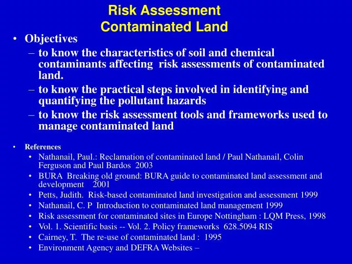
Risk Assessment Contaminated Land. Objectives to know the characteristics of soil and chemical contaminants affecting risk assessments of contaminated land. to know the practical steps involved in identifying and quantifying the pollutant hazards

E N D
Risk Assessment Contaminated Land • Objectives • to know the characteristics of soil and chemical contaminants affecting risk assessments of contaminated land. • to know the practical steps involved in identifying and quantifying the pollutant hazards • to know the risk assessment tools and frameworks used to manage contaminated land • References • Nathanail, Paul.: Reclamation of contaminated land / Paul Nathanail, Colin Ferguson and Paul Bardos 2003 • BURA Breaking old ground: BURA guide to contaminated land assessment and development 2001 • Petts, Judith. Risk-based contaminated land investigation and assessment 1999 • Nathanail, C. P Introduction to contaminated land management 1999 • Risk assessment for contaminated sites in Europe Nottingham : LQM Press, 1998 • Vol. 1. Scientific basis -- Vol. 2. Policy frameworks 628.5094 RIS • Cairney, T. The re-use of contaminated land : 1995 • Environment Agency and DEFRA Websites –
Risk Management of Contaminated Land Course Structure • Introduction • Subsurface Characteristics - Soils and Contaminants • Site Investigation (Hazard Assessment) • Interpretation of data (Risk Assessment) • Regulatory Frameworks (Risk Management) • Remediation (Risk Management)
The Contaminated Land Legacy Parliamentary Office of Science and Technology 1993 Expert Estimates:- • 50,000 to 100,000 potentially contaminated sites in UK • 100,000 to 300,000 hectares • (significantly less which pose risk to human health)
Potentially Contaminating Industries Landfill and other waste disposal sites. Gas works, coal-carbonization plants and ancillary by-product works. Sewage works and farms. Scrapyards. Railway land, especially large sidings, depots and breaking yards. Roads, airports and abandoned wartime airfields. Docks, canals and abandoned or infilled port ancillaries, shipbreaking yards. Oil refineries, petroleum storage and distribution sites. Metal mines,, foundries, steelworks, metal finishing works. Mineral extraction sites not yet infilled (quarries, coal) Glass works. Chemical works. Munitions production and testing sites, wartime installations. Asbestos works and building incorporating asbestos. Tanneries and fellmongeries. Paper and printing works. Industries making or using wood preservatives, herbicides and pesticides. Cotton and other textile mills and bleach works. Metal plating works and yards. Brickworks, potteries and ceramic works. Nuclear power stations, radioactive storage/disposal installations.
Law & Legislation • Common Law (Civil Law) • case law, not specific to CL • Statutory Law • new regulations specific to CL
Common Law (Civil liability ) Law of Tort (breach of legal duty) i.e. Case Law • Rylands v. Fletcher 1866 • A person bringing a dangerous item or substance onto his own land does so at their own risk • strictly liable for the consequences of any escape onto another’s land • substance must be ‘unnatural’ or ‘unnaturally there’ • damage must be reasonably foreseeable • conduct of the defendant is irrelevant • Trespass • direct, unauthorised interference with another’s property • could cover spillage or deposit of pollutants • not yet tested in the courts
Common Law (Civil liability ) • Negligence • fault based - failure to take care in situations in which damage is reasonably foreseeable • “care” extends to ‘future users’ • liability is variable depending on the amount of care taken • does not cover purely economic losses • Nuisance (interpretation of degree of harm) • activity that interferes with another’s enjoyment of land • On-going interference - can obtain an injunction • Concluded interference - can obtain damages • foreseeable “omission to do what a reasonable person would do” • Time Limit - 6 Years • (begins from time of discovery)
Cambridge Water (CW) v.Eastern Counties Leather (ECL) Ltd • Perchloroethylene solvent escaped from tannery • Contamination of groundwater • Water company failed new EC standards 1. CW failed in High Court • case of negligence, nuisance, Rylands v. Fletcher dismissed as tanning was not unnatural 2. Prosecution upheld in Court of Appeal • ECL deemed liable, £1m damages (focused on Nuisance) 3. House of Lords Decision (in favour of ECL) • reversed the Court of Appeal decision • no liability under Rylands v. Fletcher as “not foreseeable”
Contaminated land - Disasters • Love Canal, USA (1978) • Hooker Chemical Company 1942 - 1953 • Building in 1950’s (despite caveat in deeds) • illness, genetic disorders, residents evacuated • Lekkerkerk, Netherlands (1978) • building on reclaimed site • 1600 illegally dumped drums • drinking water polluted, residents evacuated • Eastern Counties Leather vs Cambridge Water Co (UK 1993)
Nature of the Pollution • Some important factors which determine the fate of chemicals in soil. • Organic or Inorganic • Charge (ions) • Volatility, Molecular weight • Solubility, Hydrophilic character • Functional Groups, affects solubility (polar character) • Hydrophobic character, interaction with soil colloids • Quantity or Concentration • Toxicity and Biodegradability • Density (Specific Gravity), Viscosity
Soil Structure and Hydrology • Soil Depth and Horizons • Organic Matter content • Plant Residues • Humic Acids, Fulvic Acids, Humin. • Particle size distribution • Sand, Silt and Clay Fractions • Soil Permeability • Groundwater, Water-table • Vadose (unsaturated) zone • saturated zone
Movement in the Soil Liquids • Gravity • vertical movement until sorption by soil matrix dominates. • LNAPL - as far as Capillary Zone or Water Table • DNAPL - through water table, stops at Impermeable Layer • Advection • transported by the flow of the bulk liquid (water) if dissolved Vapours • Diffusion • random molecular movement • Advection • transported by bulk flow of soil vapour
Movement of Contaminants within an Aquifer Spill Spill Soil Surface Spill Vadose Zone LNAPL Capillary Zone Saturated Zone (Aquifer) DNAPL Plume of soluble components
Potential Outcomes for Contamination in Soil • Hazard stays fixed in soil matrix = MINIMAL RISK • Hazard stays fixed in soil matrix but site has receptors = RISK • Hazard moves into groundwater and is transported towards receptor. = RISK • Dust and Volatilisation give rise to subsequent Air Contamination. = RISK Which Are relevant to the site? REMEDIATION eliminates or minimises RISKS
Typical effects of Hazards Toxicity to Human Health • Uptake of contaminants by crops • Ingestion • Inhalation • Skin Contact • Contamination of water resources (Groundwater) • Toxicity to Ecosystems / Wildlife • Fire and Explosion • Chemical attack on buildings, materials and property
Risk Management For a contamination to present a risk there must be: • a potentially harmful Source • a Pathway along which the contaminant can travel. • a Receptor • a plausible Pollution Linkage. SOURCE RECEPTOR PATHWAY
Technical Approach to Risk Management of Contaminated Land What are the key stages in the process? • Identify and assess Hazards • Collection of Data • Conceptual model (source-pathway-receptor linkages) • Evaluate and Quantify Risks posed by Hazards • Professional judgement • Generic Guidelines or screening values • Models (site-specific characteristics) • Prioritize sites (Local Authority) • fair and transparent process • Consider consequences of a change in use • force remediation of sites with “Risk”
2. Site Investigation (Hazard Assessment)
Objectives and Purpose of Site Investigation • Determine Contamination • nature, source, distribution, extent • acute effects (structures, biota) • Geotechnical Information • subsurface structures, cables, pipes, drains • soil properties, site geology • Water Environment • groundwater level and composition, local abstraction use • site run-off to surface waters
Preliminary Investigation • Desk Study • Current Layout - buildings, drains, process areas, plant, services. • Materials - feedstocks, products, wastes • History of the site • Industrial uses • previous incidents • Disposal records • Geology and Hydrology desk study information obtained from: • Maps, photographs, local history, directories, Technical Literature, Local / Government Bodies, residents, workers
Preliminary Investigation • Site Reconnaissance (Site Walkover) • External observation of acute hazards (ruptured tanks, etc) • Visual inspection for Contamination • discoloured soil, deposits, odours, gas (detection tubes) • vegetation - chlorosis, stress • condition of fences, metal structures • seepage through river banks, land drains • Activities on neighbouring land (on-going) • Confirms Desk Study details (e.g buildings / services/ etc) • Produce Photographic Evidence • Planning of Subsequent Investigations • Best estimation of the extent of contamination on the site
Exploratory Investigation • Confirms presence of contamination where the Preliminary Investigation is inconclusive • neither investigation can prove the Absence of contamination • Informed sampling locations • Sampling locations can form Stage 1 of the Main Investigation • Composite samples • Soil profile samples (depth) • Restricted range of chemical analysis (targeted e.g. BTEX) • helps with Planning of the Main Investigation
Main Investigation • Planning • Site Access • Safety Procedures • clothing, respiratory, hygiene, confined space. • sample labelling, transport • Accident Procedure, First Aid. • Environmental Protection • dust suppression, Wheel wash, decontamination • Data Requirements • specific requirements of Regulatory bodies • sampling and analysis strategy • Long Term monitoring Requirements
Main Investigation - Sampling Strategy Requirements to be addressed: • Nature of sample • air, water, soil • Sample Type and Size • spot, or composite (mixed) • Collection and Storage • containers, temperatures • Method of sampling • surface • augering • Trial pits and trenches • Boreholes - soil, water, gas • Depth • Pattern and Frequency of sampling
Main Investigation - Sampling Strategy Grid Size Site Size Grid Size (hectares)(m) 0.5 10 5 20 16 30 Number Site Size Number (hectares) of Samples 0.5 5 1 9 5 20
Main Investigation - Chemical Analysis • Quality Assurance • NAMAS • National Measurements Accreditation Service • Accuracy • Submit a prepared control sample (known value) • Scope • Specific Analysis • based on Exploratory Investigation or Desk Study • Standard Suites pH Phenols Toluene extractable Matter (TEM) coal tars mineral oils PAH, PCB, BTEX Chloride Sulphate Sulphide Cyanide sulphur Cd B Pb Hg As Cr Zn
Main Investigation - Gas Analysis • In-Ground Gases • methane, hydrogen sulphide • VOC • On-site Methods • Geophysical (conductivity/magnetic field) • Remote Imaging (IR for methane) • Spot Sampling • Portable Instruments (GC, IR) • Detection Tubes (Drager) • Laboratory Analysis • sample collection (Tedlar bags) • standard analytical equipment
3. Interpretation of Contamination Data (Risk Assessment)
Technical Approach to Risk Management of Contaminated Land What are the key stages in the process? • Identify and assess Hazards • Collection of Data • Conceptual model (source-pathway-receptor linkages) • Evaluate and Quantify Risks posed by Hazards • Professional judgement • Generic Guidelines or screening values • Models (site-specific characteristics) • Prioritize sites (Local Authority) • fair and transparent process • Consider consequences of a change in use • force remediation of sites with “Risk”
Risk Assessment Tiered “Risk Assessment Framework” • Tier 1 • Risk screening or Preliminary Risk Assessment • Desk study information • Tier 2 • Generic Quantitative Risk Assessment • Uses Generic Assessment Criteria (GAC) • i.e. SGV for “typical standard site” • Tier 3 • Detailed Quantitative Risk Assessment • requires modelling tools (CLEA)
Guidelines and Standards • Standards • system of fixed, legally binding values (not particularly relevant to the soil situation. Why?) • Soil Guideline Values • ICRCL (Interdepartmental Committee on the Redevelopment of Contaminated Land) • BRE (Building Research Establishment) • Dutch Intervention and Target Values • New UK CLEA derived SGVs
Soil Guideline Values (SGV) Different “typical land uses” defined • Residential (with and without vegetable growing) • allotments • Commercial / industrial Certain circumstances are not covered by SGVs and require Tier 3 risk assessment (i.e. CLEA modeling) • Playing fields • Schools • Complete cover by hardstanding
Trigger Values (mg/kg air-dried soil) Threshold 250 250 250 50 1000 Action 1000 5000 no limit 500 10,000 Guidelines ICRCL 58/93 Contaminant Complex Cyanides PAH Proposed Uses Domestic gardens, allotments Landscaped Areas Buildings, hard cover Domestic gardens, allotments, play areas Landscaped areas, buildings, hard cover
Toxicological Data • TOX Reports (use in CLEA model) • Arsenic, Benzo(a)pyrene, Cadmium, Chromium, Inorganic CN, Lead, Mercury, Nickel, Phenol, Selenium, Dioxins, PCB, Benzene, Toluene, Ethyl Benzene, Xylene, Vinyl chloride, tetrachloroethane, 1,1,1, trichloroethane, 1,2dichloroethane, tetrachloromethane, Naphthalene, PAH. • Soil Guideline Value Reports (set the SGV) • Arsenic, Cadmium, Chromium, Inorganic Mercury, Nickel, Selenium, Lead, Benzo(a)pyrene, Benzene, Ethylbenzene, Toluene, Xylene, Phenol, Naphthalene.
SGV (from CLEA) • SGV assume a standard site defaults conditions for: • Receptor behaviour • Age, weight height, skin area • Exposure frequency, soil ingestion rate, vegetable consumption rate, time on site • Land Use • Residential, Allotment, Commercial/Industrial • Depth of Soil • 0.5m for ingestion • 0.5m for plant uptake • 0 – 0.1 m for dust inhalation • 1m for vapour inhalation
Quantitative Risk Assessment • Human Health • CLEA Model (Contaminated Land Exposure Assessment) • RISC-HUMAN (C-soil model Netherlands) • Groundwater (Dispersion) • ConSim Model (Environment Agency) • Ecosystems • currently excluded • wildlife, biodiversity, HC50 • research needed
Human HealthContaminated Land Exposure Assessment(CLEA) • Site Specific Data • Chemicals • Climate - precipitation, wind • Soil Properties • physico-chemical, pH • particle size distribution • permeability • organic content • Site Use • user activity patterns (vegetable consumption) • building type • Monte Carlo probabilistic model • Probability Density Functions (PDF) • compare with Tolerable Daily Soil Intake (TDSI)
Risk to GroundwaterConSim Model (Environment Agency) • Determines whether contaminant is likely to exceed WQS value at several locations in the aquifer • Multi-Tiered Approach • (i)Leaching - (ii) Migration - (iii) Dispersion/Diffusion • Tier (iv) for complex geology • Monte Carlo model • input data as PDF • addresses element of uncertainty • decay and biodegradation are calculated • output data graphical, probabilities of exceeding WQS
CONTAMINATED SOIL VADOSE ZONE AQUIFER Simulated Leach Data Level 3 Dilution Dispersion Biodegradation Level 2 Unsaturated Zone Retardation Level 1 Theoretical Leach Properties If Concentration < WQS STOP If Concentration < WQS STOP Multi-Tiered Approach of the ConSim Model
Multi-Tiered Approach of the ConSim Model Contaminant Level 1 Vadose Zone Level 2 Saturated Zone Level 3
Assumptions for Guidelines and Models • Validity of analytical data • sample errors, heterogeneity of contamination • Toxicological and Ecotoxicological Reference Dose • databases incomplete • Predicted No Effect Concentration (PNEC) • Maximum Permissible Risk Concentration (MPC) • Tolerable Daily Intake (TDI) • Negligible Risk Concentration (NC) • Lowest (& No) Observable Effect Concentration (LOEC, NOEC) • Reference Dose (USEPA for carcinogens) • Uncertainties • contaminant transfer, uptake, availability, synergistic effect, metabolic detoxification, receptor behavior, soil properties (adhesion), dermal resorption data, average values representing statistical distributions of the exposure factors.
4. Regulatory Frameworks (Risk Management)
Technical Approach to Risk Management of Contaminated Land What are the key stages in the process? • Identify and assess Hazards • Collection of Data • Conceptual model (source-pathway-receptor linkages) • Evaluate and Quantify Risks posed by Hazards • Professional judgement • Generic Guidelines or screening values • Models (site-specific characteristics) • Prioritize sites (Local Authority) • fair and transparent process • Consider consequences of a change in use • force remediation of sites with “Risk”
History of Contaminated Land Policy USA • CERCLA 1980 (SUPERFUND) • SARA 1986 Netherlands • Soil Clean-up Act 1982 • policy reversal 1987 UK • ICRCL 1976 (guidance) • EPA 1990 (STATUTORY LAW) • 1993 “consultation” • EA 1995 (STATUTORY LAW) • PPC Regulations (2000) (STATUTORY LAW)
Framework Policy Objectives • Prevent new contamination • Deal with unacceptable risks to human health and the environment (Environmental) • Bring contaminated land back into beneficial use (Economic) • to limit cost burdens to proportionate, manageable and economically sustainable levels (Social) (Sustainable Development)
Contaminated Land Regime • Environment Act 1995 • Section 57 (EA 1995) inserts Part IIA into the Environmental Protection Act 1990 • Local Authority responsible • LA to formulate Strategy by mid-2002 • LA actively identify contaminated sites & cause them to be remediated
Definition of Contaminated land • “Contaminated land is any land which appears to the regulatory authority, by reason of substances in, on or under the land, that: a) significant harm is being caused or there is a significant possibility of such harm being caused; or b) pollution of controlled water is being, or is likely to be caused” (Environment Act 1995) “harm to the health of living organisms or other interference with the ecological systems of which they form part, and in the case of man, includes {harm to} his property”.
Cause their area to be inspected to identify Contaminated Land To determine whether a particular site is “contaminated” To Act as enforcing authority for contaminated sites (other than Special Sites) Establish responsibility for remediation. Determine what remediation is required and to ensure that it takes place. Arbitrate on the who bears what proportion of consequent liability. Record and maintain prescribed information in a Public Register. EA 1995Enforcement ResponsibilitiesDutiesTasks