Download
1 / 35
350 likes | 475 Vues
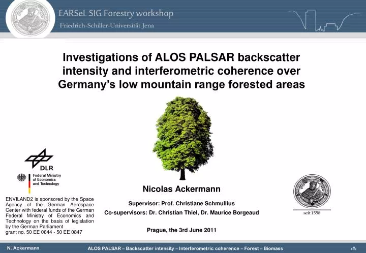
EARSeL SIG Forestry workshop. Investigations of ALOS PALSAR backscatter intensity and interferometric coherence over Germany’s low mountain range forested areas. Nicolas Ackermann Supervisor : Prof. Christiane Schmullius Co- supervisors : Dr. Christian Thiel , Dr. Maurice Borgeaud

E N D
EARSeL SIG Forestry workshop Investigations of ALOS PALSAR backscatter intensity and interferometric coherence over Germany’s low mountain range forested areas Nicolas Ackermann Supervisor: Prof. Christiane Schmullius Co-supervisors: Dr. Christian Thiel, Dr. Maurice Borgeaud Prague, the 3rd June 2011 ENVILAND2 is sponsored by the Space Agency of the German Aerospace Center with federal funds of the German Federal Ministry of Economics and Technology on the basis of legislation by the German Parliament grant no. 50 EE 0844 - 50 EE 0847
Presentationoutline • Introduction • Test site & available data • Pre-processing & preliminary investigations • Analysis of the data • Conclusions
Introduction • Context: • The monitoring of forested areas represents a great challenge in the context of the actual Global Warming. • The launch of ALOS PALSAR spaceborne system in January 2006 has been pioneer of new capabilities for the retrieval of forest biophysical parameters. • Objectives: • Investigate the ALOS PALSAR backscattter intensity and interferometric coherence. • Underline the scattering and decorrelation mechanisms occuring in the temperate forest. • Provide some new scientific knowledge for future researches.
Test site • Thuringian Forest (Germany) • Surface: 110 km x 50 km • Terrain variations • Tree species composition • Scots pines • Norway Spruce • European Beech • Weather conditions • cool and rainy • frequently clouded • Peculiarities • logging for forest exploitation • Kyrill storm (February 2007)
Test site Topography
Test site Forest understory
Available Data (state May 2011) • SAR data • ALOS PALSAR (L-Band, 46 days) • TerraSAR-X (X-Band, 11 days) • Cosmo-SkyMed (X-Band, 1 day) • Optical data • RapidEye • Kompsat-2 • Ancillary data • DEM: SRTM 25[m], LaserDEM 5[m] • Laser points (2004), • Orthophotos (2008) • HyMap (2008,2009) • Forest inventory (1989-2010) • Photos with GPS coord. (2009) • Weather data • Field work
ALOS PALSAR data 124 scenes PLR Summer acquisitions FBD Winter acquisitions FBS
High geometrical distorsions by steep incident angle. Topographic normalisation PALSAR PLR 21° R-HH, G-HV, B-HH Asc. 12apr09 Non normalised PALSAR FBD 34° R-HH, G-HV, B-HH Asc. 10jun10 Nonnormalised LiDAR DEM shaded relief
Topographic normalisation • Correction main components (Castel et al., 2001) Local incident angle Ground scattering area
Topographic normalisation • Optical crown depth (Castel et al., 2001) Volume scattering: a) Tilted surface facing the radar, b) flat surface, tilted surface opposite to the radar (Castel, 2001)
High intensity for steep slopes facing radar. Topographic normalisation Slopes oriented in Radar flight direction Aspect [°] Aspect [°] 0° Gamma nought [dB] Sensor orientation : 350° Sensor azimuth angle : +90° PALSAR 34° HV Asc. 06may08 Non normalised PALSAR 34° HV Asc. 06may08 Normalised
Overcorrection? • Crown optical depth? • Other effects? Topographic normalisation Slopes away from the radar Slopes facing the radar Gamma nought [dB] Aspect [°] PALSAR 34° HV Asc. 06may08 Normalised
Topographic normalisation Gamma nought [dB] Gamma nought [dB] Aspect [°] Aspect [°] PALSAR 34° HV Asc. 06may08 Normalised PALSAR 34° HV Asc. 06may08 Normalised + Normalised with n coefficient
Temperature approaching • 0 [°C] implies a decrease • of the backscatter intensity Weather - PALSAR intensity Precipitation [mm] Temp [°] Wind [m/s] Snow + high Water equivalent frozen frozen frozen Gamma nought [dB] Acquisition date Series of PALSAR FBD, FBS, 34.6°, HH, Asc.
A precipitation event highly affects the degree of coherence Weather - PALSAR coherence Precipitation map PALSAR Coherence HH 23jul09_X_ 07sept09
Weather - PALSAR coherence Urban Layover Precipitation [mm] Coherence Azimuth PALSAR FBD, 34.4°, HH, Asc.
Weak negative correlation between PALSAR HV and stem volume Stem Volume - PALSAR intensity r2 = 0.11 Investigations 1. Topography 2. Weather 3. Understorey 4. Forest inventory Gamma nought [dB] Stem volume [m3/ha] PALSAR 34° HV Asc. 10jun10
Stem Volume - PALSAR intensity Daily Precip: 1.9 [mm] Hourly Precip: 0 [mm] Daily Precip: 1.9 [mm] Hourly Precip: 0 [mm] r2 = 0.29 r2 = 0.31 Gamma nought [dB] Stem volume [m3/ha] Stem volume [m3/ha] Slopes < 4° ! PALSAR 34° HV Asc. 10jun10 Non normalised PALSAR 34° HV Asc. 10jun10 Normalised
Stem Volume - PALSAR intensity Legend Red: Forest stands Blue: Field observations Yellow: Stem volume [m3/ha] D. Forest typology A. Grass, No forest Low stem volume E. B. Young, dense A. C. Young, sparse D. Mature, dense High stem volume B. E. Mature, sparse Orthophoto
Stem Volume - PALSAR intensity Orthophoto PALSAR HV Observed values PALSAR HH Coherence
Stem Volume - PALSAR intensity Orthophoto PALSAR HV PALSAR HH Coherence
Surface scattering seems to be the dominant scattering mechanism. Stem Volume - PALSAR intensity r2Surf=0.09 r2Surf=0.08 r2Vol=0.008 r2Vol=0.009 r2Dbl=0.000 r2Dbl=0.005 Scatteringintensity Stem volume [m3/ha] Stem volume [m3/ha] PALSAR PLR, 21° Asc., 12apr09 PALSAR PLR, 21° Asc., 12apr09 Freeman Decomposition Van Zyl Decomposition
Interferometriccoherence • Coherence • The degree of coherence can be related to several factors, each expressing a specific source of decorrelation. • The volume decorrelation is related to objects presenting a vertical extension. This factor is spatialbaseline dependent. The temporal decorrelation is related to thestability of the objects between the two acquisitions.
ALOS PALSAR coherence B. Forests: B. Crops: C. Urban: intermediate coherence low coherence high coherence C. A. PALSAR HH, 7sep09 - 23oct09
Increase of correlation with higher perpendicular baseline. ALOS PALSAR coherence R2S=0.10 R2S=0.22 R2S=0.29 R2B=0.012 R2B=0.009 R2B=0.002 R2P=0.06 R2P=0.009 Spatial baseline Legend Blue: Spruce (S) Yellow: Beech(B) Red: Pine(P) Interferometric Coherence R2S=0.36 R2S=0.35 R2S=0.19 R2B=0.15 R2B=0.12 R2B=0.038 R2P=0.088 R2P=0.044 R2P=0.08 Stem Volume [m3/ha] Precipitation: 23jul09: 28.6mm 07sept09: 3.9mm Stem volume [m3/ha]
ALOS PALSAR coherence 1. Coherence „Stack“ Forest inventory 2. 1., 2. Select and „fit“ Model Compute RMSE and weights 4. 3. 4. Scatterplot + model Weights Inverse model and retrieve Stem volume Compute Growing Stock volume map 3. 5. Estimated Growing stock Volume Multitemporal GSV map 5. SANTORO et al., 2000; SANTORO, et al., 2002b
ALOS PALSAR coherence Multitemporal coherence biomass map • Similarly to spatial averaging, the multitemporal combination act as a filter and decreases the noise. • RMSEi>200 [m3/ha] is very high, in particular due to the high dispersion of the coherence. • The methodology should be tested for each species separately and by inversing testing and training stands. • Water and urban can be recognized, with respectively low (dark green) and high (gray) coherence RMSE>200 [m3/ha] Preliminary results!
Conclusions and outlook • Different investigations of the ALOS PALSAR backscattter intensity and interferometric coherence have been conducted. • Conclusions and open issues • The topography influence is not fully understood. • Weather conditions and particularly precipitations and temperature affect the backscatter intensity and interferometric coherence. • Interferometric coherence in L-band with 46 day temporal baseline shows a potential for estimating forest biomass. • Future work • Further investigations for the topographic normalisation • Explaination of the weak negative correlation between PALSAR and stem volume • Derivation of indices and ratios between X-band and L-band • Combination/Fusion with optical data
Acknowledgements I wouldliketothank DLR, ESA, ASI and RESA forthedistributionofthedata ENVILAND2 is sponsored by the Space Agency of the German Aerospace Center with federal funds of the German Federal Ministry of Economics and Technology on the basis of legislation by the German Parliament grant no. 50 EE 0844 - 50 EE 0847
Questions ? Thankyouforyourattention ! Thuringia Forest – July 2010