Download
1 / 10
100 likes | 260 Vues
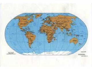
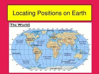
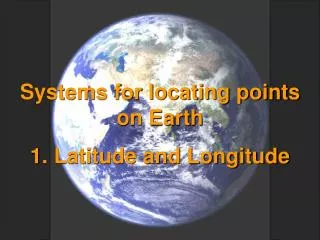
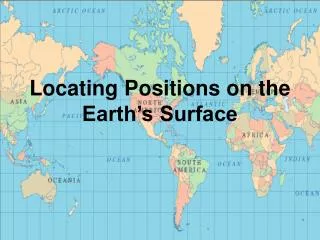
Locating Positions on Earth. Coordinates are needed to located a fixed position on Earth. Coordinates are two numbers or points on the Earth’s surface. What is a coordinate system?. A coordinate system is used for determining the coordinates of a point .

E N D
Locating Positions on Earth • Coordinates are needed to located a fixed position on Earth. • Coordinates are two numbers or points on the Earth’s surface.
What is a coordinate system? A coordinate system is used for determining the coordinates of a point . The most commonly used coordinate system is the latitude-longitude coordinate system to locate points on the Earth’s surface. Latitude and longitude are measure in angular units: degrees (°) and minutes (΄). There are 60 minutes in a degree.
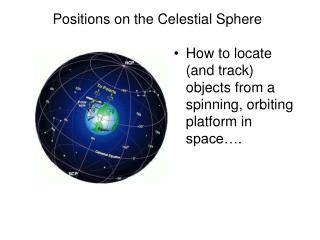
What is latitude and what are the units of measurements? Latitude is an angular distance north or south of the equator. All points that have the same latitude lie on a circle that is parallel to the equator. These circles are called parallels of latitude or parallels.
What is a main line of latitude? The main line of latitude is called the equator. The equator is considered to be the parallel of latitude 0°. Since the lines are parallel, the never intersect or touch. Increasing latitude means you are moving away from the equator! Decreasing latitude means you are moving toward the equator!
Understanding latitude!!! Shown in the figure to the right is the altitude (angle above the horizon) to Polaris –the North Star. The altitude to Polaris equals the degree of latitude of the observer in the Northern Hemisphere. Be sure to include a north or south direction when stating the latitude.
How do you determine the latitude of a location? To determine the altitude of an object in the sky, an angular-measuring instrument is used. This is called a sextant. In addition: the altitude of Polaris equals the latitude of the observer (in the N.Hemi).
What is longitude and what arethe units of measurement? Longitude is an angular distance east or west of the prime meridian. A meridian of longitude is any semicircle on Earth’s surface connecting the north and south geographic poles. All longitude lines converge or come together and intersect at the poles, like the lines on a basketball.
What is a main line of longitude? The main line of longitude is called the prime meridian. The meridian passes through Greenwich, England. The other half of the prime meridian is the international date line (180°). Any point on the prime meridian has a longitude of 0°. Decreasing longitude means you are moving toward the prime meridian and away from the 180° meridian. Increasing longitude means you are moving away from the prime meridian and towards the 180° meridian.
Understanding longitude!!! In writing a location’s longitude, be sure to include a west or east direction – because that point is either west or east of the prime meridian. The hours of the day are based upon the sun’s position in the sky. Local noon is when the sun is at its highest altitude in the sky (usually at 12 pm). We use longitude as a reference to time. If we know that in 24 hours, the earth rotates 360° from west to east, then in one hour the earth rotates 15° west to east. So technically, every 15° of longitude, the time changes by an hour.
How do you determine the longitude of a location? In order to measure longitude, if you know Greenwich mean time (GWT – time in Greenwich, England) and your local time, then you can calculate the time difference in hours and multiply by 15°.