Download
1 / 39
390 likes | 544 Vues
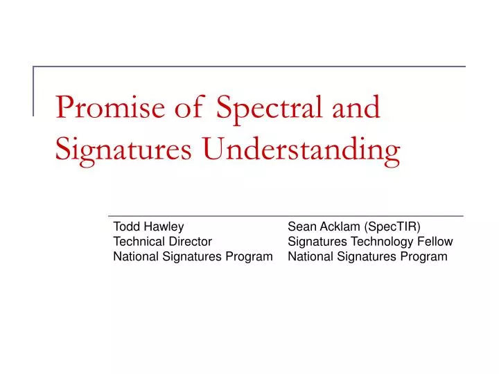
Promise of Spectral and Signatures Understanding. Todd Hawley Sean Acklam (SpecTIR) Technical Director Signatures Technology Fellow National Signatures Program National Signatures Program. Real Life Applications. Promise of Spectral. New sensor systems Novel spectral analysis

E N D
Promise of Spectral and Signatures Understanding Todd Hawley Sean Acklam (SpecTIR) Technical Director Signatures Technology Fellow National Signatures Program National Signatures Program
Real Life Applications Promise of Spectral • New sensor systems • Novel spectral analysis • Geo-database population • Imagery fusion • Information visualization Todd Hawley
Relative Biomass High Low Biomass Overlay Todd Hawley
Relative Turbidity High Low Relative Turbidity Todd Hawley
Hyperspectral data enables automated identification of roof types including discrimination of red asphalt shingles from terra cotta roofs. Combined Density Map Natural RGB Wildland Vegetation Density Analysis (determine fuel availability for wildfire and vegetation types) Bio-Mass / Material Discrimination Study Todd Hawley
Vegetation, permeability, and soil moisture mapping - Colorado Springs, CO Urban/Vegetative Boundary Todd Hawley
Principal Component - Unsupervised Classification Forested Wetlands – MD Eastern Shore – February 2006 Wetlands Todd Hawley
Geologic/Energy • Mineralogy • Geothermal • Oil/gas exploration • Mining remediation Todd Hawley
Superfund Site Todd Hawley
Land Use • Forest fire projections • Fuel abundance mapping • Invasive species • Land cover/land use • Nutrient value • Agriculture/stock • Urban mapping • Impervious surfaces Todd Hawley
AG Site in Mid-West 0.5 meter spatial 5 nm spectral Mosaic of two lines Todd Hawley
Correct: half of road is degraded Correct: Recently paved Correct: Moderate road with slight cracks Correct: Severely degraded road Road Analysis Results Todd Hawley SpecTIR Proprietary
Adding unique elements of hyperspectral imaging and material classification… …to LIDAR-derived topographic, very high resolution topographic information, yields unprecedented level of terrain information HSI & LIDAR Integration Todd Hawley
Paved Asphalt / Gravel (Lots) Paved Asphalt (Streets) Tar Roof Vegetation Sandy Soils Metallic Roofs HSI & LIDAR Integration Todd Hawley
Natural Disaster Preliminary analysis of spectral anomalies associated with hurricane damage. Todd Hawley
Near InfraRed (NIR) spectral camera together with multiple fiber optics is used to acquire snaphot moisture profiles across paper web in paper machine. Paper Industry Todd Hawley
A four-point fiber optic spectrometer measures dyed color at a resolution of <0.2 DE. Pictures: Coltex system by Iris DP Textile Dyeing Todd Hawley
Pharmaceutical Industry • NIR spectral imaging expands the capabilities of single point near infrared spectrometry to fully cover the material and product streams under inspection • Inspection of chemical composition and its homogenity • Detection of foreign pills Todd Hawley
GDB Product Examples Airfield Products 3\4 Dimensional Products Hydrological Products • Airfield threat assessments • Airfield line diagrams • Airfield graphics • Airfield image maps • Landing zones • Helicopter landing zones • 3D visualization • 3D flythroughs • Elevation tints • Line of sight/intervisibility • Anaglyphs • Viewsheds • Interferomograms • Foliage penetration • Time sequencing • Video feeds • Littoral studies • Threat predictions • Predictive modeling • Damage assessments • Turbidity • Ports of entry • Beach landing zones Todd Hawley
GDB Product Examples Engineering Products Domestic Security Earth Sciences • Power distribution • Water distribution • Sewage distribution • Petroleum distribution • Utility isolation • Damage assessments • Threat prediction • Lines of communication • Communication studies • City construction/public works • R&S reporting graphics • Key infrastructure • Trends & tactics • Predictive modeling • Threat predictions • Damage assessments • Crowd control • Event security • Dignitary security detail • Raid graphics • Geological studies • Vegetation studies • Environmental hazards/impacts • Terrain categorization • Littoral studies • Geophysical studies Todd Hawley
GDB Product Examples Orientation Products Mobility Products • Route analysis • Road isolation • Choke points • Bridges/ ford/ tunnel studies • Trafficability • Traffic Rate • MCOO/ COO • Route studies • Urban – orientation • City graphic • City image map • Targeting map • Gridded matrix • Geo – orientation • Change detection Todd Hawley
GDB Visualization Todd Hawley
Network Analysis Todd Hawley
Wavelet Transform Input Data Fusion Rule Inverse Wavelet Transform Wavelet Fusion Tool: The wavelet fusion tool developed for the STF transforms any geographically linked data into wavelet space (sparse transformation) thereby decorrelating their coefficients, applies a fusion rule to the transformed data sets (dependent on internal geometry), and performs an inverse wavelet transformation on the newly fused datasets. The outcome is a fused dataset independent of wavelength and platform. Data Fusion Todd Hawley
Independent Component Analysis Tool: The ICA tool uses fused data and transforms into a space where components within the datasets can be isolated for statistical independence from the rest of the dataset. Non independent data like Gaussian noise is “ignored” through the use of negentropy approximations as opposed to kurtosis during the transformation process. These independent components (or vectors) act as unique and accurate signatures for any future classification and feature extraction. Data Fusion Todd Hawley
Generalized Relevance Learning Vector Quantization Tool: The GRLVQ tool is a hybrid classification driven feature extraction that uses the input independent components to classify, discriminate and\or identify features of interest and extract the features into a geo-database as a geographic information system. The final geo-database format, containing all inclusive signatures of the urban area of interest, can be used for a wide variety of analyses and products. Data Fusion Todd Hawley
Three Modules for Information Visualization: Three modules define the signatures visualization tool. The first module is data input from the absolute geometric database. Data is represented in the form of clouds and is categorized via six different relationship types. These data clouds are projected using the second module made up of four axes depicted below. Finally, collection gaps and complete signature coverage are visualized by depicting collection asset coverage over the data clouds projected using the four axes. Temporal Wavelength Energy Axis: Spatial Unit: Meters Nanometers Time J\GHz Information Visualization Todd Hawley
Data relating to any sensor\observable\event can be loaded into the SVT through XML. Signature Visualization Tool (Exemplar) Axis Temporal Spatial Wavelength Energy 1. 2. 3. 4. Data Signatures Spectral Signatures Behavior Signatures RADAR Signatures TTP signatures IR Signatures Todd Hawley
Broad-based program to improve signature management & application Web-Based Operation Multiple Providers Users Spectral Infrared Diverse Signatures Secure Networks Infrared Radar Data Acoustic Data National Signatures Program What is NSP? Platform for analysis & decisions Multi-community participation Unified access to diverse, distributed signatures Operation on classified networks What Does NSP Provide? Defense Intelligence Agency National Ground Intelligence Center Data providers Senior steering group Who are Key Players? Todd Hawley
Spectral Infrared Infrared Image Radar Data Acoustic Data Signatures • Features characterize targets, threats, … • Unique, consistently reoccurring • Multiple signature domains • Traditional (radar, radio frequency, electro-optical, geophysical, nuclear, materials) • New domains (e.g., chemicals) • Multiple data types • Measurements, computational predictions • Spectral, time series, images, etc. Todd Hawley
Improve signature management and application by balancing data users’ and providers’ needs. Objective • User perspective • Simple to use one stop shopping • Common view of the nation’s signature pool data • Clear, definitive search results • Downloadable real data • Provider perspective • Provide data quickly & efficiently to many users • Maintain visibility as the source for hosted data • Control data content and quality • Define and control data access Todd Hawley
Data Need Test & Evaluation Operations Intelligence Modeling & Simulation Other US Government NSP NSP Domain Radar IR Acoustic Chem etc. Bio Aircraft Vehicles Target Ships Facilities Provider Provider Provider etc. Acoustic Radar Chemical Biological IR Seismic MS/HSI Vehicles Ships Aircraft Facilities Mat’ls etc. Chem’s National Signature Pool User Communities Multiple Providers Common View National Signature Pool Todd Hawley
Data Summary Target Data Location Date XYZ IR A 6/1/01 John Doe 123-123-1234 POC File Download Community Wide Metadata Data Set Spect. etc. Target X 1 12 R A xxx 8-12 xyz Y 2 5 S yyy 3-5 3 Z zyx X T B 4 X U 3 X yxz zzz C xxx 3-5 xyz C NSP Common Data Tgt DC Spct etc. Descriptions Thumbnail Images File Downloads (Metadata) (when available) (Signature data) Operational Overview NSP Web-Based Application NSP Find Signature Providers Results Users Local Database Dynamically Generated XML Data Summaries Local Metadata Retrieve Metadata Files Signature Files Data Location/Retrieval Data Loading Todd Hawley
Dynamic signature operations: immediate on-demand access to all sources of quality assured standardized signatures and related data maintained with DOD, IC, and OGA to support sensor reprogramming in a highly fluid environment Signature support plan (SSP): Potential observable signature types associated with each critical element of an activity, event, or equipment withing a specific mission area Operational signature package (OSP): End user defined selection of operational signatures, their specific ordered integration, and the desired time sequencing required to support a specific mission area Signature Based Direct Reporting Machine-to-Machine Signature Exchanges Signature Based Tip-off/Cross Cueing Key Components Todd Hawley
SSP/OSP Development • Gather information • Identify friendly aircraft signature requirements • Sensor and technique used • Required signature fidelity and format • Check existing signature holdings • Draft • Sensor specific, enemy aircraft OSP • Add required signatures to NSP holdings, or • Generate requirement for needed signatures • Incorporate into air engagement SSP • Finalize • User validation/review • Assess signature support Todd Hawley
Modeling & simulation (M&S) tools to estimate signatures for environments and collectors not specifically available in NSP measured signature holdings Estimation Environment NSP Customer Communities NSP Distributed Signature Modeling Centers NSP Distributed Signature Data Centers Modeled Signature Holdings Measured Signature Data Holdings Todd Hawley
Gaps Platform Sensor Location Coverage Phenomenology Visualization Tool Signatures data relating to any collections asset can be loaded into the signatures visualization tool Todd Hawley
Optimized Signatures Gaps Energy Current Collection Architecture Spectral Temporal Spatial Lower weighted Relevant Background Gap Identification Todd Hawley
Summary • Target and background signature understanding is vital to achieve the promise of spectral technologies • NSP is a one-stop federated signatures and signature data source • To be versatile, signature data must be • Measured • Integrated • Accessible by analysts and developers • NSP is ready to accept, integrate, and provide relevant signature data Todd Hawley