Download
1 / 21
210 likes | 211 Vues
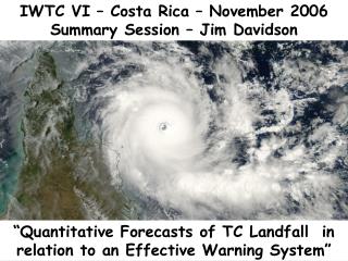
This presentation explores the track forecasts and the importance of effective warning systems for tropical cyclones. It discusses the average track forecast errors and lead time of hurricane warnings. It also highlights the impact of surveillance data from the NOAA G-IV jet on track guidance. The presentation includes examples of excellent and not-so-excellent track consensus and introduces the new Tropical Cyclone Wind Speed Probability Products from the NHC.

E N D
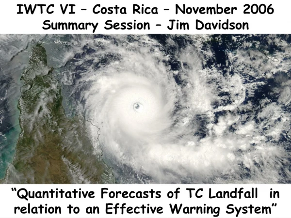
TOPIC 0.1 QUANTITATIVE FORECASTS OF TROPICAL CYCLONES LANDFALL IN RELATION TO AN EFFECTIVE WARNING SYSTEM: TRACK FORECASTS LIXION A. AVILA RSMC MIAMI SIX INTERNATIONAL WORKSHOP ON TROPICAL CYCLONES 2006 IWTC-VI SAN JOSE, COSTA RICA NOVEMBER 2006
TOPIC 0.1 WORKING GROUP: PHILLIPE CAROFF, JEFF CALLAGHAN, JAMES FRANKLIN and MARK DeMARIA SIX INTERNATIONAL WORKSHOP ON TROPICAL CYCLONES 2006 IWTC-VI SAN JOSE, COSTA RICA NOVEMBER 2006
Average track forecast errors (nm) for the 1 to 5 day period before landfall (2001-2005)
Rita Track Forecasts 1200 UTC 21 September Severe left bias in track models
Rita Track Forecasts1200 UTC 22 September Remarkable improvement in track guidance: Likely the impact of surveillance data from the NOAA G-IV jet?
Wilma Track Models10/21/05 18z U.K. Met. Office 72 h GFS 72 h NCEP GFDL 72 h NOGAPS 72 h Navy GFDL 72 h Verifying position 10/24/05 18z
Excellent example of GUNA consensus: HURRICANE ISABEL, 1200 UTC 11 SEP 2003
Not-so-excellent example of GUNA consensus: HURRICANE KATE, 1800 UTC 29 SEP 2003 This is a case where forming a selective consensus can be effective.
New Tropical Cyclone Wind Speed Probability Products from NHC June 2006 Richard Knabb, Chris Landsea, Edward Rappaport, Michelle Mainelli, Chris Lauer, Alison Krautkramer, James Franklin, and Jamie Rhome National Hurricane Center Scott Kiser and Tim Schott - NWS Headquarters Mark DeMaria – NESDIS and John Knaff - CIRA
Existing TPC/NHC Products Used to Convey Uncertainty Watch/Warning GraphicIndicates forecast track and long-term mean error
Why a new probability product? Need for improved means of conveying tropical cyclone forecast uncertainty to various types of users • New product is about a weather event at any specific location • Conveys chances of wind speeds of at least particular thresholds • 34 kt (tropical storm force) • 50 kt • 64 kt (hurricane force) • Accounts for combined uncertainty in track, intensity, and size • Extends to 5 days • Includes inland locations • Replaced strike probabilities in 2006
Challenges and Ongoing Work • Significant training and outreach needed • Lessen the focus on exact track forecast • Do users understand probabilities? • Getting familiar with the probability values • “Small” probabilities of an extreme event • Enhancements to graphical products • Faster creation of grids, and the graphics created from them • Objective guidance for watch/warning breakpoints • Eventual use by NWS forecast offices in their products • Verification • Gridded products for NDFD