Download
1 / 63
680 likes | 942 Vues
Landslides. GEOL 4093 Risk Assessment. Resources. landslides.usgs.gov Murck, Skinner, and Porter, 1997. Dangerous Earth: An Introduction to Geologic Hazards , John Wiley & Sons, 300 p. Bloom, 1998. Geomorphology: A Systematic Analysis of Late Cenozoic Landforms , Prentice Hall,482 p.

E N D
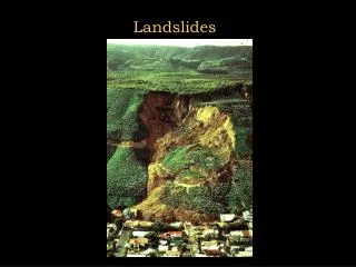
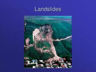
Landslides GEOL 4093 Risk Assessment
Resources • landslides.usgs.gov • Murck, Skinner, and Porter, 1997. Dangerous Earth: An Introduction to Geologic Hazards, John Wiley & Sons, 300 p. • Bloom, 1998. Geomorphology: A Systematic Analysis of Late Cenozoic Landforms, Prentice Hall,482 p.
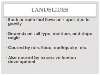
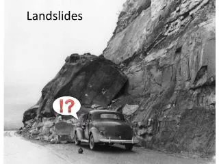
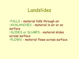
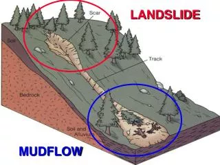
Mass Wasting • Collective term for all gravitational or downslope movements of weathered rock debris • The term “landslide” is not a real geologic term • Flowing water not involved, but water is very important in mass wasting
Role of Water in Mass Wasting • Adds weight to rock mass • Generates seepage pressure by groundwater flow
The empty can on the left slides on a dry surface when the angle reaches about 17 degrees. With a little water dripping thgough a small hole in the bottom of the can on the right, sliding will occur at a much lower angle
Angle of repose is the natural steepnees of a pile of unconsolidated material. It varies depending on grain size, grain shape, and water content.
Types of Mass Movements • Slides—blocks • Flows—internal shear • Heaves—vertical • Subsidence—vertical but no free surface
Modifiers • Composition • rock, soil, mud, mixture • Speed of movement • Fast, moderate, slow
Basic Types of Mass Movements • Slides • Flows • Creep • Subsidence • There is no single perfect way to classify all of the types of mass movements
surface slide plane Slides • Cohesive blocks of material • Moven on well-defined surface • No internal shearing • Velocity profile of pure slide:
surface base of flow Flows • Differential shearing within mass • No clear plane of movement at base • Velocity of flow decreases with depth in flow • Velocity profile of pure flow:
surface base of heave Heave • Forces act perpendicular to ground surface by expansion and contractin of material • Slow, downslope movement by gravity • Velocity profile of pure heave:
Subsidence • No free surface • Downward settling of material • Little or no horizontal motion • Main cause is slow removal of material below subsiding mass
Speed of Movement • Creep—very slow • Slides—fast • Avalanche—really fast
One way to classify mass movements is by speed of movement and by composition—slurry flows versus granular flows.
Passive Controls Nature of material Degree of lithification Degree of weathering Interstitial water Stratigraphy Structure Topogoraphy Climate Organic (vegetation/critters) Active Controls Support removal Slope oversteepening Saturation with water Earthquakes Geologic Controls on Mass Movements
Examples of Passive Controls • Nature of material • Degree of lithification (sed rocks) • Degree of weathering • Insterstitial water • All pretty self explanatory
Alternating resistant and nonresistant rocks Perched water table SS SH Passive Control—Stratigraphy
Alternating resistant and nonresistant rocks SS collapse SH Erosion removes support Passive Control—Stratigraphy
Passive Control—Structure Dipping beds, jointed rock
Mudflows from 1980 eruption of Mount St. Helens reached speeds as high as 40 m/s and traveled as far as the Columbia river, ovee 90 km away.
A 1963 landslide into the Vaiont Reservoir, Italy, caused a giant wave to overflow the dam
The 1920 Grand Banks earthquake caused a submarine landslide that broke underwater telegraph cables and disrupted communications between North America and Eurpoe. It also proved the existence of turbidity currents.