Download
1 / 24
240 likes | 388 Vues
Solid Waste: A Forgotten BUT Vital INFRASTRUCTURE Layer. Laura Stiller, Recycling Coordinator Sue Bergeron Barbara L. Maclennan Monongalia County Solid Waste Authority. Solid Waste Management Structure. The West Virginia Recycling Act, W.Va. §22-15A-16

E N D
Solid Waste: A Forgotten BUT Vital INFRASTRUCTURE Layer Laura Stiller, Recycling Coordinator Sue Bergeron Barbara L. Maclennan Monongalia County Solid Waste Authority
Solid Waste Management Structure The West Virginia Recycling Act, W.Va. §22-15A-16 • State goal of 50% reduction of the waste stream by 2010. • Only mandates recycling for residents/businesses - municipalities with a population of over 10,000 (only 10 count) • Solid waste management in West Virginia is not based on a free-market system. • Instead, different aspects of the total management of solid waste are split between several state agencies.
Solid Waste Management Structure WV Public Service Commission WV DEP Rehabilitation Environmental Action Plan (REAP) WV Solid Waste Management Board WV Solid Waste Authorities Litter Control Officers Landfills
Recycling/Solid Waste Benefits • Visible Public Good • Increase jobs in the region • WV Economic Development tied to recycling & waste management • More efficient long distance hauling • Improve environment • Create new industry
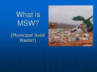
Solid Waste in Planning • Becoming increasingly important worldwide • Local business with global markets • Everyone produces waste: Residents Businesses Events Construction Industry Entertainment • Waste is a by-product of living • Solid waste should be thought of as infrastructure • similar to sewage, water, electric, and roads
Monongalia County • University Towne Centre Morgantown, WV • $25M+ to build • Did not think about trash service/recycling until AFTER built Road had to be retroactively built for trash trucks/bins. Still only one access road.
Marion County • Marion County Solid Waste Authority • Analysis determined shorter transportation times more profitable • Marion County Solid Waste Authority creating a transfer station to send material to Monongalia County Distribution Center • Saves money for Marion County and haulers • Creates jobs and income through commodities
Regional RecyclingProcessing/Distribution Center • MCSWA currently acts as processing/distribution center • Analysis indicated need for a bigger facility • MCSWA currently only publicly-owned financially self-sustaining recycling facility in N.E. U.S • Experienced growth during market crash • Has markets others don’t: #4-#7 plastic, prescription bottles, plastic film, glass, etc.
Constraints to Recycling in WV Recycling not mandated Recycling wholly voluntary Regulated as a utility No free-market for hauling solid waste/recyclables Not supported by taxes Few counties with landfill revenue No urban areas Few interstate routes
Monongalia County Solid Waste Authority GIS (MCSWA GIS) • Design Goals • Develop a GIS that could be utilized in both day-to-day operations at the MCSWA and in long-range planning • Demonstrate how solid waste and recycling could be integrated with other government services to create a comprehensive GIS management and planning tool • Data Collection • Identify and map local and regional recycling drop-off locations and resources • Identify and map waste hauler territories and routes • Identify and map relevant data related to environmental issues, such as open dumps, water quality, etc. • Develop demographic layers to aid in improving recycling service and planning for increased demand, such as business, event venues, and federal offices.
Creating Waste Hauler Data Layers • Digitizing narrative tariffs • Interpreting text descriptions of location and generating specific GIS data layers • Resolving ambiguities in descriptions • Developing a route layer • Determining streets and roads that fall within hauler territories • Generating a line layer for each hauler • Developing a service address layer • Address only, no names to protect privacy
Digitizing Waste Hauler Tariffs: Challenges and Issues • Waste hauling conceived and regulated as both a utility and a motor carrier • Goal = ensure curbside trash service to 100% of WV residents and businesses • No unified system for identifying and mapping waste hauler routes or service addresses • Interpret text descriptions filed with tariffs • Tariff authority often date back for decades • Are drawn up and executed as text documents; no maps are required or submitted • No consistent language or geographical boundaries used in descriptions • Widely varying level of detail in description section of tariff • WV Public Service Commission does not maintain a master map to determine if the tariff descriptions are accurate or comprehensive
Digitizing Waste Hauler Tariffs: Challenges and Issues – cont’d • Resolve ambiguous terms • “side roads” – • What defines a side road? • How far down a side road that connects to another road? • Resulting polygons are not related to a master data set and can not be considered authoritative for management purposes • Polygons do not indicate specific roads or locations, nor ensure that all addresses are served • Overlaps and missing areas exist • Local haulers sometimes make informal agreements to resolve disputes that are not reflected in official tariffs • WV Public Service Commission, Motor Carrier Division, also maintains a separate system of records, known as “blue cards” to determine route authority for waste haulers that do not necessarily agree with tariff boundaries
Generating a waste hauler territory polygon - example Initial description – “those points and places in Marion County, east of I-79, that are located within a radius of five (5) miles of the intersection between I-79 and W Va. Route 310”
Generating a waste hauler territory polygon - example “excluding the following points and places: (a) those points and places that are located to the east of Little Creek; (b) those points and places that are located to the north of Marion County Route 76; “
Final waste hauler territory polygon layer After all exclusions enumerated in the textual description were applied, the remaining polygons represent the waste hauler territory as described in the tariff
Mapping Waste Hauler Routes • After completing waste hauler territory GIS layer, determined that polygon layers were not sufficient • Initially, an intersect operation was utilized to select the roads and streets contained within each waste hauler territory • A preliminary line layer was generated indicating the streets and roads served by each hauler • Accuracy issues with the waste hauler tariff boundaries also affect the route layer
Mapping Waste Hauler Service Addresses • After reviewing the waste hauler territory digitization process, it was determined that the highest level of accuracy could be obtained by mapping individual service addresses for each waste hauler • Waste haulers are required by WV law to provide customer lists to SWAs and SWMB to ensure that all households and businesses comply with trash service requirements • Addresses can be geocoded (without customer names) to determine what locations are served by each hauler • Currently working with test data sets for several haulers to generate a service address data layer
Future work Continue to develop GIS data layers for waste hauler service addresses Utilize service address data to develop accurate route data Utilize MCSWA GIS data layers in the development of new management and collaboration tools, such as 3D digital city models