Download
1 / 19
200 likes | 214 Vues
Chapter 9 p. 290. EARTHQUAKES AND VOLCANOES. 9.1 Earthquakes. EQ is vibrations in the ground that result from movement along breaks in Earth’s lithosphere. Breaks are called faults or fault lines (broken lithosphere). These fault lines are also referred to as plate boundaries.

E N D
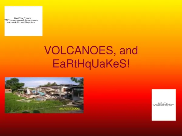
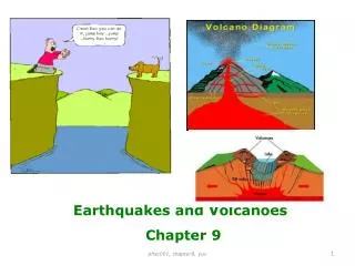
Chapter 9 p. 290 EARTHQUAKES AND VOLCANOES
9.1 Earthquakes EQ is vibrations in the ground that result from movement along breaks in Earth’s lithosphere. Breaks are called faults or fault lines (broken lithosphere). These fault lines are also referred to as plate boundaries. Forces that move tectonic plates also push & pull on rocks along faults. Weak forces are rarely detected by people (only by scientists). But strong forces can cause earthquakes. AMSTI stick demo : when a force is applied to rocks, they can bend/break like the sticks Does Alabama have earthquakes?
Where do earthquakes occur? Typically under the ocean or along a coastline-rarely in the middle of a continent Deepest and strongest EQ occur where plates collide (convergent boundary) Shallow and weaker EQ occur where plates separate (divergent boundary) like mid ocean ridges OR at transform boundaries EQ are difficult to predict
Types of Faults p. 295 Strike up: two blocks of rock slide horizontally past each other in opposite directions (transform) Normal: two blocks of rock are pulled apart (divergent) Reverse: two blocks of rock are pushed together (convergent)
Seismic Waves When rocks move or break they release energy that travels in waves. The waves travel outward in ALL directions at the same rate. They move up & down, back & forth, or in an elliptical motion. The waves transfer energy through the ground and produce motion that can be felt by people. Strongest waves are near the epicenter-point on Earth’s crust right above the beginning of the EQ The farther away from the EQ, the energy decreases and weakens the seismic wave.
Types of Seismic Waves Scientist use wave speed & motion plus the type of material that waves travel through to classify waves. • Primary (P) waves-push & pull underground; happen first and are fastest • Secondary (S) waves-up & down at right angles underground; slower than P waves-cannot travel through liquids (oceans) • Surface waves-rolling on Earth’s surface closest to the epicenter See pics on p. 297
Focus Focus is the location underground where the EQ starts-rocks move/break-can be anywhere between Earth’s surface and 373 miles deep. The epicenter is directly above the focus ON Earth’s crust Seismologist are scientist that study earthquakes Seismometer is an instrument that measures and records ground motion and detects seismic waves Seismogram is a illustration presented on a graph that shows seismic waves
Locating EQ Epicenter Seismologist use triangulation to locate EQ epicenter: using speeds and travel times of seismic waves to determine the distance to the EQ from at least 3 seismometers. • Find the arrival times difference between P and S waves (lag time) • Find the distance to the epicenter by plotting difference of times • Plot the distance on a map and draw circle (radius = to distance) • Repeat circles from each seismometer Pics p. 299 Epicenter location is where all 3 circles intersect. * AMSTI Activity
EQ Magnitude Most common way to measure the strength of EQ is the Richter Scale It uses the amount of ground motion at a given distance from an EQ Begins at 0 but has no upper limit. 9’s have been recorded in EQ history but are rare Each increase in number on the scale represents TEN times the amount of ground motion recorded
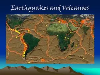
EQ Hazard Map Most EQ are on plate boundaries. In the US, Oregon, Washington, California, Hawaii and Alaska are at highest risk. The Ring of Fire areas are high risk. Analyze map on p. 302 How to protect people and property? 1)Seismologist study past EQ activity to predict future occurrences 2)Geologist study faults, population density near faults, and building designs in the area 3)Engineers design better structures and governments plan, prepare and train for possible rescues
9.2 Volcanoes Volcano is a vent in Earth’s crust through which melted rock flows (molten rock) Molten rock below Earth’s crust is magma. Molten rock above Earth’s crust is lava. Volcanic eruptions constantly change the topography of Earth’s surface. They can form mountains, create new crust, and leave a path of destruction behind Volcanoes can be predicted. Watch and analyze video on Mt Pinatubo
How do volcanoes form? Volcanologist have determined that the movement of Earth’s tectonic plates cause the formation of volcanoes and the eruptions that result. Satellites are used to assess movements. More than 60% of all volcanic activity on Earth occurs along mid ocean ridges (divergent boundaries) but can also occur along convergent boundaries. Volcanoes not near a tectonic plate boundary are hot spots which originate over convection currents. Ex: Hawaii When volcanoes are not active for thousands of years, they are called dormant and are safe for tourism.
Where do volcanoes form? Ring of Fire in the Pacific Ocean Convergent tectonic plate boundaries Divergent tectonic plate boundaries Hot sport
U.S. Volcanoes 60 active volcanoes in the United States- mostly in Ring of Fire, Alaska, Hawaii, Washington, Oregon and California US Geological Survey created 3 volcano observatories to monitor the potential for future volcanic eruptions in the US. They record and analyze EQ activity, changes in shape of volcano, gas emissions, and the history of volcanoes to evaluate probability of future eruptions.
Types of Volcanoes Analyze pic p. 310 Based on shape and size • Shield Volcano-on divergent plates and oceanic hot spots-large with gentle slopes of basaltic lava • Composite Volcano-on convergent plates-large and steep-extremely explosive of rhyolitic lava and ash • Cinder Cone Volcano-small steep sides-gasey eruptions with basaltic lava When volcanoes summit collapse or is blown away, a depression (bowl like) forms on top-called a caldera
Viscosity A liquid’s resistance to flow-can be thick and sticky or thin and runny AMSTI Viscosity Lab Volcanic eruptions can produce different types of lava. Most magma & lava contain a chemical called silica. The different amounts of silica determine the viscosity. Volcanic eruptions can also produce ash-tiny particles of rock. Magma & lava also contain other gases and water vapor which create pyroclastic flow Pic p. 311
Constructive or Destructive? Constructive-beautiful landscapes, increases tourism. Enriches soil, regulates climate Destructive-lava flow destroys property; ash fall disrupts air traffic, decreases air quality causing breathing problems, and disrupts atmosphere; mudflows called lahars are created from melted snow and ice on mountain summits; pyroclastic flows run quickly and burn everything in sight
Climate Change? Ash can block sunlight and change temperatures around the globe Blocking sunlight affects the natural food chain and life cycle of animal and plants Winds can move ash all around the world Analyze graph p. 314
Read main ideas on p. 318 Study vocab on p. 318 Complete Review p. 319-320 Study Quizlet Make an A! :) TEST TIME!