Download
1 / 18
190 likes | 356 Vues
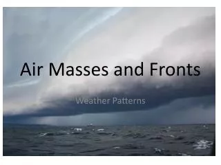
Air Masses & Weather Patterns. Question of the Day. What is an Air Mass?. Air Masses. Movements of large bodies of air that originate at a source region Characterized by temperature and moisture content Important because they cause atmospheric disturbances. Classifying Air Masses.

E N D
Question of the Day What is an Air Mass?
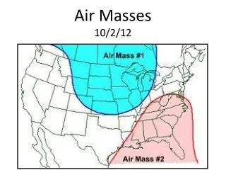
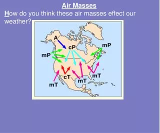
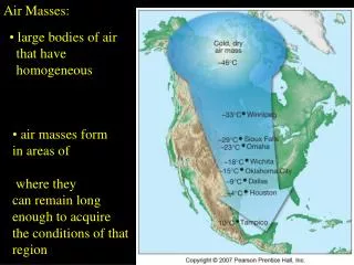
Air Masses • Movements of large bodies of air that originate at a source region • Characterized by temperature and moisture content • Important because they cause atmospheric disturbances
Classifying Air Masses • Depends on latitude and nature of surface of source area • -Latitude P(polar), A(arctic), T (tropical) • -Nature of Surface m(maritime), c(continental)
Midlatitudes Regions between southern Florida and Alaska. Primary weather producer is middle-latitude cyclone (low pressure system by meteorologists)
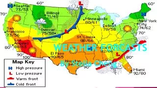
Fronts • Boundary surfaces that separate air masses from different densities. • One is usually warm and has more moisture than the other • Overrunning is when warmer, less dense air is forced up along the colder, more dense air • 5 different types of fronts • Warm • Cold • Stationary • Occluded • Drylines
Warm Fronts Warm surface air replaces area where cooler air was Red line with semicircles on a weather map Change in types of clouds as front approaches Light to moderate precipitation over a large area and for an extended period of time
Cold Front Cold air moves into region where warmer air is Blue line with triangles on a map Heavy Precipitation over a shorter duration and gusts of wind Cooler temperatures after storm clears
Stationary Front Cold Mass and Warm Mass air meet Line with blue triangles and red semicircles on map No movement or slow movement of air masses so gentle/moderate precipitation for days
Occluded Fronts Fast moving cold front over takes a warm front Heavy rain at first then light rain as it dissipates. Can have cold-type and warm-type occluded fronts
Drylines Based upon humidity Generate severe thunderstorms from Texas to Nebraska along Great Plains