Download
1 / 33
350 likes | 754 Vues
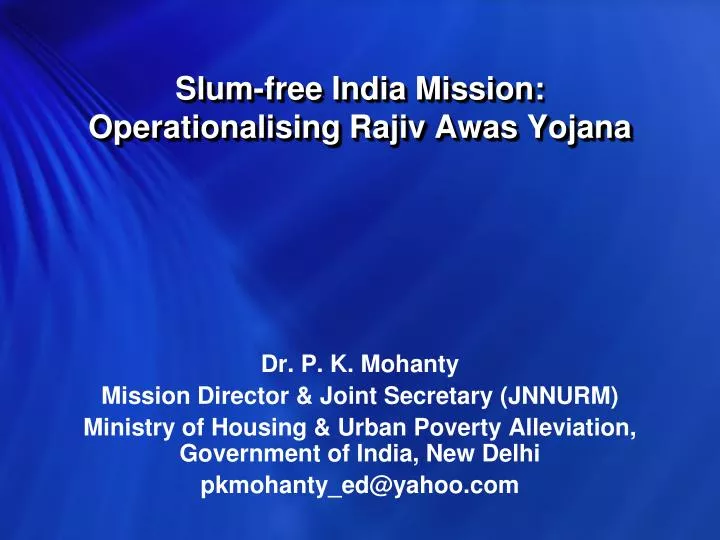
Slum-free India Mission: Operationalising Rajiv Awas Yojana. Dr. P. K. Mohanty Mission Director & Joint Secretary (JNNURM) Ministry of Housing & Urban Poverty Alleviation, Government of India, New Delhi pkmohanty_ed@yahoo.com.

E N D
Slum-free India Mission:Operationalising Rajiv Awas Yojana Dr. P. K. Mohanty Mission Director & Joint Secretary (JNNURM) Ministry of Housing & Urban Poverty Alleviation, Government of India, New Delhi pkmohanty_ed@yahoo.com
Operationalising Rajiv Awas Yojana – Progress Towards Scheme Formulation Stage I: RAY Concept Note - Consultations • Circulation of Concept Note on RAY to Central Ministries, State Governments, NGOs, Experts etc. (July-Aug 2009) • Consultation held by Minister of HUPA with NGOs, Experts, Slum-dwellers Federation, Residents of Slums from Cities & Private Sector Representatives (14 July, .2009) • Consultation held by Secretary, HUPA • State Secretaries (Urban Development & Housing), Municipal Commissioners from Large and Small Cities/ULBs and MDs of Urban Development Authorities (20 July, 2009) • Select NGOs, Subject Experts & Joint Secretary to Prime Minister (23 July, 2009) • Presentations before Deputy Dy. Chairman, Members & Secretary, Planning Commission • Presentations before Deputy Dy. Chairman, Members & Secretary, Planning Commission • Presentation before Principal Secretary to Prime Minister (1 October, 2009)
Operationalising Rajiv Awas Yojana – Progress Towards Scheme Formulation Stage II: RAY Draft Guidelines - Consultations • Circulation of Draft Guidelines on RAY to Central Ministries, State Governments, Experts etc. (27 October, 2009) • Meeting by Minister of HUPA with Secretary (Statistics) and Registrar General regarding Slum Survey in Census 2011 • Consultation held by Minister of HUPA with Select State Secretaries (Urban Development & Housing), Bankers, Real Estate Developers, and Experts (5 November, 2009) • Consultations by Secretary (HUPA) with State Secretaries & City Commissioners (Oct-Nov, 2009) • Hilly States, NER States, Union Territories, States of Punjab, Maharashtra, Andhra Pradesh , Delhi and Gujarat and several Cities • Discussions with State Ministers of Urban Development/ Housing/ Municipal Affairs (3 December, 2009) • Presentation before Dy. Chairman, Planning Commission (8 December, 2009)
Operationalising Rajiv Awas Yojana – Progress Towards Scheme Formulation Stage II: RAY Draft Guidelines - Consultations • Consultation with senior officers of the Government of Maharashtra, including Officers from MMRDA, MHADA, Municipal Corporation of Greater Mumbai, select other Municipal Corporations, representatives from NGOs and experts held by Secretary (HUPA) at Mumbai (11-12 December, 2009). • Meeting by Member, Planning Commission on the issues of Credit Flow to the urban poor for affordable housing in the context of Rajiv Awas Yojana (16 December, 2009) • Consultation with senior officers of the Government of West Bengal and Minister for Urban Development & Municipal Affairs (22 December, 2009) • International Consultation, 28-29 January, 2010
Operationalising Rajiv Awas Yojana – Preparatory Tasks Legislative Framework for Property Rights: • Model legislative framework for property rights to slum-dwellers to guide States/UTs to undertake legislation • Suggestive Amendments to Existing Laws: Town Planning, Urban Development, Slum, Housing, Municipal Corporation, Revenue etc.; Norms for Planning of Informal Settlements – Housing & Infrastructure Procurement of Satellite Imagery & Base Map Preparation: • Demarcation of all Slums: Notified, Non-notified, Tenable, Non-tenable, etc., adopting a ‘Whole City’ approach and dividing the City into Grids/Zones (based on land value/other parameters) for operational purposes • Procurement of Cartosat II 1 Metre Resolution Images from Indian Space Research Organisation (ISRO)/National Remote Sensing Centre (NRSC) for Cities, Zones and Slum Locations; Geo-referencing & Preparation of Base Maps (1:5000 scale) indicating Slums and their Internal and External Infrastructure Connectivities
Operationalising Rajiv Awas Yojana – Preparatory Tasks …contd. Slum Survey & Management Information System (MIS) • Formation of Slum Survey Teams & Supervisory Teams, Conduct of Training Programmes involving NSSO, CSO, State Statistics/Municipal Departments etc. for Slum Survey Operations • Conduct of Slum Survey - Detailed Model Formats on Slum, Household & Livelihoods Surveys & Guidelines for Training circulated to all States by National Buildings Organisation (NBO); Community to be closely involved in Survey (States like Andhra Pradesh have adopted Community Self-Survey Model) • Development of web-enabled MIS, entry of data from Slum Surveys in MIS, compilation and collation of data, preparation of Slum Profiles, City/Zone and State Slum Database and Baseline Reports. The MIS is to be based on Open Source and will conform to the stipulations by Unique Identity Authority of India • Training of MIS Users • Socio-economic Analysis of Data accumulated through Slum MIS.
Operationalising Rajiv Awas Yojana – Preparatory Tasks …contd. GIS Mapping of Slums • Training in GIS Mapping Tools using Open Source Technology through ISRO/NRSC-CGG & Select Partners. • Development of Slum Maps using GIS Tools based on : (i) Cartosat II imagery secured from the Indian Space Research Organisation / National Remote Sensing Centre (ii) Ground truthing and geo-spatial data measurement, collection and collation and superimposing the same on the Satellite Images - to be undertaken with assistance of technical partners of ISRO/NRSC and other agencies. • Spatial Analysis of GIS Data
Operationalising Rajiv Awas Yojana – Preparatory Tasks …contd. GIS-enabled Slum Information System • Integrating Slum MIS with GIS Maps to enable the preparation of a dynamic GIS-enabled Slum Information System - Slum-wise, Zone-wise and for City; Spatio-socio-economic analysis of Data Choice of Land Tenure/Development Model • Establishment of community organisation and community engagement mechanisms • Establishing Tenurial Rights & Grievances Redressal Mechanism; Biometric Identification of Dwellers • Community consultation and participatory decision-making regarding the choice of model of land tenure / development for each slum: In situ PPP covering infrastructure & housing with or without FSI/zoning incentives; In situ Land Sharing/Infrastructure provision only, with beneficiary-driven/incremental housing model; In situ community-based development through Rajiv Awas Housing Societies; Relocation; Ownership/Ownership-Rental, etc.
Operationalising Rajiv Awas Yojana – Preparatory Tasks …contd. Preparation of Slum Development Plan • Slum Reconfiguration / De jure Formalization – following special Town Planning Norms applicable for Informal Sector Settlements • Plan for Housing based on chosen Development Model using a zonal/city-wide approach – bunching of high-density and low-density slums and accommodating dwellers from non-tenable locations • Plan for Internal Infrastructure: water supply, sewerage, storm drainage, solid waste management, roads, power transmission lines & substations, parks & playgrounds, education & health infrastructure, livelihoods centres/workplaces, informal sector markets etc. • Plan for External Connectivities – Establishing links to City-wide Infrastructure Networks
Operationalising Rajiv Awas Yojana – Preparatory Tasks …contd. Preparation of Slum-free City Plan • Amalgamation of Slum Development Plans for Zones/Grids/Slums • Integrating Slum-free City Plan with City-wide Infrastructure Development Plan (CDP) • Slum-free City Financing Plan, including Credit Mobilisation for the Poor / Micro-finance, etc. • Slum-free City Plan Implementation Framework, including Institutional structure e.g. City Slum Rehabilitation Authority • City-wide Policies for Slum Prevention including Reservation of Land for Housing the Poor in Private & Public Housing Colonies & Affordable Housing • Plan for Implementation of Pro-poor Reforms stipulated under JNNURM
Operationalising Rajiv Awas Yojana – Preparatory Tasks …contd. Preparation of Slum-free State Plan • Amalgamation of Slum-free City Plans • Legislation for Property Right to Slum-dwellers • Inclusive Urban Planning Paradigm / Town Planning Model for the prevention of new slums • Slum-free State Financing Plan • Slum-free State Plan Implementation Framework, including Institutional Structure, e.g. State Slum Rehabilitation Authority empowered with quick decision-making on all aspects of slum-free city planning and implementation.
Operationalising Rajiv Awas Yojana – Support for Preparatory Tasks Slum Free State/City Planning e-Tools/Manuals/Guidelines: • Guidelines for Slum Surveys – Detailed Formats & Methodology already circulated to States • Model Legislation for Property Rights to Slum-dwellers • Step-by-Step Guide for drawing up Slum Development Plan, Slum-free City Plan and Slum-free State Plan. • Slum Survey MIS – e-Tool & Operational/User Manual • Slum Mapping using GIS – GIS Tool & Operational/User Manual for Slum Mapping
Operationalising Rajiv Awas Yojana – Support for Preparatory Tasks Slum Free State/City Planning e-Tools/Manuals/Guidelines: • GIS-MIS integration and development of a dynamic tool “GIS-enabled Slum MIS” for being operated as an instrument for Slum-free city planning and monitoring the implementation of Slum-free City Plans and projects (Guidelines for integration of Slum Survey MIS covering spatial and socio-economic data with GIS-based Slum Maps based geo-spatial data from sources of satellite images/remote sensing/aerial surveys and ground level corrections). • Manual for use of latest gadgets, tools and techniques required for GIS mapping of slums within the framework of statutory spatial planning for cities.
Operationalising Rajiv Awas Yojana – Support for Preparatory Tasks Slum Free State/City Planning e-Tools/Manuals/Guidelines: • Guidelines for Reforms required to usher in Slum-free Cities and States; Inclusive Planning Paradigm – New Town Planning Model • Guidelines for structuring PPP-based slum rehabilitation projects • Guidelines for biometric identification of slum-dwellers and issue of biometric identity cards, duly taking into account the standards set by the Unique Identity Authority of India • Design of low-income housing finance model, including Mortgage Guarantee Fund, Use of Land as a Resource, Impact Fee, Shelter Fund etc.
Operationalising Rajiv Awas Yojana – Support for Preparatory Tasks Slum Free State/City Technical Cells: • Establishment of Slum-free City/Technical Cells in Ministry, States and Select Cities for guiding the preparation and implementation of Slum-free State/City Plans - Support proposed to be extended for 5 years A Technical Cell is proposed to be established at National/ State/ULB (select cities) level with the following experts on contract basis: • MIS Specialist – 1 • GIS Specialist – 1 • Town Planning Specialist – 1 • Social Development Specialist – 1 • Project/Engineering Specialist – 1 and • Capacity Building/Training Coordinator -1.
Operationalising Rajiv Awas Yojana – Support for Preparatory Tasks Slum-free City Plans: Select Cities • Detailed works for the preparation of Slum free City Plans for select cities/urban agglomerations to develop models for all States/cities in the country to be covered under RAY. These works are to be coordinated by the State/City Technical Cell and undertaken by: • Reputed consultant team to be selected through a transparent process. • Reputed NGOs/CBOs – Social Mobilization Team to guide and anchor community mobilization for slum-free cities in the select pilots. Hardware & Software • Procurement of Hardware and Software at Central, State and ULB levels based on recommendation by a Technical Expert Committee
Operationalising Rajiv Awas Yojana – Support for Preparatory Tasks Other Capacity Building Support: • Training Programmes in Slum MIS/GIS, Slum Mapping, Slum Development/Slum-free City and Slum-free State Planning, Project Management, Third Party Monitoring, Pro-poor Reforms, Municipal Strengthening, Community Mobilization, Social Audit etc. with the involvement of National Technical Institutions and National Network of Resource Centres – coordinated by CGG in association with NRSC. • Other Technical Support inputs to States/ Urban Local Bodies for Slum-free State/City Planning as needed • Periodic Workshops to arrive at consensus on guidelines, slum-free city planning and exchange of best practices and successful tools and techniques.
Operationalising Rajiv Awas Yojana – Next Steps Slum-free City Campaign – City Pilots • Securing Commitments from States/Cities – Minister has written to Chief Ministers • Establishing Policy & Programme Support Unit at MoHUPA and Slum-free State & Slum-free City Technical Cells • Preparing TORs & Engaging Slum-free City Planning Teams • Survey Teams • GIS Partner – ISRO/NRSC/Centres for Remote Sensing Application/Other Institutions • MIS Partner – CGG/State MIS Cells/Other Institutions • Slum-free City Planning Expert/Resource Institution • Lead NGO/CBO – for Community Mobilisation & Engagement • Training Coordinator – NRSC-CGG/State Partner • Financial Institution/Banker • Development of Tools & Manuals and Conduct of Training Programme in Slum MIS/GIS, Slum Mapping, Slum-free City and Slum-free State Planning, etc. • Undertaking Surveys, MIS, GIS, Spatio-Socio-economic Analysis, Community Engagement, Slum-free City Plan Preparation & Formulation of PPP Projects, to start with
Operationalising Rajiv Awas Yojana – Some Action Action Points • Developing Model Legal Framework for Property Rights to Slum-dwellers • Manual for GIS-enabled Slum Information System • Step-by-Step Guide for Preparation of Slum-free City Plan • Inclusive Town Planning Model – Measures to Prevent Future Slums • Framework of PPP Model for Slum Redevelopment • Affordable Housing Finance Model – Measures to Facilitate Credit Flow, including Mortgage Guarantee Fund
Slum Survey Results: Andhra Pradesh (Part I Completed) Notified slums Non-notified Pockets of slums Poor Total Settlements State 5382(72%) 1996(27%) 66(1%) 7,451 JNNURM (BSUP & UIG) Cities : Hyderabad 1248 206 1 1455 Visakhapatnam 284 451 0 735 Vijayawada 109 -- -- 109 Tirupati 38 4 -- 42 Other than Mission Cities 120 ULBs 3703 1335 65 5103
Andhra Pradesh: Physical Location Analysis of Slums Vulnerability for Flooding / Inundation: Prone to Flooding – 1731 (24%) Number %
Land Ownership in Slums • More than 35% of slums located in State govt lands • 21 % of slums located in ULB lands
Andhra Pradesh: Status of Tenurial / Property Rights to Slum dwellers (Survey Part I) No. of Slums on State/ULB lands : 4187 No. of Tenable Slums : 3323 No. of Occupants : 17.87 lakhs Issue of Property Titles So far No Issued Pattas : 1.89 Lakhs (11%) Balance: : 15.68 lakhs (89%)
Andhra Pradesh: Basic Services Connectivity of Slums to Citywide Networks Individual Toilets to Slum Households Estimated Households not having toilets: 3.63 lakhs (19.08%)
Andhra Pradesh: Status of Solid Waste disposal in Slums ByNo. of Slums Municipal Staff - 3,950 Municipal Contractors - 2,745 Residents Themselves - 477 No Arrangements - 235
Andhra Pradesh: Approach Road Connectivity to Slums No. of Slums Motorable Pucca - 5107 Motorable Katcha - 1410 Non-motorable - 890
Andhra Pradesh Pilot Study of 39 Slums: Road Width
Andhra Pradesh: Pilot Study of 39 Slums - Types of Roads
Andhra Pradesh Pilot Study of 39 Slums - Ownership of Houses
Andhra PradeshPilot Study of 39 Slums - Plinth Area of House