Download
1 / 50
500 likes | 687 Vues
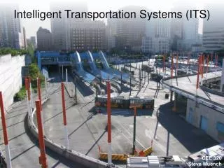
The OU Intelligent Transportation Systems Laboratory. Lab Overview. Established in 1998 as a joint venture between ODOT and the OU School of ECE. The ITS Lab has been involved from the very beginning of the ITS program in Oklahoma.

E N D
Lab Overview • Established in 1998 as a joint venture between ODOT and the OU School of ECE. • The ITS Lab has been involved from the very beginning of the ITS program in Oklahoma. • Current partners include OkTC, DPS, OHP, OHSO, ODOT, FHWA, FMCSA. • Lab projects were featured on local TV news broadcasts 18 times between 2005 and 2007. • In a recent report, the California DoT (CalTrans) and UC Davis cited Oklahoma’s ITS as a national exemplary model.
Lab Activities • System Planning • System Design • System Integration • System Testing • Field Maintenance • Software Development • Software Maintenance
ITS Lab Personnel • 15 graduate students • 4 non-student staff engineers • 4 faculty members Mascot:
Feedback 73 DMS Overhead Signs Dynamic Lane Control ATIS HAR/511 Statewide ITS Implementation • Sensors • 232 video cameras • 70 m-wave speed detectors • Inductive loops • RWIS (weather) • Infrastructure • Heterogeneous communications network • Distributed Control (OklahomaVirtual TMC)
Current Deployment • Oklahoma City Metro • Tulsa Metro • Tinker AFB • Norman and Edmond • Lawton • Fort Sill • McAlester • McAlester Army Ammunition Plant
TMC Cost Issues in Oklahoma • Cost is a major issue with ITS deployment in Oklahoma. • The cost of building and operating a large, centralized TMC was deemed prohibitive. • Funds were not available to construct the facility. • Typical cost: USD × 107. • No agency was able to accept financial responsibility for 24/7 staffing. • Typical Cost: USD 2M – 3M per year.
The Virtual TMC Concept Question: how can you realize the full functionality of a large, integrated multi-agency TMC without incurring the costs? Answer: build a virtual TMC that allows the stakeholder agencies to remain in their current physical locations. Each agency receives an instantiation of the Statewide ITS Console. Nominally, this is a COTS PC with special hardware and software to support ITS functionality.
Virtual TMC Philosophy Build a geographically distributed, fault tolerant peer-to-peer network of ITS consoles. Any group of mutually connected consoles can self-organize to control all ITS resources that are visible to the group. one console self selects as Master. others in the group self identify as Slaves. The master manages message passing with MSMQ to maintain database synchronization between all members of the group.
User ID and Privilege Structure User ID’s are associated with individuals. There are eight user levels. There are a large number of privileges can be individually enabled/disabled on a per user basis (e.g. “can pan/tilt/zoom camera”). Identity, user level, and privileges are maintained consistently when logging into any console in the State. User levels and privileges used to prioritize access to ITS system resources (e.g. camera, DMS).
Operator Control Surface Philosophy GOAL: for each type of system resource, Provide a consistent, uniform control surface Independent of specific make/model/vendor. Develop custom software module for each type of device (camera, web cam, DMS). Avoid vendor specific control software Implement control surface with a superset of the special features/functionalities. Unavailable features “grayed out.” Make/model and vendor specific protocols stored in database.
Heterogeneous Video Environment Oklahoma City Metro: analog video Tulsa Metro: packet switched digital video CCTV system to support special “low bandwidth” consoles: Point-to-point microwave Internet/VPN “Home” console… requires security HW (PIX/ASA)
Other “Neat” Features Network “heals” automatically after outage. Handhelds for DMS control and network monitoring. Quick multiparty communications: Text/chat VOIP conferencing Development in progress for multi-agency radio system interoperability.
RWIS-Inclement Weather Console • Unified Visualization Framework combines data from the following sources: • AVL instrumentation data (Lat, Long, Alt, Speed) • Weather sensor data from a network of RWIS stations (surface temp., wind speed/dir.) • National Oceanographic and Atmospheric Administration (NOAA) (radar overlays) • National Weather Service (NWS) (forecast) • Oklahoma Climatological Survey (OCS) (mesonet/micronet) OR
OHP-Geo-Aware Reporting System • Major Reporting Goals • Record Lat/Long information in collision, citation, warning and impound reports • Provide a method for improving GPS data when the police vehicle is not positioned at the exact location of the incident • Provide a method for reporting infrastructural damage to ODOT property, eyewitness weather conditions, etc. • Data Distribution System • Integrate Geo-Aware information gathered by the OHP system into a real-time multilayer map view/interface • Provide a method of exporting and analyzing large sets of data and performing studies that involve correlation with other large data sets such as WIM, FARS, SAFE-T, etc.