Download
1 / 32
320 likes | 429 Vues
Integration of Statistical and Spatial Information for Data Dissemination in Cape Verde. United Nations Regional Workshop on Data Dissemination and Communication Amman, Jordan – 9 to 12 September 2013. Amândio Furtado Amandio.furtado@ine.gov.cv. Summary. About Cape Verde

E N D
Integration of Statistical and Spatial Information for Data Dissemination in Cape Verde United Nations Regional Workshop on Data Dissemination and Communication Amman, Jordan – 9 to 12 September 2013 AmândioFurtado Amandio.furtado@ine.gov.cv
Summary • About Cape Verde • The National Statistical System (NSS) and National Institute of Statistics (NIS) • Data Dissemination in the NIS • Some Dissemination Products (an overview) • The WebGIS-INE (A Geospatial Tool to Disseminate Data Trough Internet) • An Example of integrating Statistical and Spatial Data
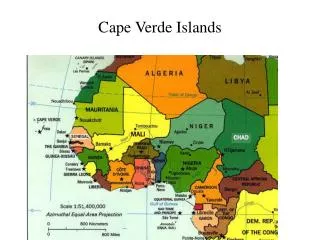
About Cape Verde Atlantic Ocean
About Cape Verde Atlantic Ocean West Cost of Africa (Western Country of Africa) 500 Km from Senegal
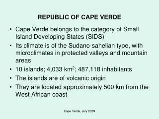
About Cape Verde Atlantic Ocean West Cost of Africa (Western Country of Africa) 500 Km from Senegal 10 Islands of Volcanic Origins Area: 4.033 Km2 Population: 491.683 (2010) 512173(Est. -2013) Capital: Praia Independence: July 1975 Praia
About Cape Verde 10 - Island • Political-Administrative divisions
About Cape Verde 22 - Municipalities • Political-Administrative divisions
About Cape Verde 32 - Freguesias • Political-Administrative divisions
The NSS and NIS State agency that oversees and coordinates superiorly the National Statistical System. unifying body of producers and users of statistical information Fixed guidelines for statistics, by outlining the national statistical activities and programs. Holds the methodological coordination. Approving the concepts, definitions, classifications and other instruments of technical coordination. National statistical System
The NSS and NIS Governmental Representatives Associations Representatives Academic and Civil Society Representatives
The NSS and NIS The National Institute of Statistics (NIS) is the central executive organism, of the National Statistical System (NSS) responsible for production and dissemination of the statistical information. Mission: Produce and disseminate with efficiency and exemption, statistical information with quality, relevant and timely.
Data Dissemination in INE Confidentiality Users needs (output's different forms and formats) Make the internet the core dissemination vehicle Easy the access to information • Free access to census data, including geographic data Data Available in different forms and format Enable advanced users to “directly” handle the information.
Data Dissemination in INE www.ine.cv
Data Dissemination in INE • Cape Verde Census Info • SINE (CPLP) • BDEO • BDMI • Data Request • INE Mobile • WebGIS-INE
The WebGIS-INE - Background In 2010 the NIS, conducted a Population and Housing Census Use of New Technologies (Mobile Devices) Use of GIS to support data collection and dissemination Completely Digital Census (One of the first in Africa)
The WebGIS-INE - Background Minimum use of paper Geo referencing all household (Using GIS and GPS) Improve quality control PDA (Personal Digital Assistant) with GPS (Global Positioning System).
The WebGIS-INE - Background Mobile GIS” – IBGE Mobile GIS Technicaland logistic support of the Brazilian Institute of Geography and Statistics (IBGE) App that allows the visualizations, navigation map and use of GPS.
The WebGIS-INE - Background Geo Code Edifice Lodgment Household Individual
The WebGIS-INE – Geospatial Tool to Disseminate data through Internet SIG INE-CV Developed in P Mapper (Html) Features - Shape files: Interaction with the map (Zoom, Select the information that you want to view) Help reading data Query the data (spatial or numeric criteria) “Create” maps (User design) Export data, (Excel, CSV, andmaps)
The WebGIS-INE – Geospatial Tool to Disseminate data through Internet http://webgis.ine.cv WebGIS INE
The WebGIS-INE – Geospatial Tool to Disseminate data through Internet Navigate the map, Select, Enable, Disable the layer/information
The WebGIS-INE – Geospatial Tool to Disseminate data through Internet Navigate the map - Change the information
The WebGIS-INE – Geospatial Tool to Disseminate data through Internet Overlap some layers
The WebGIS-INE – Geospatial Tool to Disseminate data through Internet Query the data (SQL)
The WebGIS-INE – Geospatial Tool to Disseminate data through Internet Export data (CSV, Excel, PDF) and export maps
An Example of integrating Statistical and Spatial Data Highestpoint of Cape Verde: 2829 m Fogo www.wikipedia.pt www.caboindex.com http://hotelxaguate.com www.topicos123.com
An Example of integrating Statistical and Spatial Data Hill shed Model of Fogo A simulation for the development of an emergency plan and risk map (volcanic outburst) using Census data
An Example of integrating Statistical and Spatial Data Using Different layers Points, representing Households - number of individuals, age and sex Circular areas from the peak (area of incidence)
Challenges Improve the access to geospatial information Improve visualization, and interactivity (more visual and more social) Improvements in managing (Tools, data, Live ware) Better use and integration of spatial and statistical data (Geostatitical Analysis) Implementation of an harmonized and systematic Metadata (Geospatial data) Increased and better management of Statistical metadata
Thank You for your attention Obrigado Amândio Furtado Dissemination Team INE CV amandio.furtado@ine.gov.cv