Download
1 / 22
220 likes | 623 Vues
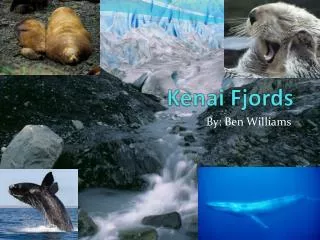
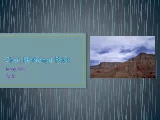
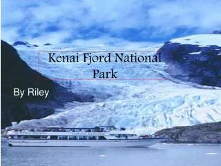
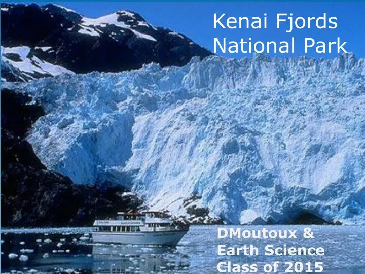
Kenai Fjords National Park. DMoutoux & Earth Science Class of 2015. Where is Kenai Fjords National Park?. Why Visit Kenai Fjords National Park?. View arctic marine wildlife Visit fjords and glaciers Sea kayak, hike, backpack Find solitude – most of the park is inaccessible by car.

E N D
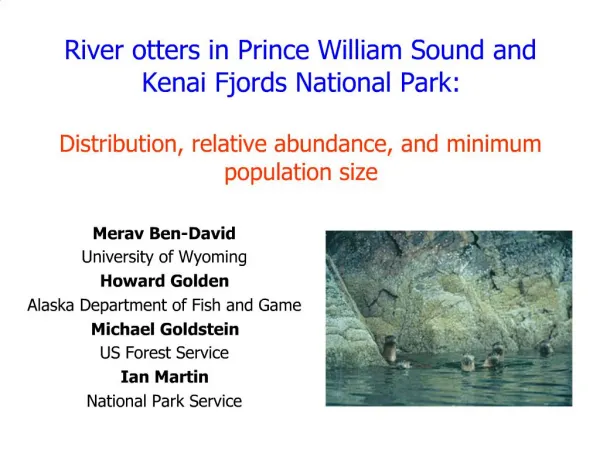
Kenai Fjords National Park DMoutoux & Earth ScienceClass of 2015
Why Visit Kenai Fjords National Park? • View arctic marine wildlife • Visit fjords and glaciers • Sea kayak, hike, backpack • Find solitude – most of the park is inaccessible by car
How Plate Tectonics Affect the Park… • Southern coast of Alaska lies along a convergent plate boundary • Pacific Plate subducting beneath NA Plate • 4 Active Volcanoes on the Kenai Peninsula • Large & frequent earthquakes • One of the largest recorded earthquakes, MR 9.2 struck nearby in 1964
Plate Tectonics Affects Rock Type … • Pillow Basalts from Volcanoes
Plate Tectonics Affects Rock Type … • Batholith • Magma that cools Underground • Granodiorite (like granite, but darker)
Plate Tectonics Affects Rock Type … • Accreted Terranes • Foreign land transported by the Pacific Plate and scraped off on the coast • Chert & Basalt from the ocean floor • Limestone (old coral reef)
Plate Tectonics Affects Rock Type … • Produces Fractures • Injected with superheated water carrying minerals • Iron, silica (quartz), arsenic, and gold
Kenai Fjord National Park Today … • Half the park covered in ice • Glaciers originate in the Harding Ice Field
Kenai Fjord’s Past … • About 30,000 year ago, the entire Kenai Peninsula was covered by an ice sheet, much like Greendland or Antarctica West AntarcticIce Sheet
Kenai Fjord’s Past … • Elevation was higher • Tectonic action is causing subsidence(slow sinking) • Diagram shows subsidence following the 1964 earthquake
Mechanical Weathering & Erosion by … • Glaciers • Waves
How Glaciers Form • Abundant snowfall • Harding Icefield receives 60 feet of snow per year. • Cool summers • More snow accumulates than melts • Air squeezed out as snow accumulates • Becomes glacial ice in 4-10 years. • Vertical relief • To allow flow downhill • Tremendous weight of glacier crushes and abrades rock • Flow transport debris downhill.
Glacier-carved Features • U-Shaped Valleys
Glacier-carved Features • Morraines – Piles of eroded rock left by retreating glaciers
Glacier-carved Features • Glacial Marks
Glacier-carved Features • Fjords – a long, narrow, deep glacier-carved valley filled by ocean water • Found only in Norway, Greenland, New Zealand, Chile, and Alaska
How Does a Glacier Carve a Fjord? • During an ice age, ocean water levels are much lower, so valleys can be longer • After the ice age, water level rises and fills the long, narrow, and deep u-shaped valley. • Glaciers carve deep u-shaped valleys, but stop at the edge of the ocean
Wave-carved Features • Pounding surf erodes the coast • Softer rock (limestone) far more susceptible than basalts and granodiorite
Kenai Fjord’s Future • Near Future - Embattled glaciers • 3% decrease in area of Harding Ice Field in the last 16 years • Estimated 40 cubic miles of glacial loss in Alaska annually • 1000’s of Years Gradual filling of fjords • Sediments accumulate at rates of up to a foot a year. • Fjords that are 600 to 1000 feet deep could be filled within the next couple thousand years. • Long Term - Continued subsidence • The ocean will slowly encroach on the park.
Bibliography • More, Inventory And Monitoring Network Learn about the various projects being studied. Read. National Parks Service. 19 Jan. 2013. National Parks Service. 12 Feb. 2013 <http://www.nps.gov/kefj/naturescience/index.htm>. • "Geomorphology." Geomorphology. 12 Feb. 2013 <http://svp.soic.indiana.edu/svp/4970813/FID1/html/ecosys/physical/geomorph.htm>. • "Moraine on Pederson Glacier, Aialik Bay, Kenai Fjords NP, Alaska." Panoramio. 12 Feb. 2013 <http://www.panoramio.com/photo/1268828>. • "McCarty Fjord and glacier, Kenai Fjords National Park, Alaska - aerial photograph (aat)."Panoramio. 12 Feb. 2013 <http://www.panoramio.com/photo/76217421>. • "Glaciers: Earthâs Rivers of Ice â Icebergs and Glaciers â Beyond Penguins and Polar Bears."Beyond Penguins and Polar Bears Glaciers Earths Rivers of Ice Comments. 12 Feb. 2013 <http://beyondpenguins.ehe.osu.edu/issue/icebergs-and-glaciers/glaciers-earths-rivers-of-ice>.
Bibliography • "West Antarctic Ice Sheet Science Traverse." : The Ice. 12 Feb. 2013 <http://waisdividetraverse.blogspot.com/2010/12/ice.html>. • "Harding Icefield." Photo Blog Photography Blog for Niebrugge Images Harding Icefield Comments. 12 Feb. 2013 <http://www.my-photo-blog.com/harding-icefield>. • "LARRY'S RAMBLE." : 2011-02-13. 12 Feb. 2013 <http://larrysramble.blogspot.com/2011_02_13_archive.html>. • "Kurt Friehauf - Alaska 2011 project description - Kenai FjordsNational Park." Kurt Friehauf - Alaska 2011 project description - Kenai FjordsNational Park. 12 Feb. 2013 <http://faculty.kutztown.edu/friehauf/alaska_2011/kenai_fjords/>.