Download
1 / 11
110 likes | 194 Vues
Soil Loss Along the Watts Bar and Fort Loudon Portion of the Tennessee River. Katherine Phipps. Introduction. Reports from 1970’s brought public attention to the massive amounts of soil being depleted in the U.S. 1970’s about 16,000 pounds per acre per year.

E N D
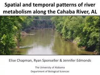
Soil Loss Along the Watts Bar and Fort Loudon Portion of the Tennessee River Katherine Phipps
Introduction • Reports from 1970’s brought public attention to the massive amounts of soil being depleted in the U.S. • 1970’s about 16,000 pounds per acre per year. • 1994 USDA reported approximately 12,000 pounds of soil loss per year in U.S. • According to the U.S. Global Change Research Information Office, soil is being eroded at about 17 times the rate that it can form naturally.
What factors influence soil loss? • Climate • Greatest in arid and semiarid regions. • Vegetation • Soil and rock type • Relief and slope • Human activities, such as: • Construction of dams and levees • Sedimentation causes reservoirs to fill and reduces the dams ability to control flood waters. • Timber harvesting • Agriculture (plowing, irrigation, grazing) • Urbanization, construction, surface mining.
What are the affects of soil loss? • Sediment load has a large affect on the channel types, patterns, and stream sinuosity. • Stream braiding, meandering, and flood plains. • Stream sediment degrades water supplies for municipal and industrial use. • Provides a means of transportation for a wide range of chemical pollutants that attach to the sediment surface. • Increases turbidity of coastal waters, which can have a major affect on coastal life. • Loss of important nutrients and amounts of topsoil needed to sustain life for trees and crops.
Study Area • Estimation of soil loss along the Tennessee River in six sub watersheds in the area of the Watts Bar reservoir and the Fort Loudon Reservoir.
Processes • Uses (USLE) Universal soil loss equation to compute the potential average annual soil loss in tons/acre/year. • A = R * K * L * S * C * P • R: rainfall erosivity factor of about 200 for this area. • K: soil erodibility factor 0 – 1916.4 • L S : slope length-gradient factor– measured for me using the slope feature in ArcMap and the following equation: • L S(r)=(m+1)[A(r)/ao]m[sinb(r)/bo]n • C: Vegetation Management Factor – Uses seamless land use land cover to determine the effectiveness of the land cover in preventing soil loss. • P: Support Practice Factor – did not use this, but accounts for practices used to reduce amount of water runoff and erosion.
Analysis • Obtained a rainfall erosivity factor ‘R’ of 200 for this region, process usually done by analyzing rainfall data in excel. • ‘K’ factor is obtained from Statsgo soil data. Purpose is to find the weighted average kffactor of each soil type.
Analysis • Next I used the ‘slope’ feature in spatial analyst to measure slope. • Then, I calculated the L S factor by inputing the given equation into ‘raster calculator’ • LS(r)=(m+1)[A(r)/ao]m [sinb(r)/bo]n
Analysis • Obtained ‘C’ factor by reclassifying the land use land cover layer to the land use codes. This step determine each areas effectiveness in preventing soil loss.
Conclusion • Finally, I entered the USLE into the Raster Calculator to obtain a final calculation. • I obtained the mean annual soil loss from this calculation, which was 55.0327. • My final soil loss for this area was 3.37 tons/acre/year