Download
1 / 3
30 likes | 195 Vues
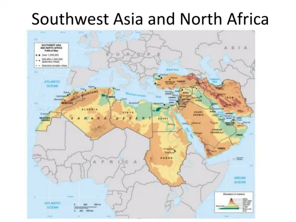
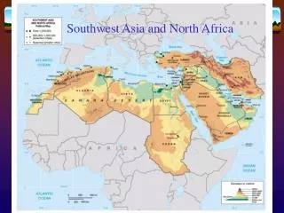
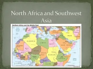
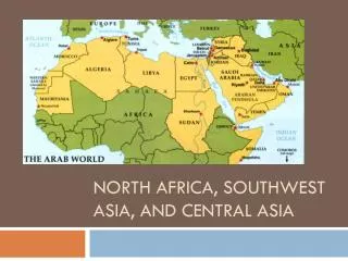
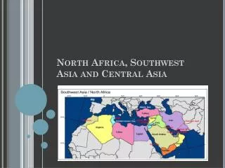
Map of North Africa and SW Asia. Grab some colors – blue, brown, green. Physical Features. Eastern Mediterranean – Ch 20 Anatolia Dardanelles Bosporus Sea of Marmara Pontic Mts Taurus Mts Jordan River Dead Sea Negev Desert. North Africa – Ch. 21 Atlas Mts Ahaggar Mts Maghreb

E N D
Map of North Africa and SW Asia Grab some colors – blue, brown, green
Physical Features • Eastern Mediterranean – Ch 20 • Anatolia • Dardanelles • Bosporus • Sea of Marmara • PonticMts • Taurus Mts • Jordan River • Dead Sea • Negev Desert North Africa – Ch. 21 • Atlas Mts • AhaggarMts • Maghreb • Nile River • Mediterranean Sea • Strait of Gibraltar • Red Sea • Sinai Peninsula • Aswan High Dam • Sahara Desert • Qattara Depression Persian Gulf and Interior – Ch 19 • Persian Gulf • Arabian Peninsula • Gulf of Aden • Arabian Sea • Tigris River • Euphrates River • Shatt al Arab • Zagros Mts • Elburz Mts • Hindu Kush • Rub al-Khali
Political Features • Eastern Mediterranean – Ch 20 • Turkey • Cyprus • Lebanon • Israel • Syria • Jordan North Africa – Ch. 21 • Morocco • Western Sahara • Algeria • Tunisia • Libya • Egypt Persian Gulf and Interior – Ch 19 • Yemen • Oman • Saudi Arabia • United Arab Emirates • Qatar • Bahrain • Kuwait • Iraq • Iran • Afghanistan