Download
1 / 24
240 likes | 332 Vues
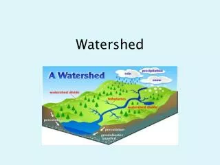
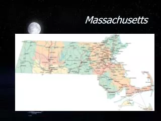
Watershed Tools For Massachusetts. Pete Steeves USGS WRD MA-RI District. A Cooperative Environment. MassGIS development of centerline data (24k) creation of the ARCVIEW interface and initial set of tools AVENUE expertise USGS WRD -- MA/RI District

E N D
Watershed Tools For Massachusetts Pete Steeves USGS WRD MA-RI District
A Cooperative Environment • MassGIS • development of centerline data (24k) • creation of the ARCVIEW interface and initial set of tools • AVENUE expertise • USGS WRD -- MA/RI District • initial watershed delineation programs in ARC • compilation of DEM/GRID data and drainage enforcement programs • working with MassGIS to enhance the watershed tools with new and improved features based on project applications
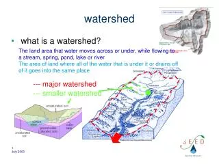
Goals for the Development of GIS Watershed Analysis Tools • Quick and reliable method for delineating basins from any point on any river in the State • Broad and flexible in its applicability to hydrologic investigations • Demonstrate its use through pilot applications that address management concerns
Datalayer Pre-requisites • Networked centerline of USGS DLG hydrography with a system of reach codes attached • Sub-basin boundaries within a watershed that will help to minimize the dependence on DEM based basin delineation and speed up subsequent analysis • Drainage enforced DEM/Grid data
Working Environment: ARCVIEW • Perform actions on the network such as ‘upstream trace’ and ‘find all downstream events’ • Delineate a basin from a selected point on the network • Batch delineate basins using an event table • Make linear events from point events to establish a population of segments
Drainage Enforcement Steps For 24K DEMs • Merge DEM derived grids and ‘clip’ to a 4000 foot buffer around selected watershed • ‘VIP’ 70% of the cells into a point coverage • Run ‘Topogrid’ • resample cell size to 10 meters • input would include vector centerline and VIP elev points • watershed may have to be broken up and pieced back • Run ‘agree.aml’ from University of Texas • exaggerate the depths of the streams by canyonizing them • enhances the topogrid processing • minimize smooth distance tolerance • Run ‘fill’ on the output, followed by ‘flowdirection’ and ‘flowaccumulation’
Application I • Obtaining streamflow statistics for Massachusetts streams on the WEB • User chooses any point on any stream • The watershed is delineated • The application calculates variables(area of stratified drift, total length of streams, mean elevation and slope values) from which stream flow statistics are calculated, including: • Peak-flow frequencies - mean annual, 10-, 25-, 50-, 100-, and 500-year floods • Low-flow frequencies - 7-day, 2- and 10-year low flows • Flow durations - 99 through 1 % exceedance probabilities • August median flow
THE STREAM STATISTICS WEB PAGEhttp://ma.water.usgs.gov/streamstats/
Application II • Characterize water resources (streams, lakes/ponds) on a river network (Neponset River Basin) for water-quality monitoring: • Define a population of stream segments • Determine physical characteristics of stream segments (length, stream order) • Classify stream segments in terms of watershed characteristics that might affect water quality (i.e. - land use)
Stream Segments are Defined Based on Locations Where a Change in Water-Quality May Occur: Tributary confluences Significant lakes (> 5 acres) Significant point-source discharges (NPDES sites)
Physical Characteristics of StreamsNeponset River Basin Total: 312 stream segments152 stream miles 45 significant lakes(not shown) Stream Order
Determining Watershed Characteristics Requires Delineating Watersheds Batch Delineation
Development of Watershed Tools in the NHD ArcView Toolkit • Currently working on adding watershed delineation functionality to the Toolkit • Focusing on areas where 1:24,000 scale National datalayers are available • Testing the validity of using 1:100,000 scale NHD • Plans to incorporate other tools into the Toolkit (event creation and search, a raindrop tool, batch delineation of watersheds…)