Download
1 / 30
300 likes | 424 Vues
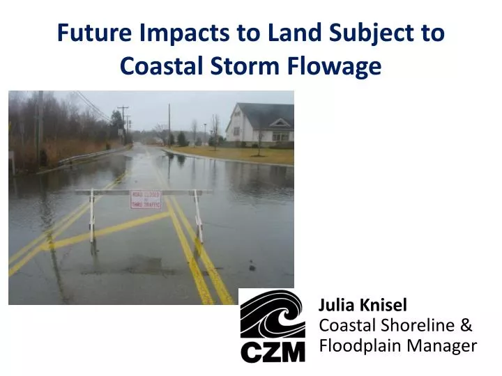
Future Impacts to Land Subject to Coastal Storm Flowage. Julia Knisel Coastal Shoreline & Floodplain Manager. IPCC, 2001. Historic Rate of Sea Level Rise (Boston Tide Gauge). Mean range (MHW-MLW) = 9.5 feet Record = 1921-2012 (91+ years) Sea level rise = 0.9 feet/100 years.

E N D
Future Impacts to Land Subject to Coastal Storm Flowage Julia KniselCoastal Shoreline & Floodplain Manager
Historic Rate of Sea Level Rise (Boston Tide Gauge) • Mean range (MHW-MLW) = 9.5 feet • Record = 1921-2012 (91+ years) • Sea level rise = 0.9 feet/100 years
Historic Sea Level Trends from 1921 to 2006-2012 (Boston) • Linear mean sea level rates ( ) & 95% confidence intervals (mm/yr) calculated from 1921 to recent years (2006-2012) at the NOAA Boston tide gauge station • Values are trend of entire data period up to that year
Recent Expert Assessment of Sea Level Rise Projections Horton et al., 2013
Coastal Inundation Mapping Elements • Water Level: • Local tide ranges • Sea level rise data & projections • Flood event data (surge & precipitation) • High Resolution Elevation Data: • Topographic & bathymetric LIDAR • Digital elevation models referenced to tidal datums • Natural & Human Responses: • Current ecosystems (beaches & wetlands) • Landform changes (erosion & accretion) • Physical barriers to migration (development, seawalls, culverts, etc.)
Buzzards Bay Potential Flood Zone Expansion with Sea Level Rise (static)
Buzzards Bay Potential Hurricane Impacts with Sea Level Rise (dynamic)
South Shore Potential Nor’easter Impacts with Sea Level Rise (5 ft, dynamic)
3D Coastal Inundation Depth (with 5 ft of Sea Level Rise & Nor’easter Storm Surge)
Critical Parameters for Modeling Marsh Migration Marshes on the Move, 2011 • If sediment accretes (traps on surface or accumulates) as fast as sea level rises, then marsh may avoid being converted or submerged
Wetland Types & Tidal Ranges Land Surface 66% wetland Majority Mean High Water Spring Mean High Water Elevation Mean Tide Level Mean Low Water Unconsolidated Shore* Salt Marsh Brackish/ Transitional Freshwater Wetlands Water Dry Lands *includes silt, sand, or gravel that is subject to inundation and redistribution due to the action of water; substrates lack vegetation
Marsh Conversion to Unconsolidated Shore (Gloucester) Current 75-Year Time Horizon (2080) Net marsh impact = MHHW + 4.5 ft sea level rise – 1 ft accretion
Marsh Conversion to Unconsolidated Shore (Salisbury) Current 75-Year Time Horizon (2080) Net marsh impact = MHHW + 4.5 ft sea level rise – 1 ft accretion
Marsh Migration Limited by Development & Infrastructure (Newbury) Current 75-Year Time Horizon (2080) Net marsh impact = MHHW + 4.5 ft sea level rise – 1 ft accretion
Marsh Migration Limited by Development & Infrastructure (Salisbury) Current 75-Year Time Horizon (2080) Net marsh impact = MHHW + 4.5 ft sea level rise – 1 ft accretion
Summary of Sea Level Rise Projections & Impacts • Historic rate of sea level rise (~ 1 ft/century) has shaped our shoreline • Current rate accelerating • 1.5 – 3x current rate reasonable by 2100 with climate mitigation measures…but uncertain • Data exists to evaluate potential impacts & communities are actively engaged in projects • Communities are vulnerable without shoreline migration/erosion • Loss of wetlands increases reach of storm surge & flooding • Preparation is extremely important