Download
1 / 46
460 likes | 748 Vues
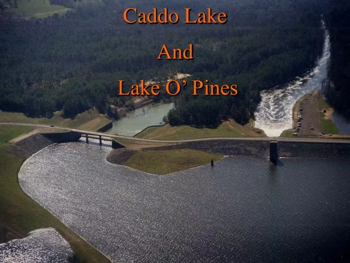
Caddo Lake And Lake O’ Pines. Lake Caddo. Project History Original Dam 1914 Cypress Bayou Navigation Project Reconstruction Began August 1968 Reconstruction Completed June 1971 (COE). Lake Caddo. Project Specific Physical Data 2780 mi 2 of Drainage Area Above Lake Caddo

E N D
Lake Caddo • Project History • Original Dam 1914 • Cypress Bayou Navigation Project • Reconstruction Began August 1968 • Reconstruction Completed June 1971 (COE)
Lake Caddo • Project Specific Physical Data • 2780 mi2 of Drainage Area Above Lake Caddo • 1900 mi2 Uncontrolled Area (68 %) • 880 mi2 Controlled By Lake O’ Pines (32%) • 2400 Spillway @ 168.5 (860 ft) and 170.5 (1540 ft)
Uncontrolled Area 1900 mi2 or 68% Cypress Bayou Basin Total Drainage Area Above Caddo 2780 mi2
Lake Caddo • Operational or Regulation Plan • Uncontrolled Spillway (No Human Operations Required) • Planning Studies to Look at Modifying Lake Caddo Operation Characteristics
Lake Caddo • Historical Flood Data Flooding Elevation Date (ft – NGVD) May 1958 182.6 May 1966 180.2 March 2001 175.3 January 1988 176.7 April 1989 176.4
Lake Caddo Damages(2001) • Flooding of Homes & Businesses Around Lake Caddo • Costs Not Quantified • Road Closures Due To High Water • Overall Damage Cost Not Quantified • Need Available Data of Damage Costs
Lake Caddo • Exceedence Probability Data Exceedence Elevation Probability(ft – NGVD) 1 (100-year) 185.0 2 (50-year) 182.7 4 (25-year) 179.3 10 (10-year) 175.5 20 (5-year) 173.1 Source: Cypress Bayou Basin, Feasibility Report, February 1987 (2001 – 175.3)
Lake O’ The Pines • Project History • Construction Began January 1955 • Impoundment Began August 1957 • Project Purpose • Flood Control (Flood Control Act of 1946) • Water Supply (Flood Control Act of 1936) • As Requested By NE TX Municipal Water Dist. • 100% of Conservation Pool (201 – 228.5 ft NGVD No Flood Storage This Zone)
Lake O’ The Pines • Project Specific Physical Data • 880 mi2 of Drainage Area Above Lake O’ The Pines • 32% Combined Lake O’ Pines/Lake Caddo Area • 200 ft Uncontrolled Spillway • Maximum Capacity 68,200 cfs • Outlet Works 2 – 8 ft x 12.5 ft Gates • Maximum Controlled Release = 3000 cfs • Top of Conservation Pool 228.5 ft NGVD • Surface area 17,649 ac-ft • Top of Flood Control Pool 249.5 ft NGVD
Total Drainage Area Above Lake O’ Pines 880 mi2or 32% Cypress Bayou Basin Total Drainage Area Above Caddo 2780 mi2
Lake O’ The Pines • Real Estate • Federal Ownership to 236 ft NGVD (29,105 acres) • Federal Easements 236 – 254.5 ft NGVD (16,320 acres) • Damage to Structures Begin Around 242 ft NGVD
Lake O’ The Pines • Operational or Regulation Plan • Guidelines • Evacuate as quickly as possible to prepare for subsequent flooding events • Prevent uncontrolled spillway flows when possible • Control 3000 cfs except when Shreveport stage > 31 ft * • Total of gaged flows for Little, Black and Big Cypress Jefferson gages not to exceed 7000 cfs • Rule Curve – 230.0 (May – Sept.), otherwise 228.5 *Note: Structural and flooding factors limit releases to 3000 cfs even though outlet works are capable of releasing more.
Lake O’ The Pines • Deviation Process • Deviation Required To Regulate Other Than to Adopted Plan of Regulation • SWF Requests Deviation To Plan • SWD Reviews & Approves or Denies
Lake O’ Pines • Historical Flood Data Flooding Elevation Date (ft – NGVD) May 1958 239.7* May 1966 245.4 March 2001 244.7 * Deliberate impoundment began, August 1957 with a starting water surface elevation of 208.42. Maximum pool elevation of 246.5 would have resulted if the flood would have occurred on a normal pool level of 228.5.
Lake O’ Pines • Exceedence Probability Data Exceedence Elevation Probability(ft – NGVD) 1 (100-year) 253.5 2 (50-year) 249.5 10 (10-year) 239.3 20 (5-year) 235.4
Notable Historical Floods • December – March 2001 • Maximum Precipitation 30” • Basin Average Precipitation 28” • Peak Inflow /Elevation of 25,000 cfs/244.7 ft NGVD • 23 April – 2 May 1966 • Maximum Precipitation 24.5” • Basin Average Precipitation 17.5” • Peak Inflow/Elevation of 38,600 cfs/245.4 ft NGVD • 25 April – 4 May 1958 • Maximum Precipitation 18.1” • Basin Average Precipitation 15.3” • Peak Inflow/Elevation of 69,200 cfs/239.7 (246.9) ft NGVD
Lake Caddo & Lake O’ Pines • December – March 2001 Flood Event • Long Duration Event • Extremely High Rainfall Accumulations • Pines Basin Average 27.3” • Caddo Basin Average 28.3” • Continued Rainfall Prevented Evacuation
Lake O’ Pines Damages(2001) • Flooding of Homes & Businesses Around Lake O’ Pines • Costs Not Quantified • Damage to Spillway Approach, Parks, Recreational & Other Government Facilities • $1,155,000 ($900,000 Spent to Date) • Marinas • Costs Not Quantified • Road Closures Due To High Water • Overall Damage Costs Not Quantified • Splitter wall failed below outlet works
Summary • Operational Plan for Lake O’ Pines • Limit, Not Totally Prevent, Downstream Flooding • Minimize Uncontrolled Spillway Discharges • Ensure Safety of Dam • Limited Flood Storage In Lake O’ Pines • Flood Water Must Be Quickly Evacuated • Majority of Runoff into Lake Caddo is From the Uncontrolled Area (68 %) • Historically Lake O’ Pines Reduces Lake Caddo Elevations 3-5 ft • The 2001 Flood Was a 10-year Event
Lake Caddo • Recent Planning Studies For Lake Caddo • Reconnaissance Report, Cypress Valley Watershed, Texas, September 1995 • Environmental Emphasis • Flood Reduction Options for Caddo Lake Included • More Efficient Spillway • Downstream Channelization of Twelvemile Bayou • No Local Sponsor Identified