Download
1 / 24
240 likes | 397 Vues
Mountain Home Plateau. Ground Water Conditions and Management Activities. Presented to the Idaho Legislature Natural Resources Interim Committee By Helen Harrington, IDWR August 5, 2004. Welcome to the Western Snake Plain. Lake and stream sediments

E N D
Mountain Home Plateau Ground Water Conditions and Management Activities Presented to the Idaho Legislature Natural Resources Interim Committee By Helen Harrington, IDWR August 5, 2004
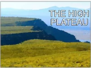
Welcome to the Western Snake Plain • Lake and stream sediments • Basalt appears as interbeds and cap rock • Subbasins • Boundary with ESRP is in the vicinity of King Hill
Regional Geology • Alluvium & terrace gravels • Snake River Group • Idaho Group – primary aquifer • Idavada Volcanics • Idaho Batholith
Aquifers • Perched Aquifer • Underlies approximately 38,000 acres around Mountain Home and Cinder Cone Butte area • Depth to water ranges from 10 feet to several hundred feet below land surface • Perched lenses of clay, silt, sand & gravel in the shallow alluvium • Recharged from creeks, canals and seepage from Mountain Home Reservoir • Perched water discharges to regional system • Supplies small domestic and irrigation uses
Aquifers (cont.) • Regional Aquifer • Depth to water generally greater than 250 feet • Well yields from 10 to 3500 gpm • Recharged from precipitation, streams, perched aquifer, infiltration from irrigation • Discharges through well pumpage, springs in Snake River canyon and underflow
WATER BALANCE • An accounting of water availability • How much water comes in to the basin • How much water is used or leaves the basin • Positive number –water available for current and/or future needs • Negative number – use exceeds recharge
WATER BALANCE(in acre-feet per year)Basin Inflow and Supply Supply/Use Canyon Creek yield 20,900 Little Camas Creek (imported) 9,500 Rattlesnake Creek yield 3,800 Ditto Creek and adjacent areas 4,100 Precipitation on rocky areas 4,400 Total 42,700Consumptive Use and Loss Loss to Snake River 1,500 Use by irrigated crops 69,600 Use by Municipal and Air Base 2,500 Total 73,600 Inflow Minus Use -30,900
Reasons for Designation • Rapid agricultural development • Declines in ground water levels • Further information showed declines over a larger area • Pending applications for additional development of ground water
Cinder Cone Butte CGWA No new appropriations Mountain Home GWMA New appropriations allowed if it is determined that sufficient supply is available and prior water rights will not be injured Administrative Restrictions Exception: Domestic uses and associated domestic irrigation
Management Strategies • Creation of advisory committee • Established by Director in 1996 • Local representation, 10 members • Objectives: • Develop recommendations for ground water management plan • Develop ground water recharge program • Act as forum for data collection, review and mediation • Act as forum for communication with community
Advisory Committee • In 1999, a recharge project was initiated. • Source: Canyon Creek • Method: Infiltration through existing gravel pits • Amount recharged: Approximately 1200-1500 acre feet • Impact: Undetectable change
Potential Sources for Managed Recharge • Canal lining from Little Camas Reservoir • Canyon Creek • Highly variable discharge • Primary source of water for Mountain Home Irrigation District • Snake River • Requires pumping and transport • Water availability • Other local basins
Information Needs • Subsurface structures controlling water movement • Ground water level information in specific locations