Download
1 / 22
220 likes | 332 Vues
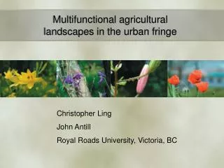
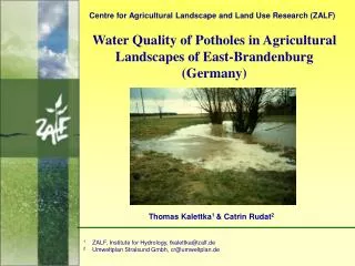
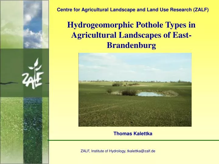
Centre for Agricultural Landscape and Land Use Research (ZALF). Hydrogeomorphic Pothole Types in Agricultural Landscapes of East-Brandenburg. Thomas Kalettka. ZALF, Institute of Hydrology, tkalettka@zalf.de. Agricultural landscape with potholes in spring.

E N D
Centre for Agricultural Landscape and Land Use Research (ZALF) Hydrogeomorphic Pothole Types in Agricultural Landscapes of East-Brandenburg Thomas Kalettka ZALF, Institute of Hydrology, tkalettka@zalf.de
Soll (German); pothole, kettle hole (English) = glacially shaped isolated depression within the sink of an internal catchment inthe young moraine landscape standing water or wetland respectively - water area </= 1 ha- - depression area </= 3 ha - hydrogeomorphic (HGM) type (Brinson 1993): isolated depression with vertical water fluctuation
Water regime of potholes in agricultural landscapes of East-Brandenburg Mapping of wetness 1993-2002
Cross section Morphological parameters of a pothole Top view EB = Edge border TSB = Top shore border BSB = Bottom shore border HwL = High water line MwL = Middel water line
Factor analysis of hydrogeomorphic variables of potholes (n=144) extraction: main components; factor rotation: varimax; results: factor loadings of variables, marked loadings 0,65
Cluster analysis for derivation of hydrogeomorphic pothole types Example: Cluster of shallow potholes (n=95, mean values, K-Means-Cluster analysis) WR = Water regime; SBT = Shore overflow tendency, CA = Catchment area; PA = Pothole area at top shore; SS = Shore slope
Hydrogeomorphic types of potholes in agricultural landscapes WR = Water Regime 1: never, 2: episodic (temporary, 3: periodic (seasonal), 4: semipermanent, 5: permanent
Short form of the determination key for water bearing hydrogeomorphic pothole types MD = max. depth; SS = Shore slope; OT = overflow tendency; PA = pothole area; CA = catchment area; WR = water regime; CR = catchment relief
HGM-type:Big deep storage type Dom. veg.:Edge type with shore woods (Sambucus nigra, Salix cinerea)
HGM-type: Small shallow shore overflow type Dom. vegetation: Edge type with Phalaris-reed (P. arundinacea)
HGM-type: Bigshallow shore overflow type Dom. veg.: Full reedtype with sedges(C. elata) and reed (P. australis)
HGM-type: Big shallow shore overflow type + peaty island Dominant vegetation: Wood type with Betula stand (B. pubescens)
HGM-type: Big shallow storage type Dominant vegetation: Full reed type (Phragmites australis)
HGM-type: Small wadeable overflow type Dominant vegetation: Full reed type (Phalaris arundinacea)
Example of a target image for a hydrogeomorphic pothole type
Potential abiotic functions for HGM pothole types in the agricultural landscape 0 – no x - low xx – moderate xxx - high other functions: source function (groundwater recharge, gas emission) microclimat. function (slowing down of wind, local humidity)
Potential habitat functions for vegetation of HGM pothole types in the agricultural landscape 0 – no x - low xx – moderate xxx - high Other functions: Hideaway for endangered species of open landscape Stepping stone in the biotope integrated system
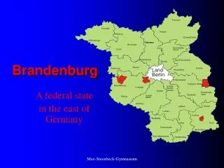
Distribution of hydrogeomorphic pothole types depending on landscape relief slightly to middle rolling ground moraine 78 % small, 36 % wadeable, 52 % shore overflow hilly rolling ground moraine 88 % big, 6 % wadeable, 38 % shore overflow