Download
1 / 16
160 likes | 161 Vues
Explore the use of radar (NEXRAD) in studying bird migration patterns and identifying migration corridors. Discover the potential of real-time analysis to minimize bird strikes and monitor avian influenza risk.

E N D
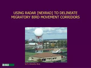
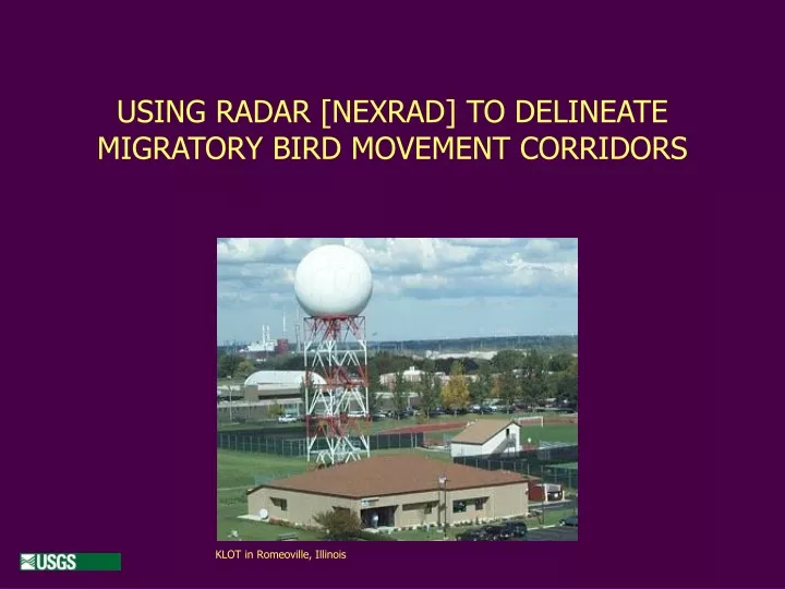
KLOT in Romeoville, Illinois USING RADAR [NEXRAD] TO DELINEATE MIGRATORY BIRD MOVEMENT CORRIDORS
Rick Sojda, Wildlife BiologistUSGS - Northern Rocky Mountain Science Center John Paxton, ProfessorComputer Science - Montana State University Robb Diehl, Postdoctoral Fellow Biological Sciences - University of Southern Mississippi Robert Klaver, Wildlife Biologist USGS - EROS Data Center
Erickson et al. (2001) reassessed U.S. turbine impact, based on more than 15,000 turbines (some 11,500 in California), and estimated mortality in the range of 10,000 to 40,000 (mean = 33,000), with an average of 2.19 avian fatalities/turbine/yr. and 0.033 raptor fatalities/turbine/yr. …while in Europe, Winkelman (1992) estimated mortality at 0.1 to 37 birds/turbine/yr.
Kinds of Radar Used • Doppler –high range / low resolution • – best for wide area studies • (habitat usage, regional studies) Detecting bird exodus
Information Obtained via Radar • Daily movements to and from a roost - Time of day, direction, distance, areas used • Seasonal migration patterns • - Time of year, stopover sites, corridors used
??? • Can birds be detected algorithmically in NEXRAD data? Some inherent challenges include: • birds per unit volume • delineating species; individuals • time series • obstructions • uncertainties • representing 3D airspace as a 2D map
NREL Photo …and the future • Can we build a decision support tool to help in evaluating wind power farm proposals? • NEXRAD data could be mined to identify migration corridors and patterns as they existed over the past 15 years. • Expert knowledge could be encoded to predict the effects of wind power projects. • Can real-time analysis of NEXRAD data be used by the industry in the operation of wind farms to minimize bird strikes in any fashion? • Is real-time monitoring of bird migration possible to help evaluate the evolving risk of avian influenza?