Download

1 / 32
330 likes | 475 Vues
Numerical Evaluation of Tsunami Wave Hazards in Harbors along the South China Sea. Huimin H. Jing 1 , Huai Zhang 1 , David A. Yuen 1, 2, 3 and Yaolin Shi 1 1 Laboratory of Computational Geodynamics, Graduate University of Chinese Academy of Sciences

E N D
Numerical Evaluation of Tsunami Wave Hazards in Harbors along the South China Sea Huimin H. Jing 1, Huai Zhang1, David A. Yuen1, 2, 3 and Yaolin Shi 1 1Laboratory of Computational Geodynamics, Graduate University of Chinese Academy of Sciences 2Department of Geology and Geophysics, University of Minnesota 3Minnesota Supercomputing Institute, University of Minnesota
Contents 1. Introduction 2. Numerical experiments 2.1 Governing equations 2.2 Finite difference scheme 2.3 Numerical Model 3. Results and conclusions
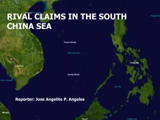
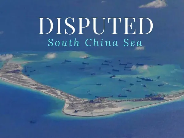
1. Introduction The probability of tsunami hazards in South China Sea. The Manila Trench bordered the South China Sea and the adjacent Philippine Sea palate is an excellent candidate for tsunami earthquakes to occur. The coastal height along the South China Sea is generally low making it extremely vulnerable to incoming waves with a height of only a couple meters.
Historical earthquakes in South China Sea and its adjacent regions
The results of the probabilistic forecast of tsunami hazard show the region where the wave height is higher than 2.0m and between 1.0-2.0m with a grid resolution of around 3.8km (Y. Liu et al. 2007). In order to investigate the wave hazard in the harbors, simulations in higher precise are needed……
2. Numerical experiments Shallow water equations Conventional Boussinesq equations Weakly Dispersive Non dispersive Dispersive Deep water wave Shallow water wave L < 2h L > 20h Extended Boussinesq equations
2.1 Governing equation z,w Ω L y,v h(x,y,t) D hB(x,y) x, u is the basic parameter in the theory of shallow water model:
Derivation of the Shallow Water Equation For mass conservation equation
Derivation of the Shallow Water Equation For mass conservation equation
Derivation of the Shallow Water Equation For momentum conservation equation
Derivation of the Shallow Water Equation For momentum conservation equation
2.2 Finite difference scheme • We simplify the equation into a linearized form • In our program, leap-frog scheme of finite difference method has been used to solve the SWE numerically and to simulate the propagation of waves. The leap-frog algorithm is often used for the propagation of waves, where a low numerical damping is required with a relatively high accuracy.
Simplify the equation into a linearized form • Let H(x,y) be the still water depth, and (x,y,t) be the vertical displacement of water surface above the still water surface. • Then we get • It follows from the definition where C is a constant.
Simplify the equation into a linearized form • Taking the partial derivatives of h(x,y,t) • We linearized the equation by neglecting the product terms of water level and horizontal velocities to obtain the following linearized form of the SWE.
Staggered Leap-frog Scheme • The leap-frog scheme is used to solve the SWE numerically and to simulate the propagation of waves. • Staggered grids (where the mesh points are shifted with respect to each other by half an interval) are used.
2.3 Numerical model • Model components • a. the actual topography bathymetry data • b. the wave propagation simulation packages • c. scenarios of the wave source • Considering that we haven’t the high precise actual bathymetry data of the harbors along South China Sea, we use the data of the Pohang New Harbor in the southeast part of South Korea instead.
Comprised topography data The data of the compute area is comprised by topography data on the land (SRTM3, with a grid resolution of around 90m ) and bathymetry data of the seabed (SRTM30, with a grid resolution of around 900m ) . In our numerical model, the grid size of the computational area is about 50m while the time step is 0.05s.
Scenario for plane wave source When the tsunami comes from far field, the incident waves near the harbor area can be approximately considered as plane waves. Plane wave function is as following: Supposed the wave height is about 1m in the far field ocean, and carried on our simulations on the actual bathymetry data with the wave propagation packages.
Animations of the different sources The reflection, diffraction and interference phenomenon of the waves are illustrated by the animations. Water surface elevation track recorder points The time series data of the water level vary with time have been recorded. 3.Results and conclusions
Maximal wave height at the track recorder points By doing comparisons in the cases with different incident waves at the same point we get the effects of wave direction. By doing comparisons in the same incident wave case at different recorder points we get the effects of water depth.
3. Conclusions The numerical simulations can be conducted to evaluate the reasons of harbor hazards and investigate the effects of different incident waves. The direction of incident waves affect the wave hazard in a harbor. The wave height in the coast area would be 7-8 times higher than it is in the ocean. Water depth is the significant factor which affects the wave height.
References: Fukao, Y., Tsunami earthquakes and subduction processes near deep-sea trenches, J. Geophys. Res., 1979, 84, 2303-2314. Liu, Y., Santos, A., Wang, S.M., Shi, Y., Liu, H. and D.A. Yuen, Tsunami hazards along the Chinese coast from potential earthquakes in South China Sea, Phys. Earth Planet. Inter., 2007, 163: 233-244. YEE, H.C., WARMING, R.F., and HARTEN, A.,Implicit total variation diminishing (TVD) schemes for steady-state calculations, Comp. Fluid Dyn. Conf. 1983, 6, 110–127. ADAMS, M.F. (2000), Algebraic multigrid methods for constrained linear systems with applications to contact problems in solid mechanics, Numerical Linear Algebra with Applications 11(2–3), 141–153. BREZINA, M., FALGOUT, R., MACLACHLAN, S., MANTEUFFEL, T., MCCORMICK, S., RUGE, J. (2004), Adaptive smoothed aggregation, SIAM J. Sci. Comp. 25, 1896–1920. WEI, Y., MAO, X.Z., and CHEUNG, K.F., Well-balanced finite-volume model for long-wave run-up, J. Waterway, Port, Coastal and Ocean Engin. 2006, 132(2), 114–124. P. Marchesiello, J.C. McWilliams and A. Shchepetkin, Open boundary conditions for long term integration of regional oceanic models, Ocean Modell. 2001, 3, pp. 1–20. E.D. Palma and R.P. Matano, On the implementation of passive open boundary conditions for a general circulation model: the barotropic mode, J. Geophys. Res 1998, 103, pp. 1319–1341. Huai Zhang, Yaolin Shi, David A. Yuen, Zhenzhen Yan, Xiaoru Yuan and Chaofan Zhang, Modeling and Visualization of Tsunamis, Pure and Applied Geophysics, 2008, 165, pp. 475-496.