Download
1 / 15
150 likes | 158 Vues
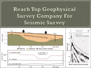
This study presents the results of a geophysical survey conducted in a rapidly urbanized area near Hosakerahalli, Bangalore to address the geo-environmental problems caused by unplanned urbanization. The study utilized ground-penetrating radar (GPR), seismic refraction survey (SRS), and electrical resistivity tomography (ERT) techniques to investigate the underlying geology and drainage system. The results revealed flow paths and blockages that could be responsible for slope failures, cracks, sinkholes, and bulging of gabion walls. The study suggests alternative drainage solutions to mitigate further damage.

E N D
Geophysical survey for addressing geo-environmental problem due to unplanned rapid urbanization • Dr. P. C. Jhaand Dr. H S Venkatesh Presenting by Dr. B. ButchiBabu Engineering Geophysics Department National Institute of Rock Mechanics Bangalore - 560070
Study Area Luxurious residential apartments near Hosakerahalli, Bangalore
Local Geologyof Site • Precambrian granite and gneiss of the Indian Precambrian Shield and which are part of the peninsular granitic complex. • Granitic rock is in massive form and fine grained • Presence of Lataritic soils along hill slopes • Approach roads was made by backfilling of locally available soils • Gabion walls was made to stabilize the pavements Drainage System • The direction of drainage channels orienting towards the Hosakerehalli Lake right below Hanumagirihill • Naturally formed surface runoff water flowing channels were filled with construction debris
Site conditions Undercutting of road Water seepage through soils Cracks along road and sinkholes Continuous seepage through concrete walls
Problem Statement • Repeated occurrence of slope failures • Formation of cracks, sinkholes and potholes • Breaking of underground drainage pipes • Bulging of gabion walls • Continuous seepage through concrete walls as well as through lataritic soils Assumption • If the problem is due to leakage around the subsurface drainage pipe, this should be reflect in surface GPR study • If the problem is due to wash-out by any hidden water flow channel, this should reflect in surface seismic and resistivity study
Layout of Geophysical Surveys Along approach road: Ground Penetrating Radar (GPR) Between gabion and pavement: Seismic Refraction Survey (SRS) : Electrical Resistivity Tomography (ERT)
Techniques used for Data Acquisition • SRT • Data acquisition system: ABEM Terraloc MK6 • No of channels: 24 • Source: 16lb sledge hammer • Receiver: 10Hz geophones • Geophone spacing:2.5m • Sampling Interval: 50µsec • Recording frequency : 10-250Hz • ERT • Data acquisition unit: SYSCAL Pro (10-channels) • No of channels: 48 • Electrode spacing: 2.5m • Array configuration: Dipole-dipole • GPR/SFR • Transmitter& Receiver: Network Analyzer (HP8714ET) • Antenna type: Dipole (2m) • Operating frequency range: 1-250MHz • Survey Mode: Reflection • Tx and Rx cable length: single-core50m pair • Antenna step movement: 0.5m
Refraction data Acquisition at Site 16lb sledgehammer for generation of seismic signal Acquiring data using ABEM seismograph
Conclusions • Integrated approach using SRT, ERT and GPR studies demarcated the possible flow path channels between approach road and gabion wall. • These flow paths might be the naturally exist before construction and are apparently blocked below the access road. • The probable reason for under cutting of roads, formation of cracks etc due to blockage of these flow paths and in the rainy season due to accumulation of excessive pore pressure may responsible for bulging of gabion wall etc. • Suggested for alternative drainage tubes along the flow path to reduce further damage and allowing of these flow channels in their natural paths eco-system was not disturbed.