Download
1 / 31

E N D
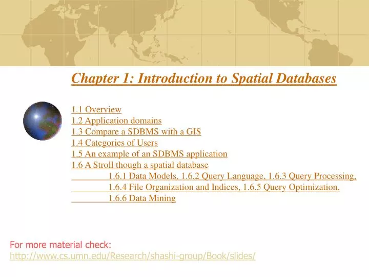
Chapter 1: Introduction to Spatial Databases1.1 Overview1.2 Application domains1.3 Compare a SDBMS with a GIS 1.4 Categories of Users1.5 An example of an SDBMS application1.6 A Stroll though a spatial database 1.6.1 Data Models, 1.6.2 Query Language, 1.6.3 Query Processing, 1.6.4 File Organization and Indices, 1.6.5 Query Optimization, 1.6.6 Data Mining For more material check: http://www.cs.umn.edu/Research/shashi-group/Book/slides/
Learning Objectives • Learning Objectives (LO) • LO1 : Understand the value of SDBMS • Application domains • users • How is different from a DBMS? • LO2: Understand the concept of spatial databases • LO3: Learn about the Components of SDBMS • Mapping Sections to learning objectives • LO1 - 1.1, 1.2, 1.4 • LO2 - 1.3, 1.5 • LO3 - 1.6
Value of SDBMS • Traditional (non-spatial) database management systems provide: • Persistence across failures • Allows concurrent access to data • Scalability to search queries on very large datasets which do not fit inside main memories of computers • Efficient for non-spatial queries, but not for spatial queries • Non-spatial queries: • List the names of all bookstore with more than ten thousand titles. • List the names of ten customers, in terms of sales, in the year 2001 • Spatial Queries: • List the names of all bookstores with ten miles of Minneapolis • List all customers who live in Tennessee and its adjoining states
Value of SDBMS – Spatial Data Examples • Examples of non-spatial data • Names, phone numbers, email addresses of people • Examples of Spatial data • Census Data • NASA satellites imagery - terabytes of data per day • Weather and Climate Data • Rivers, Farms, ecological impact • Medical Imaging • Exercise: Identify spatial and non-spatial data items in • A phone book • A cookbook with recipes
Value of SDBMS – Users, Application Domains • Many important application domains have spatial data and queries. Some Examples follow: • Army Field Commander: Has there been any significant enemy troop movement since last night? • Insurance Risk Manager: Which homes are most likely to be affected in the next great flood on the Mississippi? • Medical Doctor: Based on this patient's MRI, have we treated somebody with a similar condition ? • Molecular Biologist:Is the topology of the amino acid biosynthesis gene in the genome found in any other sequence feature map in the database ? • Astronomer:Find all blue galaxies within 2 arcmin of quasars. • Exercise: List two ways you have used spatial data. Which software did you use to manipulate spatial data?
Learning Objectives • Learning Objectives (LO) • LO1 : Understand the value of SDBMS • LO2: Understand the concept of spatial databases • What is a SDBMS? • How is it different from a GIS? • LO3: Learn about the Components of SDBMS • Sections for LO2 • Section 1.5 provides an example SDBMS • Section 1.1 and 1.3 compare SDBMS with DBMS and GIS
What is a SDBMS ? • A SDBMS is a software module that • can work with an underlying DBMS • supports spatial data models, spatial abstract data types (ADTs) and a query language from which these ADTs are callable • supports spatial indexing, efficient algorithms for processing spatial operations, and domain specific rules for query optimization • Example: Oracle Spatial data cartridge, ESRI SDE • can work with Oracle 8i DBMS • Has spatial data types (e.g. polygon), operations (e.g. overlap) callable from SQL3 query language • Has spatial indices, e.g. R-trees
SDBMS Example • Consider a spatial dataset with: • County boundary (dashed white line) • Census block - name, area, population, boundary (dark line) • Water bodies (dark polygons) • Satellite Imagery (gray scale pixels) • Storage in a SDBMS table: create table census_blocks ( name string, area float, population number, boundary polygon ); Fig 1.2
Modeling Spatial Data in Traditional DBMS • A row in the table census_blocks (Figure 1.3) • Question: Is Polyline datatype supported in DBMS? Figure 1.3
Spatial Data Types and Traditional Databases • Traditional relational DBMS • Support simple data types, e.g. number, strings, date • Modeling Spatial data types is tedious • Example: Figure 1.4 shows modeling of polygon using numbers • Three new tables: polygon, edge, points • Note: Polygon is a polyline where last point and first point are same • A simple unit sqaure represented as 16 rows across 3 tables • Simple spatial operators, e.g. area(), require joining tables • Tedious and computationally inefficient • Question. Name post-relational database management systems which facilitate modeling of spatial data types, e.g. polygon.
Evolution of DBMS technology Fig 1.5
Spatial Data Types and Post-relational Databases • Post-relational DBMS • Support user defined abstract data types • Spatial data types (e.g. polygon) can be added • Choice of post-relational DBMS • Object oriented (OO) DBMS • Object relational (OR) DBMS • A spatial database is a collection of spatial data types, operators, indices, processing strategies, etc. and can work with many post-relational DBMS as well as programming languages like Java, Visual Basic etc.
How is a SDBMS different from a GIS ? • GIS is a software to visualize and analyze spatial data using spatial analysis functions such as • Search Thematic search, search by region, (re-)classification • Location analysis Buffer, corridor, overlay • Terrain analysis Slope/aspect, catchment, drainage network • Flow analysis Connectivity, shortest path • Distribution Change detection, proximity, nearest neighbor • Spatial analysis/Statistics Pattern, centrality, autocorrelation, indices of similarity, topology: hole description • Measurements Distance, perimeter, shape, adjacency, direction • GIS uses SDBMS • to store, search, query, share large spatial data sets
How is a SDBMS different from a GIS ? • SDBMS focusses on • Efficient storage, querying, sharing of large spatial datasets • Provides simpler set based query operations • Example operations: search by region, overlay, nearest neighbor, distance, adjacency, perimeter etc. • Uses spatial indices and query optimization to speedup queries over large spatial datasets. • SDBMS may be used by applications other than GIS • Astronomy, Genomics, Multimedia information systems, ... • Will one use a GIS or a SDBM to answer the following: • How many neighboring countries does USA have? • Which country has highest number of neighbors?
Evolution of acronym “GIS” • Geographic Information Systems (1980s) • Geographic Information Science (1990s) • Geographic Information Services (2000s) Fig 1.1
Three meanings of the acronym GIS • Geographic Information Services • Web-sites and service centers for casual users, e.g. travelers • Example: Service (e.g. AAA, mapquest) for route planning • Geographic Information Systems • Software for professional users, e.g. cartographers • Example: ESRI Arc/View software • Geographic Information Science • Concepts, frameworks, theories to formalize use and development of geographic information systems and services • Example: design spatial data types and operations for querying • Exercise: Which meaning of the term GIS is closest to the focus of the book titled “Spatial Databases: A Tour”? Skip!!
Learning Objectives • Learning Objectives (LO) • LO1 : Understand the value of SDBMS • LO2: Understand the concept of spatial databases • LO3: Learn about the Components of SDBMS • Architecture choices • SDBMS components: • data model, query languages, • query processing and optimization • File organization and indices • Data Mining • Chapter Sections • 1.5 second half • 1.6 – entire section
Components of a SDBMS • Recall: a SDBMS is a software module that • can work with an underlying DBMS • supports spatial data models, spatial ADTs and a query language from which these ADTs are callable • supports spatial indexing, algorithms for processing spatial operations, and domain specific rules for query optimization • Components include • spatial data model, query language, query processing, file organization and indices, query optimization, etc. • Figure 1.6 shows these components • We discuss each component briefly in chapter 1.6 and in more detail in later chapters.
Three Layer Architecture Fig 1.6
1.6.1 Spatial Taxonomy, Data Models • Spatial Taxonomy: • multitude of descriptions available to organize space. • Topology models homeomorphic relationships, e.g. overlap • Euclidean space models distance and direction in a plane • Graphs models connectivity, Shortest-Path • Spatial data models • rules to identify identifiable objects and properties of space • Object model help manage identifiable things, e.g. mountains, cities, land-parcels etc. • Field model help manage continuous and amorphous phenomenon, e.g. wetlands, satellite imagery, snowfall etc. • More details in chapter 2.
1.6.2 Spatial Query Language • Spatial query language • Spatial data types, e.g. point, linestring, polygon, … • Spatial operations, e.g. overlap, distance, nearest neighbor, … • Callable from a query language (e.g. SQL3) of underlying DBMS • SELECT S.name • FROM Senator S • WHERE S.district.Area() > 300 • Standards • SQL3 (a.k.a. SQL 1999) is a standard for query languages • OGIS is a standard for spatial data types and operators • Both standards enjoy wide support in industry • More details in chapters 2 and 3
Multi-scan Query Example • Spatial join example • SELECT S.name FROM Senator S, Business B • WHERE S.district.Area() > 300 AND Within(B.location, S.district) • Non-Spatial Join example • SELECT S.name FROM Senator S, Business B • WHERE S.soc-sec = B.soc-sec AND S.gender = ‘Female’ Fig 1.7
1.6.3 Query Processing • Efficient algorithms to answer spatial queries • Common Strategy - filter and refine • Filter Step:Query Region overlaps with MBRs of B,C and D • Refine Step: Query Region overlaps with B and C Fig 1.8
Query Processing of Join Queries • Example - Determining pairs of intersecting rectangles • (a):Two sets R and S of rectangles, (b): A rectangle with 2 opposite corners marked, (c ): Rectangles sorted by smallest X coordinate value • Plane sweep filter identifies 5 pairs out of 12 for refinement step • Details of plane sweep algorithm on page 15 Fig 1.9 Skip!!
1.6.4 File Organization and Indices • A difference between GIS and SDBMS assumptions • GIS algorithms: dataset is loaded in main memory (Fig. 1.10(a)) • SDBMS: dataset is on secondary storage e.g disk (Fig. 1.10(b)) • SDBMS uses space filling curves and spatial indices • to efficiently search disk resident large spatial datasets Fig 1.10 Skip!!
Organizing spatial data with space filling curves • Issue: • Sorting is not naturally defined on spatial data • Many efficient search methods are based on sorting datasets • Space filling curves • Impose an ordering on the locations in a multi-dimensional space • Examples: row-order (Fig. 1.11(a), z-order (Fig 1.11(b)) • Allow use of traditional efficient search methods on spatial data Fig 1.11
Spatial Indexing: Search Data-Structures • Choice for spatial indexing: • B-tree is a hierarchical collection of ranges of linear keys, e.g. numbers • B-tree index is used for efficient search of traditional data • B-tree can be used with space filling curve on spatial data • R-tree provides better search performance yet! • R-tree is a hierarchical collection of rectangles • More details in chapter 4 Fig 1.12: B-tree Fig. 1.13: R- tree
1.6.5 Query Optimization • Query Optimization • A spatial operation can be processed using different strategies • Computation cost of each strategy depends on many parameters • Query optimization is the process of • ordering operations in a query and • selecting efficient strategy for each operation • based on the details of a given dataset • Example Query: • SELECT S.name FROM Senator S, Business B • WHERE S.soc-sec = B.soc-sec AND S.gender = ‘Female’ • Optimization decision examples • Process (S.gender = ‘Female’) before (S.soc-sec = B.soc-sec ) • Do not use index for processing (S.gender = ‘Female’) Skip!!
1.6.6 Data Mining • Analysis of spatial data is of many types • Deductive Querying, e.g. searching, sorting, overlays • Inductive Mining, e.g. statistics, correlation, clustering,classification, … • Data mining is a systematic and semi-automated search for interesting non-trivial patterns in large spatial databases • Example applications include • Infer land-use classification from satellite imagery • Identify cancer clusters and geographic factors with high correlation • Identify crime hotspots to assign police patrols and social workers
1.7 Summary • SDBMS is valuable to many important applications • SDBMS is a software module • works with an underlying DBMS • provides spatial ADTs callable from a query language • provides methods for efficient processing of spatial queries • Components of SDBMS include • spatial data model, spatial data types and operators, • spatial query language, processing and optimization • spatial data mining • SDBMS is used to store, query and share spatial data for GIS as well as other applications