Download
1 / 27
270 likes | 373 Vues
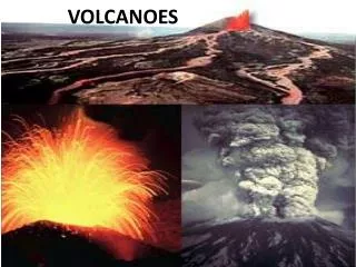
Studying Volcanoes With InSAR : Where Have We Been and Where Are We Going? . Howard Zebker , Cody Wortham Stanford University. 10 Years Ago: Where Were We?. Anticipated several new space radar systems for monitoring and forecasting of volcanic events

E N D
Studying Volcanoes With InSAR: Where Have We Been and Where Are We Going? Howard Zebker, Cody Wortham Stanford University
10 Years Ago: Where Were We? • Anticipated several new space radar systems for monitoring and forecasting of volcanic events • Developing inverse methods to reveal the details of faulting or pressure changes at depth, and better describe precise magma chamber geometries • Beginning reliable interferometric imaging,m-scale resolution of mm-scale deformation over wide areas • Proposed high-res stereo radar for 3-D topographic maps fast events, e.g. rapid dome growth • Foresaw data collection over all of Earth’s 600 potentially active volcanoes weekly or even daily • Designing satellite constellations in along-track interferometric formation to map flow velocities
Reality: What actually happened • Anticipated several new space radar systems for monitoring and forecasting of volcanic events • Developing inverse methods to reveal the details of faulting or pressure changes at depth, and better describe precise magma chamber geometries • Beginning reliable interferometric imaging,m-scale resolution of mm-scale deformation over wide areas • Proposed high-res stereo radar for 3-D topographic maps fast events, e.g. rapid dome growth • Foresaw data collection over all of Earth’s 600 potentially active volcanoes weekly or even daily • Designing satellite constellations in along-track interferometric formation to map flow velocities
Reliable imaging • Technology has advanced to where we know how to do this • Want long wavelength, high resolution, rapid repeat times • Systems beginning to reflect community knowledge • Still waiting for the “perfect” system
Longer wavelengths yield higher correlation Wortham et al., 2010 ALOS Kilauea interferogram: 460 day separation, 1490 m baseline
Time series volcano observationsEyjafjallajokull PS deformation Time series 1993-2000 SBAS deformation From Hooper, 2008
PS image of San Andreas Fault - ERS satellite Precision of PS method PS performance RMS error ~1 mm/yr PS spacing is ~1km
Higher resolution promotes time series analyses Brightest scatterer Brightest scatterer A fine resolution cell A coarse resolution cell • Bright scatterer perhaps less than rest of background • Pixel scintillates over time from background signal • Same brightest scatterer, much less background • Pixel does not scintillate, is “persistent”
New spaceborne systems • Radar systems launched this decade have expanded the data modalities for InSAR • New frequency bands and orbit repeat geometries • ALOS PALSAR (Japan) launched 2006 • TerraSAR-X (Germany) launched 2007, Tandem-X satellite launched 2010 • Some commercial systems as well
ALOS/PALSAR • ALOS satellite, PALSAR radar instrument • L-band, wavelength 24 cm • Repeat period 46 days • Multipolarization • 10-20 m resolution • Very high correlation • Just ended successful mission
TerraSAR-X • X-band, wavelength 3 cm • Repeat period 11 days • Multipolarization • 1-20 m resolution • Ideal for time- • series observations
Current research … • Most exciting area is time series analysis • Modeling continues to advance • Tandem satellites supersede previous desire for radar stereo • New measurements and methods will yield new descriptors
Time series mimics GPS imaging From Lundgren et al.
Modeling of Yellowstone caldera Interpretation: Inflating sill Interferograms: C-band From Wicks et al., 2006
Modeling Uzon caldera, Kamchatka (a) Distributed opening model, (b) distributed crack model, (c) depth slice of model b Radarsat measurements 2000-2005 Lundgren and Lu, 2006
Probabilistic modeling of Etna activity • Predict eruptive activity from observed deformation and thermal flux • Highest activity from coincident increases • PDF derived from spaceborne data only From Patrick et al., 2006
Tandem observations for DEMs Mt. Merapi Digital Elevation Model from Tandem TerraSAR-X observations From DLR • Higher resolution and accuracy than traditional stereo • Could produce radar stereo, but this method is superior
New local measurements From C. Werner, Gamma Res.
… but some things still lacking • Enabling technology is coverage, temporal and geographic • Optimizing designs for InSAR • Orbits: poor north retrieval • System parameters • High resolution, long wavelength helps • Future mission prospect good/bad/?
Vector deformation SBAS vector solution for average deformation rate at Kilauea, HI Wortham et al., 2010 • ALOS yields fairly high correlation over 2 year time span • Near polar orbit results in poor northing component retrieval
Poor retrieval – northing componentKilauea: GPS – black line, InSAR – Red symbols Up North East Wortham et al., 2010
Multiple Aperture InSAR (MAI) Method • SLCs formed from forward and • backward squinted beams • Beam filtered in Doppler • Interferograms formed from each beam • MAI phase gives along-track displacement from differencing forward/backward interferograms N. Bechor, PhD Thesis (2006)
Average north displacement using MAI North component of displacement averaged over all InSAR acquisitions
Coverage • ALOS L-band yields high correlation over challenging volcanoes • South America data show comprehensive coverage possible • 46 day repeat is too long- misses many signals • PALSAR data rate/volume too low to monitor 600 volcanoes From: Fournier et al., 2010
NASA DESDynI-R Mission • Launch in 20XX • L-band, potential 2 m resolution • Free and open data policy • Specifically designed for InSAR • Volcano hazards one of the major science objectives Artist’s concept from JPL
Additional exciting missions • ALOS-2 (Japan): L-band follow-on to ALOS, launch 2013?, 1-10 m resolution, 14 day repeat • But likely will be commercially oriented with data hard to get • Tandem-L (Germany): Similar in philosophy to Tandem-X, but companion to DESDynI, no money yet • Sentinel-1 (ESA): C-band heir to Envisat, 12 day repeat, 5 m resolution, 201w? Launch • There are others…
Summary and looking ahead • InSAR continues to evolve better accuracy and temporal/spatial coverage • Volcano hazard applications benefit • Future satellites converging on ~12 day repeats and m-scale resolution • Limiting factor is probably data policy- agencies still don’t get the science message and pursue commercialization • If data are acquired, volcanologists will come