Download
1 / 10
100 likes | 235 Vues
Dawn Coordinate System. PDS Management Council 28 March 2012 Mike A’Hearn. PDS Standards. PDS Standards Reference (Feb 2009), Chapter 2: Cartographic Standards

E N D
Dawn Coordinate System PDS Management Council 28 March 2012 Mike A’Hearn SBN report for PDS Management Council
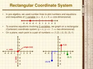
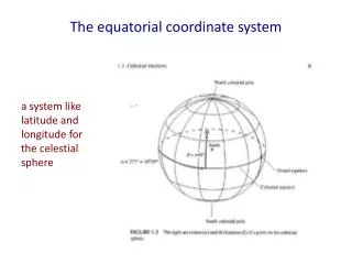
PDS Standards • PDS Standards Reference (Feb 2009), Chapter 2: Cartographic Standards • "All data providers for PDS products should follow accepted standards and be aware of current NASA and international recommendations on cartographic coordinate systems and conventions relevant to their bodies of interest.” • "The primary international body for coordinate systems in the Solar System is the International Astronomical Union (IAU)... [discussion of celestial coordinates follows]” • "For cartographic coordinates and conventions for planets and satellites, the IAU and the International Association of Geodesy (IAG) have established jointly the Working Group on Cartographic Coordinates and Rotational Elements (WGCCRE), which publishes triennial reports, currently in the journal Celestial Mechanics and Dynamical Astronomy (Davies, et al., 1980, 1983, 1986, 1989, 1992, 1996; Seidelmann, et al., 2002, 2005, 2007). This working group includes PDS-affiliated scientists, thus assuring full interaction in defining the standards. Publications and reports issued by the WGCCRE can be found at http://astrogeology.usgs.gov/Projects/WGCCRE/. PDS data providers should refer to these reports for current information and recommendations on rotational elements for Solar System bodies and how these are related to their cartographic coordinates.” SBN report for PDS Management Council
IAU WG Standards • Archinal et al., 2011, Cel. Mech. Dyn. Astr., 109, page 106) • “The Working Group would like to emphasize - as it did in the introduction to its first report (Davies et al., 1980, page 73) - that once an observable feature at a defined longitude is chosen, the longitude definition origin should not change except under unusual circumstances (such as perhaps a change in or loss of the feature). This implies that once such a feature has been adopted, a return to a value of W0 defined by some other method (e.g. the principal axes of inertia for resonantly or synchronously rotating bodies such as Mercury (Margot, 2009), or Jovian or Saturnian satellites) should be avoided. Note, however, that this does not preclude the use of smaller or more precisely determined features, multiple features, or even human artifacts to define longitude - as long as the original definition is maintained to within the accuracy of previous determinations.” SBN report for PDS Management Council
Previous Publications • Thomas et al. 1997 Icarus128, 88 • Defines Olbers Regio as 0° • Li et al. 2010 Icarus 211, 528 • HST observations • Maps showing Olbers Regio at 0° longitude SBN report for PDS Management Council
Dawn Maps SBN report for PDS Management Council
History 1 • Summer 2011 – informal discussions between PI and Chairman of IAU WGCCRE about changing coordinates on Vesta • Referred to WG publications with recommendations • Change polar orientation and rotation rate but keep zero-point of longitude • 7 Sep 2011 – Official request to WG to change longitude • 13 Sep: Call for vote; 10.5:2:1:1 against. First time in memory that WG carried out official vote other than at IAU GA • 14 Sep: PI responds – too late to change • 3 Oct 2011 – DPS talk by PI cites non-IAU coordinates • 4 Oct 2011 – SBN Advisory Council (@ DPS) • No waiver, insist on IAU guidelines • 5 Oct 2011 – Suggest PI meet with SBN • Not necessary, IAU will change its mind SBN report for PDS Management Council
History 2 • ?day? Oct 2011: Informed Dawn DAWG at weekly telecon that SBN would not review data in current coordinate system • 10 Nov 2011 – DAWG telecon states project will proceed with Claudia system • SBN will not send data to peer review • 1 Dec 2011 – A’Hearn & Joy agree on compromise thought to have been approved by PI • 12 Dec – PI says no compromise agreed to – see next slide • ~18 Dec 2011 – Dawn proposal to HQ on why Dawn is right • Nobody is convinced at HQ or several external reviewers • 6 Jan 2012: 1 hr telecon – A’Hearn, Russell, Raymond, Sykes • No progress SBN report for PDS Management Council
What Was the Compromise • All Vesta-centric coordinate keywords are in Olbers-based system • Local Data Dictionary contains Dawn-Specific coordinate keywords in Claudia-based system • Net difference between systems: • Claudia longitudes = Olbers longitudes – 220° SBN report for PDS Management Council
History 3 • 12 Jan 2012: HQ Directive to Dawn to archive in Olbers-based system • 23 Feb 2012: Telecon HQ & Dawn • HQ directed Dawn project to not bother IAU WG any more • Per email from HQ to A’Hearn & Archinal • 25 Feb 2012: New request from Dawn PI to WG CCRE • Under discussion by WG – sentiment running negative as of today • Feb-Mar 2012: Data being delivered to SBN with compromise from 1 Dec 2011 • No public SPICE kernels in Olbers system • SBN will not make data public until public SPICE kernels are Olbers-based • 23 Mar 2012: Long mtg @ LPSC - Archinal, Russell, Raymond • No progress • 25 March 2012: New request from Dawn PI to WG SBN report for PDS Management Council
Possible Future Path • Date TBD – NAIF posts correct PCK • 1st Week May – SBN Peer Review Completed for Approach through HAMO RAW data from FC & VIR & GRAND • May – Dawn SDC reruns data for VIR & FC, submits to SBN for archiving, makes data public • June – August – Data deliveries continue with configuration controlled pipeline, i.e. accumulating datasets • August – IAU WG, having decided to NOT address the issue until then, meets at IAU GA and decides not to change policy • Early 2013 – SDC delivers calibrated data and derived products • Does the argument start over? I.e. will we allow both longitudes to be on archived maps? SBN report for PDS Management Council