Download
1 / 26
260 likes | 370 Vues
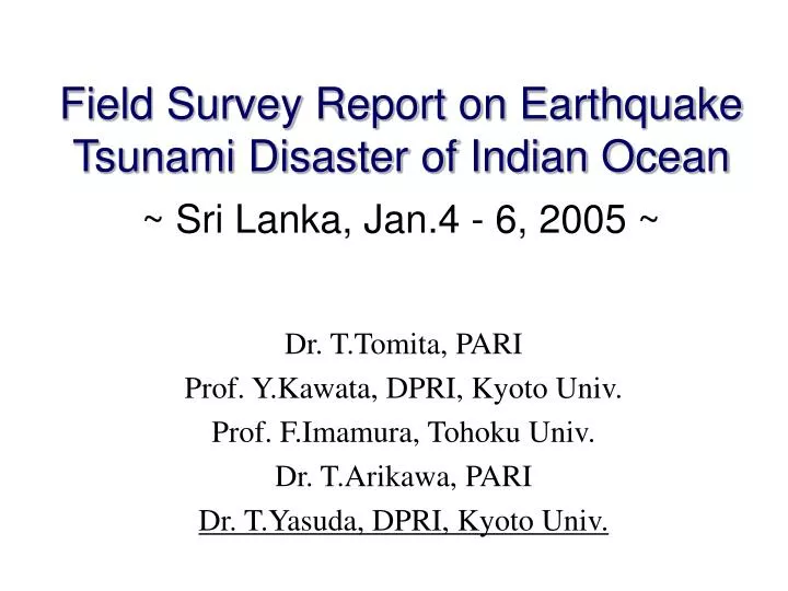
Field Survey Report on Earthquake Tsunami Disaster of Indian Ocean ~ Sri Lanka, Jan.4 - 6, 2005 ~. Dr. T.Tomita, PARI Prof. Y.Kawata, DPRI, Kyoto Univ. Prof. F.Imamura, Tohoku Univ. Dr. T.Arikawa, PARI Dr. T.Yasuda, DPRI, Kyoto Univ. Locatgion of Epicenter and Bathymetry data.

E N D
Field Survey Report on Earthquake Tsunami Disaster of Indian Ocean~ Sri Lanka, Jan.4 - 6, 2005 ~ Dr. T.Tomita, PARI Prof. Y.Kawata, DPRI, Kyoto Univ. Prof. F.Imamura, Tohoku Univ. Dr. T.Arikawa, PARI Dr. T.Yasuda, DPRI, Kyoto Univ.
Locatgion of Epicenter and Bathymetry data USGS: U.S. Geological Survey Hav: Harvard Univ.
Historical tsunami occurred in the Indian Ocean (Solov'iev and Go, 1975)
South-West of Sri Lanka Island Survey Locations (2) Colombo Jan. 4 3.8-4.4 Moratuwa 5.6 Pana dula 6.0 Paiyagala 2.4-4.8 Beruwala Jan. 6 4.7 Ambalangoda Hikkaduwa 4.1-10.0 Dodanduwa 4.0 Galle Jan. 5 3.9-6.0 Koggala Weligama 3.7-9.3 4.9
Galle Bay Galle Port Buoy Cottage owner testified: At first, the tide ebbed until buoy where the water depth is around 10-12m. Then, tsunami which height was 7m came into the bay.
Galle Port The ship was launched on the quay. 6.03m 5.28m 2.70 3.04 3.33 2.24 1.70 190.0m
Eastern coast from GallePort (1) View 1 4.79m Sand on Roof is left Completely damaged Road 2.18 2.61 2.53 68.0m Sand on the roof wasn’t flushed by tsunami view 1
Eastern coast from GallePort (2) View 2 3.24m Few damage Road 0.63 2.61 View 2
Galle Fort Most area was survived.
Galle Central 3.93m River 2.30 1.63 32.0m
Dodanduwa (1) Road 3.90m Bridge 3.88m 3.80m View 1 0.9 2.36 2.26 3.00 1.44 1.62 24.0m View 1 420 fishing boats damaged in this residential area.
Dodanduwa (2) previous slide Guide rail was broken View 2 View 2 sea Two persons who rode on the motorcycle were washed away on the bridge by the tsunami.
Akurala (1) Splashed dead leaf The train floated and was washed away. Washed train 10.04m Road Railway 9.15m Beach 1.97m 1.69m 64m 0.89m 188m 228m
Akurala (2) view 1 view 1 4.38m Road Beach 1.4m 0.08m 142m
Ambalangoda (1) 4.72m Beach 3.22m 50m
Ambalangoda (2) Road sea Estuary View 1 View 1 Houses View 3 Railway View 2 View 2 View 3
Hikkaduwa Fishery Harbour View 1 65 fishery boats were damaged in the port. View 1 4.73m 7m Tsunami trace on the 2nd floor Wharf No damage for the buildings
Beruwala Fishery Harbour Harbour entrance is narrow. 2.35m 1.58m 1.0m 6m Wharf No damaged facilities
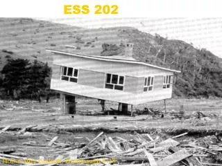
Broken roof Pana dura 5.59m Seawall was damaged. 86m Shed 24m Rubble mound breakwaters 3.34m Floor of shed is broken by the tsunami lift force.
Houses made by brick or block were collapsed. Houses made by concrete were less damaged.
GOSL planning of restoration I II III Sea 0m 100m 300m 1000m I. No constructions II. Only permit constructions (e.g. hotels) III. Construction allowed with the permission of UDA GOSL also considers 3m elevation contourline.
Tsunami simulation by DRS, DPRI Governing Equation Linear Shallow Water Theory in Spherical Coordinate System Spatial Grid Size 30 arc second Temporal Grid Size 1.8 s Bathymetry Data ETOPO2 Computational Domain SE(77°52'E, 10°24'S)- NW(111°12'E, 22°56'N) Seismic Deformation Yamanaka(2004) Computed Time 6 hrs Fault Parameter (Yamanaka, 2004)
Calculated Tsunami waveform 1.0m 1.5m Output points
Thank you for your attention! I'd like to send my deepest condolences to all victims.