Download
1 / 25
250 likes | 364 Vues
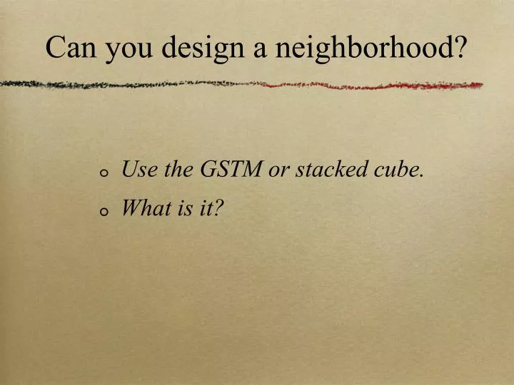
Can you design a neighborhood?. Use the GSTM or stacked cube. What is it?. above geocoded zero: allopatric 10km3 neighborhood sets. geocoded zero: sea level. below geocoded zero: sympatric 10km3 neighborhood sets.

E N D
Can you design a neighborhood? • Use the GSTM or stacked cube. • What is it?
above geocoded zero: allopatric10km3 neighborhood sets geocoded zero: sea level below geocoded zero: sympatric 10km3 neighborhood sets
Geocoded Spatial Transparent Metric neighbor effects exist between GSTM scale volumes: can seeing patterns between GSTM units allow perception of risk? • share information 24/7 for timely anomaly detection and local action e.g. earthquake indicators e.g. NOAA buoys, GHG (greenhouse gases and ODS (ozone depleting substances e..g. CFCs) • capturing synergies in local land management e.g. tracking pollination systems in local agricultural production at one meter cubed within GSTM • allowing health infrastructure to access deficits and assets for timely interventions e.g. monitoring UN Treaties, SALW, mapping trafficking, NPT
Challenge: • Create a 3-D model: learning to think spatially using the stacked ten kilometer cube GSTM at all scales of organization e.g. mm3, cc to 10m3 to 100m3 , adding an extra ten kilometers cubed etc. • Target curriculum cohorts: K12+4+4 creating opportunities for team teaching and data sharing in curriculum pedagogy between grades and ages. • Job creation: data collections, data entry protocol oversight are just a few kinds of jobs for K12+4+4 students involved in GSTM spatial learning curriculum. • GSTM spatial think pedagogy offers life long learning opportunities.
Predictable Proximity • I can count on you to watch me. We are visual social, small group size (cohorts) primates. • You will not leave too soon. • Words are magic. • You will give language signals to indicate your unique personal spatial-temporal needs. • There will appear to be a choreography to your unique, recognizable complex, predictable pattern (ing) = ‘ecoplay’. • “I am because we are.” Hippocampus mapping and replaying of ‘happy’ events. Linking back (as in religio) to ‘dream’ peace, smoothing chaos.... ‘catching the wave’, ‘take a sit’ by me. Patting. Touching.*
GSTM Transparency Framework Mapping the local using indicators published in the Millennium Ecological Assessment---MEA Mapping the local using Food and Agriculture early warning indicators ---FAO Mapping the local using Center for Disease Control indicators---CDC, WHO
LTM=Long Term Monitoring • Watching as you ‘take a sit’. • Engaging by gift giving*. • Using language to describe caring. • Sitting close enough to see eye to eye comfortably as in the meaning of relax. • Welcoming embarrassment. • Awareness of alert behavior. • Opening up to owning your own chauvanism. • Seeing the beauty in the other and the moment.
Goals of creating a GSTM spatial think pedagogy K12+4+4 • create model of your local area and use water data e.g. rainfall patterns, storage, demand • incorporate your local interest e.g. study Monarch butterflies or frogs etc. • pick a piece of data and run with, plot it out in the ten kilometer stacked cube format or GSTM • use a 3D modeling program to create a visual display of the GSTM and at one meter cubed within GSTM
.....ecoplays Ecoplays provide for cooperative and creative and timely n=10 small group size... K12+4+4... activities in enhancing local predictable proximity in vegetation connectivity and soil cover, data entry protocols, and new moves in seasonal and diurnal K12+4+4 activities of K12+4+4 n=10.....ecoplays in emergent ecological restoration... Buffering climate change is only local ecological, it is endemic vegetation connectivity enhancement and the present efforts towards UNFCC/Kyoto? Bali et al ...climate restoration. Vegetation and the water cycle. Salt water freshening. Global Circulation Model. Each 1m3:10km3x2 volume in the local is unique, and as n=10 students examine, study, record etc. varied biogeochemical markers or MEA indicators ....each recognizable, complex, predictable pattern is brought in to focus, frame or context” = urcpp****= mapping graticule @1m3 or less volume within 10km3x2 allows seeing anomaly. Risk assessment relies on GSTM. Sets, frames and context...games in ecological restoration and the beauty of nature...seeing cohorts. Enhancing beauty, fostering hope, planning on clean water and food. **** “If this, then that.” Tamra Engelhorn Raven January 2009
Is out of sight, out of mind, the the last word as we struggle to manage global ecosystem services? • Geocoded Spatial Transparent Metric GSTM offers a new way to see our neighborhood. • It can facilitate spatial thinking which forces the issue that each of us impact one another and are neighbors.
Does biodiversity extinction challenge local actions to buffer climate change? • Local photosynthetic overyielding and increasing local plant species diversity may increase carbon sequestration and increase biodiversity resilience locally. • The GSTM or Geocoded Spatial Transparent Metric scale of ten kilometers cubed above and ten kilometers cubed below geocoded zero may offer a model for local institutional and individual participation in acting locally to buffer global climate change.
Witness • “Look at me , look at me, look at me.” This is the sound of our first call. • Our hippocampus maps it all. But why can we not over come our resistance to changing behavior? We will not move off base. It seems safe. • Ways of learning* in a world of near seven billion humans will be different. Human gestation within more than half of our human population, it is a female thing.... • Resources of all kinds are patchy and unpredictable. • Patterns of human behavior anomaly are increasingly unpredictable. • Patterns of biochemical pollution and biodiversity disturbance are increasingly unpredictable. • * “Spatial Thinking” is one kind of thinking we are good at.
Does biodiversity extinction challenge local actions to buffer climate change? • Local photosynthetic overyielding and increasing local plant species diversity may increase carbon sequestration and increase biodiversity resilience locally. • The GSTM or Geocoded Spatial Transparent Metric scale of ten kilometers cubed above and ten kilometers cubed below geocoded zero may offer a model for local institutional and individual participation in acting locally to buffer global climate change.
How can we organize information? • Being hopeful is critical to local action and quality of life • action is critical to human perception of well being, that feeling of being in control
Plenty of data in the global institutional infrastructure e.g. WHO, NOAA, CDC, EPA, NIEHS etc. But does human denial keep us from seeing pattern in data and reacting appropriately to local risk? Can K12 spatial thinking pedagogy enhance risk response? • responding to National Academy of Sciences USA 2006 call for spatial thinking in the GIS-GPS era see thought explanation of GSTM at http:web.me.com/tamraraven/ • using local ten kilometer stacked cubed data for K12+4+4 education: begin with Kindergarten and choose at least one other grade to team teach 1-9 as team leaders, teachers aids or teachers (stipend $?) • design 3D GSTM to for K12+4+4 using college student participation in all disciplines and manage university credit for participation in GSTM pedagogy • create jobs for timely local access to ten kilometer stacked cube data and scholarships or stipends for students K12+4+4 and local municipality GIS tech support
How can local denial of risk be overcome by education of local human resources? • Ten kilometers stacked cubes begins by measuring soil, air, water and albedo indicators at one meter cubed within the GSTM e.g. manage local mangroves and coral reefs measured at one meter cubed within GSTM • GSTM facilitates 3D grid for cross sectional information to be observed for analysis
Can mapping local vegetation at the GSTM scale spotlight local biodiversity patterns, local water shortfalls, or disease health clusters each of which may have a psychological impact on sustainable environments? • help to manage local biodiversity resources e.g. endemic vegetation monitoring by GPS ground truthing • increase local carbon sequestration by managing for increased ‘vegetation cover’ on soil at one meter cubed within GSTM • increase predictability of the watershed and associated local weather patterns by monitoring land use -albedo change at one meter cubed within GSTM • increase ecological resilience and local food and water security by monitoring agricultural-soil indicators
Could mapping vegetation at the GSTM scale enhance community coherence and involvement such that early detection of biodiversity extinction risk would facilitate action to engage in Long Term Monitoring (LTM) of Does extinction drive climate change? • allowing policy makers and educational institutions to access local ten kilometer cubed data sets to enable action to buffer global change (adaptations to climate, agricultural, ecological, economic change) • distribution and choreographed data entry protocol by university and governmental research facilities provide platform for awareness of local priorities e.g. salt water intrusion measured at one meter cubed within GSTM
Local health issues might drive local policy if GSTM provided better local transparency by allowing visual perception of spatial data sets: does this become a metric for a global early warning system? • Medical infrastructure such as hospital and neighborhood clinics using GSTM could facilitate WHO monitoring and early warning, mapping urban pollution and disproportionate effects on women and girls. • Sharing news on EID = Emerging Infectious Diseases e.g. H1N1, West Nile Fever, TB, HIV-AIDS, to WHO at one meter cubed within GSTM
Clean Development Mechanisms (CDM) of UNFCCC (1992) could share technology and training education best practices in sustainable development using GSTM scale neighborhoods: could this kind of transparency allow for better and more timely globally data sharing? • Building local human capacity e.g. to monitor sea level rise in SIDS at one meter cubed within GSTM • Information and technology transfer on monitoring trafficking in body parts, women, children, drugs, and Small Arms and Light Weapons at one meter cubed within GSTM • Teachers and students, policy makers and local governments receive funding for job creation and local human capacity building including LTM or long term monitoring of MDG Millennium Development Goals
Guidelines for modeling a GSTM neighborhood. • keep it simple, choose what interests you e.g. map roadside plants and their pollinators, specific bird species and seasonal migrations • quality control of information: use EPA or WHO data sets or comparable public access data bases as well as universities to establish and monitor data entry protocol for accuracy and real time management • create university level presentation about your GSTM visualization 3D model highlighting transparency, quality control, and information trading attributes in the spirit ‘freeware’. Begin with Kindergarten and include any other grade in team teaching and at least two university level entry points to K12.
Spatial thinking beginning in Kindergarten and the gift of the stacked cube neighborhood 10km3x2 can facilitate structuring problems, finding solutions, and expressing solutions about local air, water, soil and biodiversity as well as actions beyond reduce, reuse, recycle:3Rs. • GSTM or Geocoded Spatial Transparent Metric allows real time monitoring of 3R’s effectiveness in an information-based economy which is high tech intensive • spatial thinking can enhance visual management of biodiversity, soil,, air, and water quality using a 3D grid, ten kilometer cubed over another cube underground • a ten kilometer cube above geocoded zero and below it, the air and soil stacked cube represents the 3D GSTM which may allow our species to see their neighborhood
Can GSTM facilitate timely local action to enhance buffering climate change locally?? • Allow GSTM pedagogy to inform students beginning in Kindergarten: each student receives ‘ten kilometer stacked cube’ folder or home neighborhood 3D data base • Build curriculum based on relational spatial thinking building on our human capacities e.g. hippocampus, visual, layered complexity • Adapt GSTM to “visualizing relationships within spatial structures, we can perceive, remember, and analyze the static and dynamic properties of objects and the relationship between objects”...presented as “a constructive combination of concepts of space, tools of representation, and processes of reasoning---uses space to structure problems, find answers, and express solutions.”
Resources for mapping. • http://web.mac.com/tamraraven/ • FAO food security • WHO HIV AIDS resistant TB • NOAA tsunami earthquakes • CDC H1N1 • NIEHS pediatric epidemiology • N
* • Chilton Pearce ...The Magical Child • Ashley Montague ...Touching • Frans de Waal ...Gift Giving in the Primates • National Academy of Sciences Spatial Thinking 2006