Download
1 / 26
260 likes | 391 Vues
Virtual Reality Techniques for Sharing Data and Models. Bianca Falcidieno Flavio Rossi Michela Spagnuolo . Istituto per la Matematica Applicata Consiglio Nazionale delle Ricerche Via De Marini ,6 Genova Italy. CONSIGLIO NAZIONALE DELLE RICERCHE (CNR).

E N D
Virtual Reality Techniques for Sharing Data and Models Bianca Falcidieno Flavio Rossi Michela Spagnuolo Istituto per la Matematica Applicata Consiglio Nazionale delle Ricerche Via De Marini ,6 Genova Italy
CONSIGLIO NAZIONALE DELLE RICERCHE (CNR) The Italian National Research Council is a government body responsible for the promotion and regulation of research to further scientific and technological progress in Italy 334 Operative Units located throughout Italy (191 Institutes) Research Areas 15 National Advisory Committees
IMA Istituto per la Matematica Applicata CONSIGLIO NAZIONALE DELLE RICERCHE Via De Marini 6 Genova Italy
Computer Graphics Group • Silvia Ansaldi • Marco Attene • Silvia Biasotti • Chiara Catalano • Andrea Clematis • Monica De Martino • Bianca Falcidieno • Marzia Fontana • Giovanni Gallo • Franca Giannini • Maria Meirana • Marina Monti • Michela Mortara • Massimiliano Moscati • Laura Papaleo • Corrado Pizzi • Caterina Pienovi • Alessandro Raviola • Flavio Rossi • Michela Spagnuolo • Salvatore Spinello • Franco Tallero
Computer Graphics Group • Projects • Industrial Design • Aesthetic Design • Fast Prototyping • Antarctica • Digital Terrain Modeling • Sea Floor Modeling • Coastal Area Management • Pollutant Diffusion • Ergonomy International Cooperations France, Germany, Greece, Japan, Spain • Research Fields • Geometric Modelling • Shape Modelling • Main Applications • Product Modelling for Industrial Design • Spatial Data Modelling in Geographic Information Systems
International Projects related to Spatial Data Handling • PLAINS: Prototype Landscape Assessment Information System • Starting date: Nov 1999 • Contact Person: Andrea Clematis • EC TELEMATICS FOR ENVIRONMENT • WATERMAN: System for Water Monitoring and Sustainable Management Based on Ground Stations and Satellite Images • Starting date: Oct 98 • Contact Person: Giuliana Dettori • EC INCO-COPERNICUS • ACT: Autonomous Container Tracking • Starting date: 1 Dec 1998 • Contact Person: Andrea Clematis, Monica De Martino • EC BRITE EURAM III CRAFT
International Projects related to Spatial Data Handling • High-quality surface modelling Consultancy Research Contract between IMA-CNR and Monolith co Ltd, Tokyo, Japan (1998-2001) • surface modelling • model compression • uncertainty coding • shape analysis
International Projects related to Spatial Data Handling • THETIS: a Data Management and Data Visualisation System for Supporting Coastal Zone Management of the Mediterranean Sea TELEMATICS, Project F0069, Starting: 1st July 1998 (30 months) • ICS-FORTH, Greece (Leader Contractor) • ERCIM, France • INRIA, France • University of Crete, Greece • IACM-FORTH, Greece • Space Alcatel, France • HR WALLINGFORD, UK • RECORMED-NTEWORK, France • IMBC, Greece • IMA-CNR, Italy
THETIS Project • Vision: • Information management in CZM is promoted through an open, federated system that facilitates resource sharing while maintaining operational autonomyfor its members • Objectives: • On-line access using WWW technology • Straightforward plug-in / publishing capability both for models and data sets • Efficient search for data and models via appropriate metadata descriptions and a distributed search engine • Flexible data integration using mediation techniques • Dynamic invocation of models to produce data on demand • Interactive data visualisation using GIS technology and VR
data programs access retrieval engine wrappers for data and programs programs THETIS search engine data publish data THETIS architecture user
data programs search engine THETIS architecture retrieval engine programs THETIS data data
data programs search engine THETIS architecture retrieval engine programs data THETIS data data
THETIS Demonstrator Scenarios • Waste Transport, for the simulation of pollution point sources general circulation data, concentration of effluents, transport of pollutants • Tracking of Sea Structures, for the study of the dynamic of oceans oceanographic structures • Nearshore and Offshore Waves, for coastal defences, coastal and offshore structures, flood prevention, etc • Calculation of the wave climate based on historical windandwave data • Estimation of directional (2D) spectra of surface waves based on heave-pitch-roll time series
IMA-CNR Contribution • Embedding of a 3D surface modelling program in the THETIS system • digital topographic data of coastal areas (i.e. bathymetry, coast lines, contours, ……) are merged in a suitable geometric model able to capture the different morphological shapes of coastal areas • Integration of advanced visualization tools in the THETIS system • virtual reality techniques offer a transparent and easy-to-use support for sharing GUI environments over the WEB
data digitalized contours bathymetric profiles shape reconstruction filtering enriched data abstraction analysis shape reconstruction medial axis transform shape-based model constrained Delaunay TIN reconfiguration shape-based model shape-based model Surface modelling system: a shape-based approach
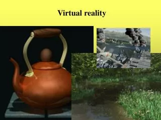
Virtual Reality • Virtual Reality • Computer interface technology for the interaction with real-time 3D virtual environments in a more intuitive manner • Virtual Environments • realistic,interactive and immersive simulations of places and scenes
Virtual Reality for Geodata • VR, as a tool for simulating the real world rather then for imitating it, is a suitable graphical interface for navigating spatial data and supporting users in decision-making processes or exploratory data analysis • VRML: Virtual Reality Modeling Language • Standard language for representing VR worlds • Support for modelling of geometry and interactions • Sharable and platform-independent • VRML is a suitable support for building GUI for geodata • Cost effective (generally, VR plug-ins are freeware) • Easy to use
VINCA: Virtual Navigation of Coastal Areas http:// thetis.ima.ge.cnr.it/~thetis/thetis.html
Conclusions and Future Work • THETIS: data and program sharing system • Full embedding of the surface modelling module in the THETIS system, with integration with the GIS user interface of THETIS • VR to support data visualization together with traditional GIS tools • Extend the interaction capabilities with VR-DTM • VRML or Java3D ??